
| Memorials | : | 137 |
| Location | : | Bromfield, Shropshire Unitary Authority, England |
| Coordinate | : | 52.3873900, -2.7636700 |
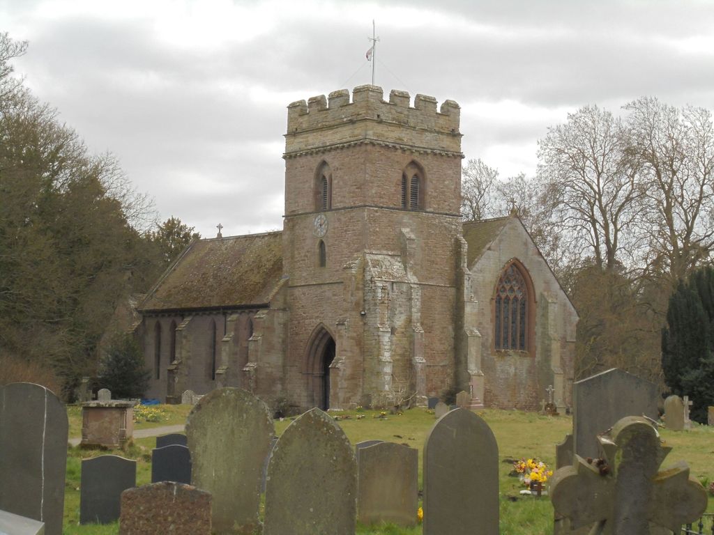
| Description | : | Bromfield is located near the market town of Ludlow, two miles northwest of the town centre, on the A49 road. The A4113 road (to Knighton) has its eastern end in Bromfield, at its junction with the A49.The village is situated near the confluence of the River Teme and River Onny. The latter splits the village into two, with the church and many of the older buildings to the west and the recently redeveloped business area to the east (towards Ludlow). A bridge takes the main road over the river.The manor of Bromfield, and separately Bromfield Priory, are recorded in the... Read More |
frequently asked questions (FAQ):
-
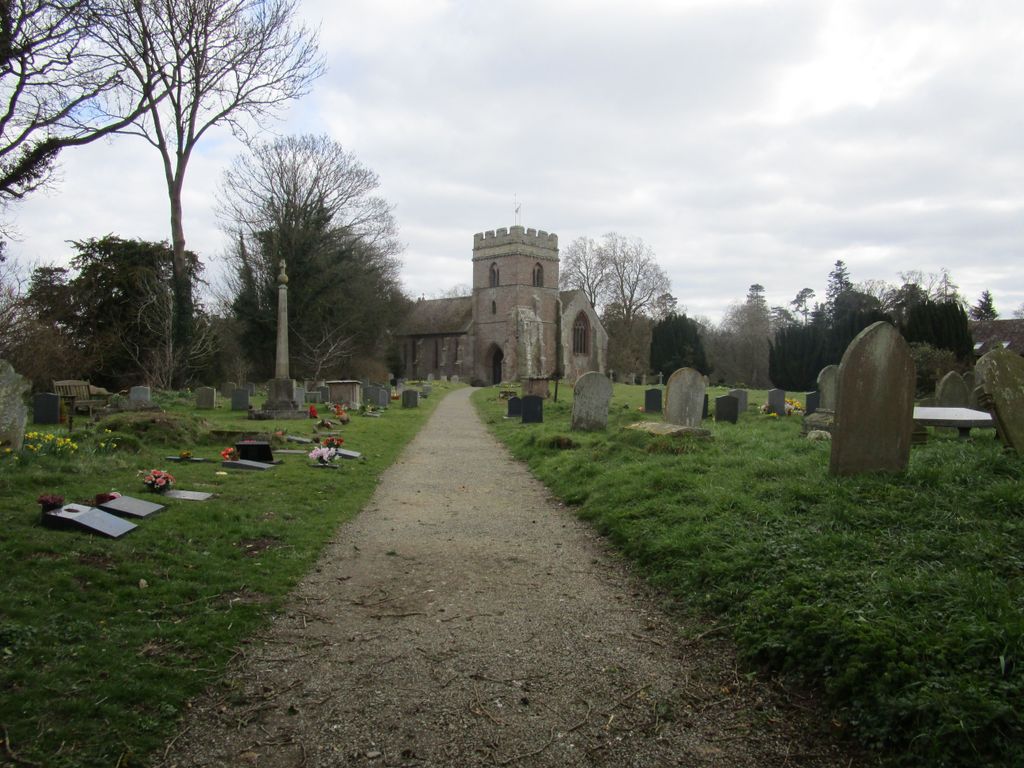
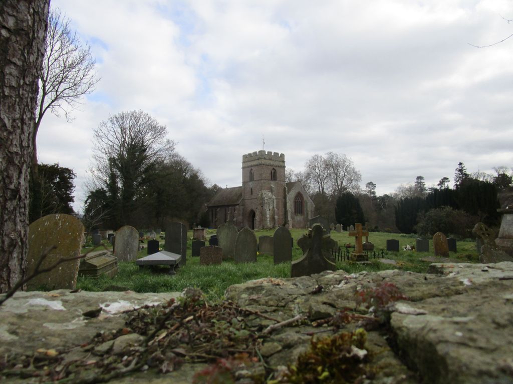
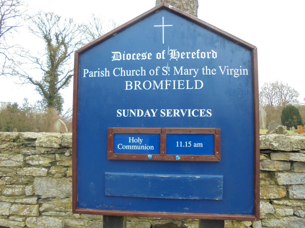
Where is St. Mary the Virgin Churchyard?
St. Mary the Virgin Churchyard is located at Bromfield, Shropshire Unitary Authority ,Shropshire , SY8 2JPEngland.
-
St. Mary the Virgin Churchyard cemetery's updated grave count on graveviews.com?
136 memorials
-
Where are the coordinates of the St. Mary the Virgin Churchyard?
Latitude: 52.3873900
Longitude: -2.7636700
Nearby Cemetories:
1. All Saints Churchyard
Culmington, Shropshire Unitary Authority, England
Coordinate: 52.4334800, -2.7463500
2. St. George's Churchyard
Burrington, Herefordshire Unitary Authority, England
Coordinate: 52.3440700, -2.8200100
3. St. Mary the Virgin Churchyard
Elton, Shropshire Unitary Authority, England
Coordinate: 52.3345972, -2.7969324
4. St. Andrew, Ashford Bowdler.
Ashford Bowdler, Shropshire Unitary Authority, England
Coordinate: 52.3308770, -2.7065930
5. St. Thomas' Churchyard
Craven Arms, Shropshire Unitary Authority, England
Coordinate: 52.4450630, -2.8306870
6. St. Mary's Churchyard
Caynham, Shropshire Unitary Authority, England
Coordinate: 52.3558260, -2.6564540
7. St Cuthbert Churchyard
Clungunford, Shropshire Unitary Authority, England
Coordinate: 52.4032350, -2.8909360
8. St. Peter's Churchyard
Diddlebury, Shropshire Unitary Authority, England
Coordinate: 52.4640570, -2.7249740
9. St. Mary's Churchyard
Bitterley, Shropshire Unitary Authority, England
Coordinate: 52.3922280, -2.6319790
10. Knowbury, St Paul
Caynham, Shropshire Unitary Authority, England
Coordinate: 52.3734750, -2.6300130
11. Westhope Chapel Burial Ground
Diddlebury, Shropshire Unitary Authority, England
Coordinate: 52.4714690, -2.7818850
12. St. Mary Magdalene Churchyard
Little Hereford, Herefordshire Unitary Authority, England
Coordinate: 52.3112129, -2.6572039
13. Clee St. Margaret Churchyard
Clee St Margaret, Shropshire Unitary Authority, England
Coordinate: 52.4554270, -2.6423086
14. St Marys Churchyard
Hopesay, Shropshire Unitary Authority, England
Coordinate: 52.4440470, -2.8999020
15. St Mary Churchyard
Bedstone, Shropshire Unitary Authority, England
Coordinate: 52.3759660, -2.9284570
16. St. Swithin Churchyard
Clunbury, Shropshire Unitary Authority, England
Coordinate: 52.4201670, -2.9261080
17. St. Edward Churchyard
Hopton Castle, Shropshire Unitary Authority, England
Coordinate: 52.3985700, -2.9369700
18. St Mary's Churchyard
Hopton Castle, Shropshire Unitary Authority, England
Coordinate: 52.3985640, -2.9369870
19. St. Barnabas Churchyard
Brampton Bryan, Herefordshire Unitary Authority, England
Coordinate: 52.3470760, -2.9255360
20. St Michael and All Angels Churchyard
Croft, Herefordshire Unitary Authority, England
Coordinate: 52.2841090, -2.8079510
21. St Margaret's Churchyard
Acton Scott, Shropshire Unitary Authority, England
Coordinate: 52.5001670, -2.8060920
22. St Michael Churchyard
Edgton, Shropshire Unitary Authority, England
Coordinate: 52.4660500, -2.9044570
23. Church of St John the Baptist and St Alkmund
Aymestrey, Herefordshire Unitary Authority, England
Coordinate: 52.2813000, -2.8428000
24. St Mary Churchyard
Bucknell, Shropshire Unitary Authority, England
Coordinate: 52.3592220, -2.9490030