
| Memorials | : | 0 |
| Location | : | Alton Barnes, Wiltshire Unitary Authority, England |
| Coordinate | : | 51.3572180, -1.8467440 |
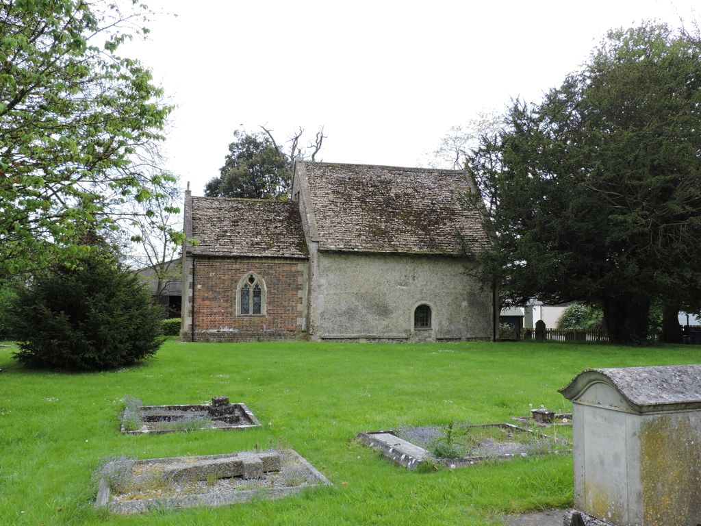
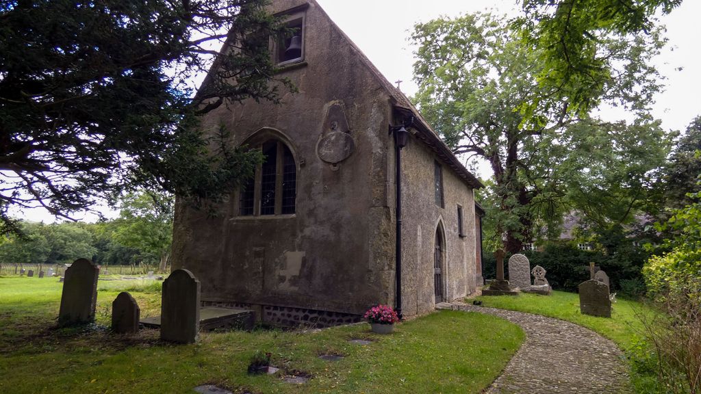
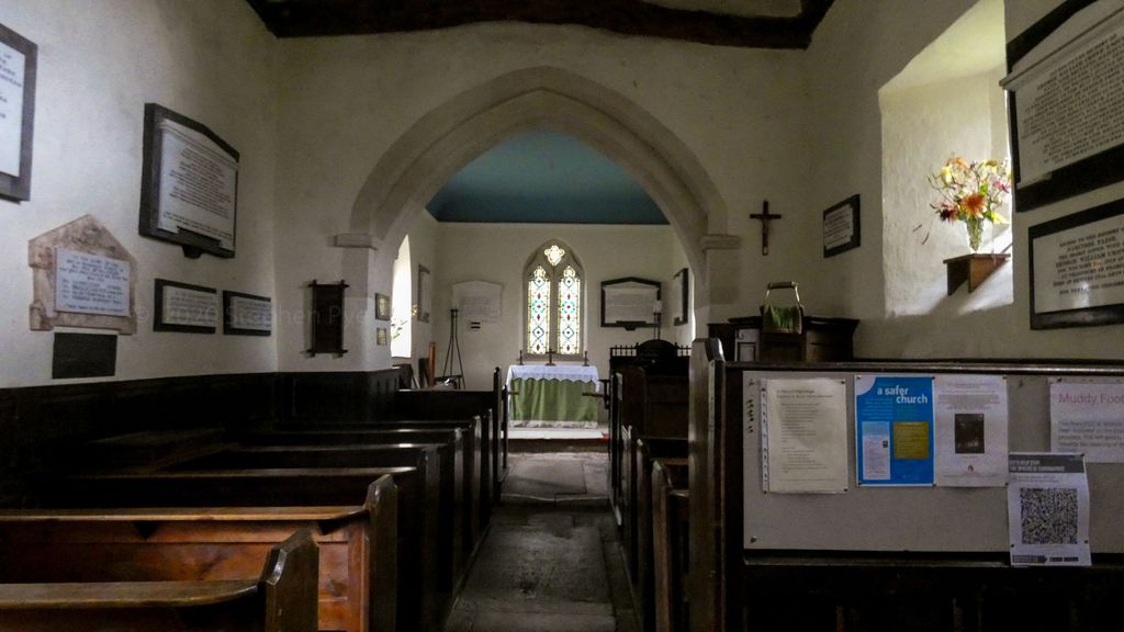
| Description | : | In the Domesday Book of 1086 Alton Barnes is first recorded as 'Aulton', a village valued at less than a quarter of neighbouring Priors. At the later date of 1316 Alton Barnes appeared as 'Aultone Berner'. In the church of St.Mary all four walls of the nave are Saxon work with pre-Norman influence, as is part of the rest of the church. The damaged west window and the old north doorway date from the 14th century. The two bells in 1553 were replaced by two dated 1626 and 1788 but were rehung from between the ceiling and the roof of the... Read More |
frequently asked questions (FAQ):
-
Where is Church of St. Mary?
Church of St. Mary is located at Alton Barnes, Wiltshire Unitary Authority ,Wiltshire ,England.
-
Church of St. Mary cemetery's updated grave count on graveviews.com?
0 memorials
-
Where are the coordinates of the Church of St. Mary?
Latitude: 51.3572180
Longitude: -1.8467440
Nearby Cemetories:
1. All Saints Churchyard
Alton Priors, Wiltshire Unitary Authority, England
Coordinate: 51.3580240, -1.8447630
2. Adam’s Grave
Alton Barnes, Wiltshire Unitary Authority, England
Coordinate: 51.3694910, -1.8399100
3. St Stephens - Beechingstoke
Beechingstoke, Wiltshire Unitary Authority, England
Coordinate: 51.3322290, -1.8782996
4. All Saints Churchyard
All Cannings, Wiltshire Unitary Authority, England
Coordinate: 51.3531290, -1.9013160
5. All Saints Churchyard
All Cannings, Wiltshire Unitary Authority, England
Coordinate: 51.3532600, -1.9014490
6. Christ Church
East Kennett, Wiltshire Unitary Authority, England
Coordinate: 51.4058760, -1.8328740
7. St John the Baptist Churchyard
Chirton, Wiltshire Unitary Authority, England
Coordinate: 51.3176500, -1.8958100
8. St Mary the Virgin Churchyard
Bishops Cannings, Wiltshire Unitary Authority, England
Coordinate: 51.3766560, -1.9471530
9. Saint James Churchyard
Avebury, Wiltshire Unitary Authority, England
Coordinate: 51.4280700, -1.8575100
10. Avebury Chapel
Avebury, Wiltshire Unitary Authority, England
Coordinate: 51.4284210, -1.8562170
11. Saint Mary the Virgin Churchyard
Devizes, Wiltshire Unitary Authority, England
Coordinate: 51.3534370, -1.9930310
12. Roundway Asylum Cemetery
Devizes, Wiltshire Unitary Authority, England
Coordinate: 51.3370470, -1.9900090
13. St. John The Baptist Churchyard
Devizes, Wiltshire Unitary Authority, England
Coordinate: 51.3502300, -1.9947490
14. Friends Burial Ground
Devizes, Wiltshire Unitary Authority, England
Coordinate: 51.3474356, -1.9945100
15. Cadley Churchyard
Cadley, Wiltshire Unitary Authority, England
Coordinate: 51.3977930, -1.7013010
16. St Swithin Churchyard
Compton Bassett, Wiltshire Unitary Authority, England
Coordinate: 51.4433640, -1.9569990
17. All Saints Churchyard
Burbage, Wiltshire Unitary Authority, England
Coordinate: 51.3509127, -1.6671428
18. Calne Holy Trinity Churchyard
Calne Without, Wiltshire Unitary Authority, England
Coordinate: 51.4303550, -1.9975930
19. St Mary the Virgin Churchyard
Calne, Wiltshire Unitary Authority, England
Coordinate: 51.4371650, -2.0027540
20. St Mary's Churchyard
Collingbourne Kingston, Wiltshire Unitary Authority, England
Coordinate: 51.3008400, -1.6583900
21. Curzon Street Cemetery
Calne, Wiltshire Unitary Authority, England
Coordinate: 51.4409010, -2.0107130
22. Bromham Cemetery
Bromham, Wiltshire Unitary Authority, England
Coordinate: 51.3854000, -2.0538000
23. St. Nicholas' Churchyard
Bromham, Wiltshire Unitary Authority, England
Coordinate: 51.3857110, -2.0543780
24. St Nicholas Churchyard
East Grafton, Wiltshire Unitary Authority, England
Coordinate: 51.3414400, -1.6317000