
| Memorials | : | 0 |
| Location | : | Devizes, Wiltshire Unitary Authority, England |
| Coordinate | : | 51.3534370, -1.9930310 |
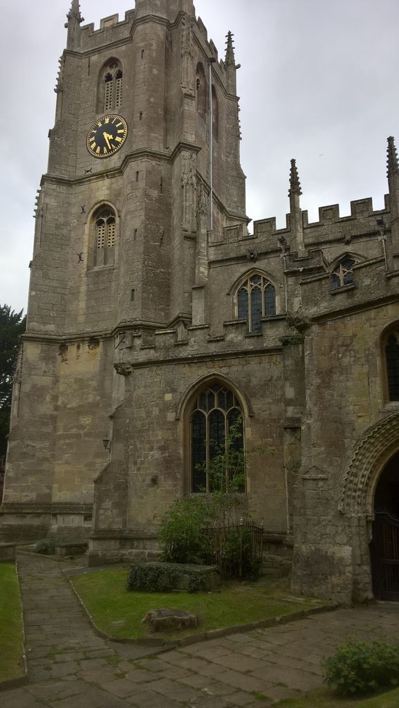
| Description | : | The early history of the church is closely linked with that of St. John, under a single rector, and the phrase, 'the Church of St. John with St. Mary annexed, first used in 1400, is often found. The church was built in the 12th century to serve the new borough of Devizes, outside the castle area , which was served by St. John's. All that remains of the early church is the chancel, there being nothing dateable in the rest of the church earlier than the 13th or 14th century. From this period the church owned many plots of land... Read More |
frequently asked questions (FAQ):
-
Where is Saint Mary the Virgin Churchyard?
Saint Mary the Virgin Churchyard is located at Devizes, Wiltshire Unitary Authority ,Wiltshire ,England.
-
Saint Mary the Virgin Churchyard cemetery's updated grave count on graveviews.com?
0 memorials
-
Where are the coordinates of the Saint Mary the Virgin Churchyard?
Latitude: 51.3534370
Longitude: -1.9930310
Nearby Cemetories:
1. St. John The Baptist Churchyard
Devizes, Wiltshire Unitary Authority, England
Coordinate: 51.3502300, -1.9947490
2. Friends Burial Ground
Devizes, Wiltshire Unitary Authority, England
Coordinate: 51.3474356, -1.9945100
3. Roundway Asylum Cemetery
Devizes, Wiltshire Unitary Authority, England
Coordinate: 51.3370470, -1.9900090
4. St Mary the Virgin Churchyard
Bishops Cannings, Wiltshire Unitary Authority, England
Coordinate: 51.3766560, -1.9471530
5. Bromham Cemetery
Bromham, Wiltshire Unitary Authority, England
Coordinate: 51.3854000, -2.0538000
6. St. Nicholas' Churchyard
Bromham, Wiltshire Unitary Authority, England
Coordinate: 51.3857110, -2.0543780
7. All Saints Churchyard
All Cannings, Wiltshire Unitary Authority, England
Coordinate: 51.3532600, -1.9014490
8. All Saints Churchyard
All Cannings, Wiltshire Unitary Authority, England
Coordinate: 51.3531290, -1.9013160
9. Chittoe Graveyard
Chippenham, Wiltshire Unitary Authority, England
Coordinate: 51.3985740, -2.0637040
10. Christ Church
Bulkington, Wiltshire Unitary Authority, England
Coordinate: 51.3244800, -2.0869130
11. St John the Baptist Churchyard
Chirton, Wiltshire Unitary Authority, England
Coordinate: 51.3176500, -1.8958100
12. St Stephens - Beechingstoke
Beechingstoke, Wiltshire Unitary Authority, England
Coordinate: 51.3322290, -1.8782996
13. Calne Holy Trinity Churchyard
Calne Without, Wiltshire Unitary Authority, England
Coordinate: 51.4303550, -1.9975930
14. St Mary the Virgin Churchyard
Calne, Wiltshire Unitary Authority, England
Coordinate: 51.4371650, -2.0027540
15. Curzon Street Cemetery
Calne, Wiltshire Unitary Authority, England
Coordinate: 51.4409010, -2.0107130
16. Church of St. Mary
Alton Barnes, Wiltshire Unitary Authority, England
Coordinate: 51.3572180, -1.8467440
17. St Swithin Churchyard
Compton Bassett, Wiltshire Unitary Authority, England
Coordinate: 51.4433640, -1.9569990
18. All Saints Churchyard
Alton Priors, Wiltshire Unitary Authority, England
Coordinate: 51.3580240, -1.8447630
19. Christ Church
Derry Hill, Wiltshire Unitary Authority, England
Coordinate: 51.4368890, -2.0654300
20. Adam’s Grave
Alton Barnes, Wiltshire Unitary Authority, England
Coordinate: 51.3694910, -1.8399100
21. St Barnabas Churchyard
Beanacre, Wiltshire Unitary Authority, England
Coordinate: 51.3936935, -2.1398827
22. Saint James Churchyard
Avebury, Wiltshire Unitary Authority, England
Coordinate: 51.4280700, -1.8575100
23. Christ Church
East Kennett, Wiltshire Unitary Authority, England
Coordinate: 51.4058760, -1.8328740
24. Avebury Chapel
Avebury, Wiltshire Unitary Authority, England
Coordinate: 51.4284210, -1.8562170