
| Memorials | : | 0 |
| Location | : | Devizes, Wiltshire Unitary Authority, England |
| Coordinate | : | 51.3502300, -1.9947490 |
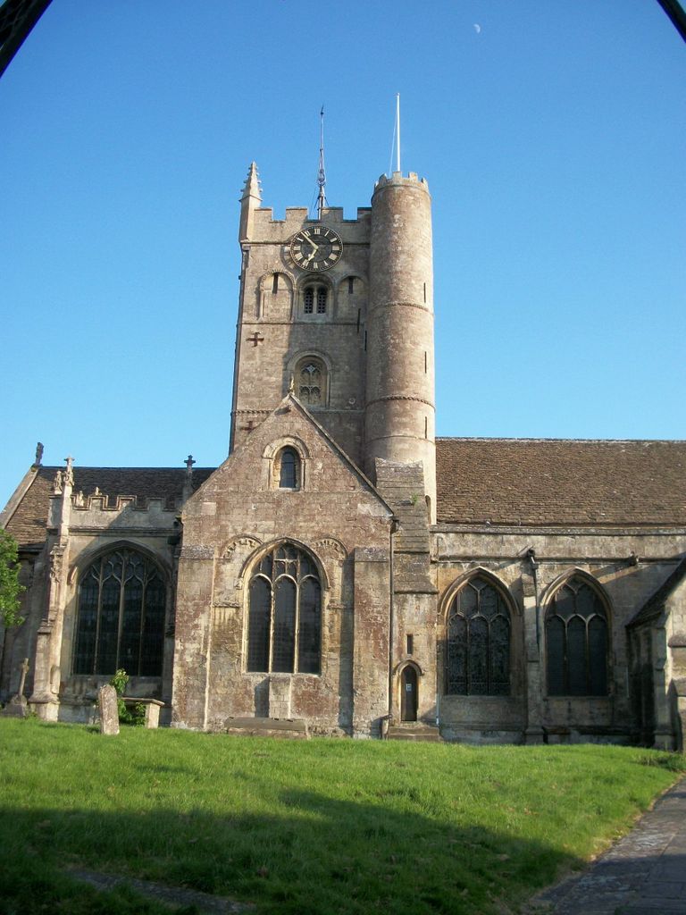
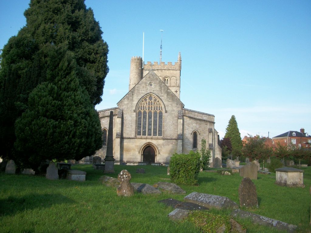
| Description | : | Saint John the Baptist Churchyard in Devizes, Wiltshire, England. Located on Long Street Keeping the Market Square in the centre of Devizes on your left hand side, Saint John the Baptist Cemetery is 200 yards further down Long Street on the right hand side. The Churchyard surrounds the 12th Century Saint John the Baptist Church and is overlooked by the Devizes castle. The churchyard is very old and many of the headstones are too ancient and weathered to read. The church and churchyard belong to the Church of England. Church of St. John the Baptist, Devizes The early history of the church... Read More |
frequently asked questions (FAQ):
-
Where is St. John The Baptist Churchyard?
St. John The Baptist Churchyard is located at Long Street Devizes, Wiltshire Unitary Authority ,Wiltshire ,England.
-
St. John The Baptist Churchyard cemetery's updated grave count on graveviews.com?
0 memorials
-
Where are the coordinates of the St. John The Baptist Churchyard?
Latitude: 51.3502300
Longitude: -1.9947490
Nearby Cemetories:
1. Friends Burial Ground
Devizes, Wiltshire Unitary Authority, England
Coordinate: 51.3474356, -1.9945100
2. Saint Mary the Virgin Churchyard
Devizes, Wiltshire Unitary Authority, England
Coordinate: 51.3534370, -1.9930310
3. Roundway Asylum Cemetery
Devizes, Wiltshire Unitary Authority, England
Coordinate: 51.3370470, -1.9900090
4. St Mary the Virgin Churchyard
Bishops Cannings, Wiltshire Unitary Authority, England
Coordinate: 51.3766560, -1.9471530
5. Bromham Cemetery
Bromham, Wiltshire Unitary Authority, England
Coordinate: 51.3854000, -2.0538000
6. St. Nicholas' Churchyard
Bromham, Wiltshire Unitary Authority, England
Coordinate: 51.3857110, -2.0543780
7. All Saints Churchyard
All Cannings, Wiltshire Unitary Authority, England
Coordinate: 51.3532600, -1.9014490
8. All Saints Churchyard
All Cannings, Wiltshire Unitary Authority, England
Coordinate: 51.3531290, -1.9013160
9. Christ Church
Bulkington, Wiltshire Unitary Authority, England
Coordinate: 51.3244800, -2.0869130
10. Chittoe Graveyard
Chippenham, Wiltshire Unitary Authority, England
Coordinate: 51.3985740, -2.0637040
11. St John the Baptist Churchyard
Chirton, Wiltshire Unitary Authority, England
Coordinate: 51.3176500, -1.8958100
12. St Stephens - Beechingstoke
Beechingstoke, Wiltshire Unitary Authority, England
Coordinate: 51.3322290, -1.8782996
13. Calne Holy Trinity Churchyard
Calne Without, Wiltshire Unitary Authority, England
Coordinate: 51.4303550, -1.9975930
14. St Mary the Virgin Churchyard
Calne, Wiltshire Unitary Authority, England
Coordinate: 51.4371650, -2.0027540
15. Curzon Street Cemetery
Calne, Wiltshire Unitary Authority, England
Coordinate: 51.4409010, -2.0107130
16. Church of St. Mary
Alton Barnes, Wiltshire Unitary Authority, England
Coordinate: 51.3572180, -1.8467440
17. All Saints Churchyard
Alton Priors, Wiltshire Unitary Authority, England
Coordinate: 51.3580240, -1.8447630
18. St Swithin Churchyard
Compton Bassett, Wiltshire Unitary Authority, England
Coordinate: 51.4433640, -1.9569990
19. Christ Church
Derry Hill, Wiltshire Unitary Authority, England
Coordinate: 51.4368890, -2.0654300
20. Adam’s Grave
Alton Barnes, Wiltshire Unitary Authority, England
Coordinate: 51.3694910, -1.8399100
21. St Barnabas Churchyard
Beanacre, Wiltshire Unitary Authority, England
Coordinate: 51.3936935, -2.1398827
22. Broughton Gifford Cemetery
Broughton Gifford, Wiltshire Unitary Authority, England
Coordinate: 51.3665806, -2.1760188
23. Christ Church
East Kennett, Wiltshire Unitary Authority, England
Coordinate: 51.4058760, -1.8328740
24. Saint James Churchyard
Avebury, Wiltshire Unitary Authority, England
Coordinate: 51.4280700, -1.8575100