
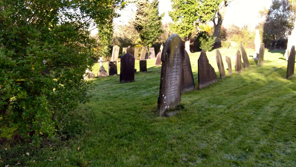
| Memorials | : | 21 |
| Location | : | Willoughby-on-the-Wolds, Rushcliffe Borough, England |
| Coordinate | : | 52.8227780, -1.0608330 |
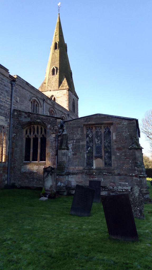
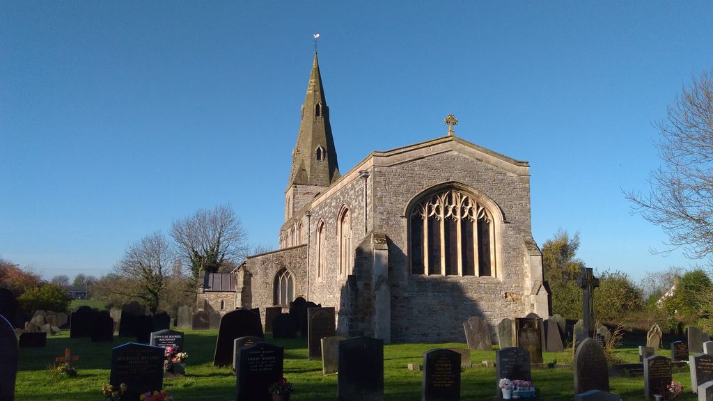
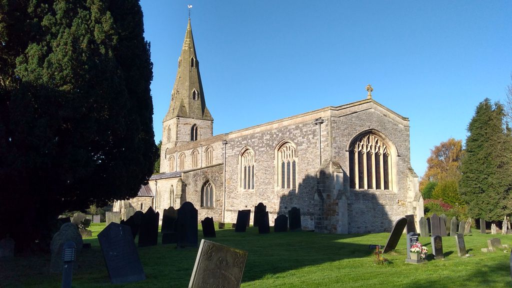
| Description | : | The Church of St. Mary and All Saints is a parish church, in the Church of England, in Willoughby on the Wolds, Nottinghamshire, England and is dedicated to St Mary. The church is medieval and has many ancient and splendid monuments of the Willoughbys, ancestors of Lord Middleton, whose predecessors sold this lordship many years ago to various proprietors. |
frequently asked questions (FAQ):
-
Where is Church of St Mary and All Saints?
Church of St Mary and All Saints is located at Willoughby-on-the-Wolds, Rushcliffe Borough ,Nottinghamshire ,England.
-
Church of St Mary and All Saints cemetery's updated grave count on graveviews.com?
20 memorials
-
Where are the coordinates of the Church of St Mary and All Saints?
Latitude: 52.8227780
Longitude: -1.0608330

Nearby Cemetories:
1. St Peter Churchyard
Widmerpool, Rushcliffe Borough, England
Coordinate: 52.8476890, -1.0679480
2. Holy Trinity Churchyard
Wysall, Rushcliffe Borough, England
Coordinate: 52.8383300, -1.1044200
3. St. Marys Churchyard
Wymeswold, Charnwood Borough, England
Coordinate: 52.8055010, -1.1067320
4. Wymeswold Rempstone Road Cemetery
Wymeswold, Charnwood Borough, England
Coordinate: 52.8084600, -1.1180480
5. Old Dalby Main Road Cemetery
Old Dalby, Melton Borough, England
Coordinate: 52.8084650, -1.0007670
6. St John the Baptist Churchyard
Old Dalby, Melton Borough, England
Coordinate: 52.8053510, -1.0017970
7. St Luke's Churchyard
Upper Broughton, Rushcliffe Borough, England
Coordinate: 52.8293700, -0.9870900
8. All Saints Churchyard
Stanton-on-the-Wolds, Rushcliffe Borough, England
Coordinate: 52.8693400, -1.0624900
9. Rempstone Anabaptist Burial Ground
Rempstone, Rushcliffe Borough, England
Coordinate: 52.8179800, -1.1426400
10. Burton-on-the-Wolds Burial Ground
Burton-on-the-Wolds, Charnwood Borough, England
Coordinate: 52.7864470, -1.1207120
11. All Saints Churchyard
Rempstone, Rushcliffe Borough, England
Coordinate: 52.8149800, -1.1477700
12. St Giles Churchyard
Costock, Rushcliffe Borough, England
Coordinate: 52.8326300, -1.1489100
13. All Saints Churchyard
Melton Mowbray, Melton Borough, England
Coordinate: 52.7728700, -1.0209400
14. All Saints Church
Melton Borough, England
Coordinate: 52.7728570, -1.0209240
15. St Mary the Virgin Churchyard
Nether Broughton, Melton Borough, England
Coordinate: 52.8289780, -0.9687040
16. St John the Baptist Churchyard
Grimston, Melton Borough, England
Coordinate: 52.7902720, -0.9850350
17. St Mary the Virgin Churchyard
Bunny, Rushcliffe Borough, England
Coordinate: 52.8606758, -1.1354220
18. Hoton Burial Ground
Hoton, Charnwood Borough, England
Coordinate: 52.7983472, -1.1500767
19. Rempstone, St Peter in the Rushes
Rempstone, Rushcliffe Borough, England
Coordinate: 52.8191600, -1.1614400
20. St Luke's Churchyard
Kinoulton, Rushcliffe Borough, England
Coordinate: 52.8697400, -0.9964300
21. St. Andrew's Churchyard
Prestwold, Charnwood Borough, England
Coordinate: 52.7875000, -1.1446400
22. St. Luke's Churchyard
Hickling, Rushcliffe Borough, England
Coordinate: 52.8564100, -0.9742800
23. St. Luke's Churchyard, Hickling
Melton Mowbray, Melton Borough, England
Coordinate: 52.8563758, -0.9738774
24. St Mary Churchyard
Walton-on-the-Wolds, Charnwood Borough, England
Coordinate: 52.7712900, -1.1241310