
| Memorials | : | 1 |
| Location | : | Trowel, Bollinger County, USA |
| Coordinate | : | 37.2318306, -90.0125275 |
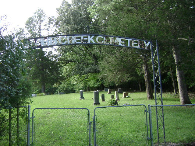
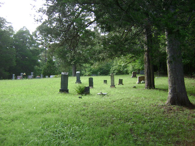
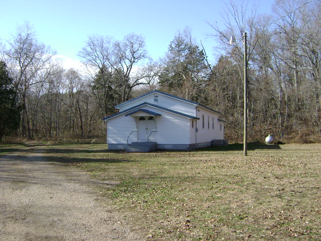
| Description | : | The cemetery is located adjacent to the Clubb Creek General Baptist Church. The name of the cemetery is Clubb Creek Cemetery. Directions to the cemetery are: From Marble Hill go south on Hwy 51, west on FF Hwy, south on PP Hwy to end of pavement; right across bridge to church and cemetery. |
frequently asked questions (FAQ):
-
Where is Clubb Creek Church Cemetery?
Clubb Creek Church Cemetery is located at Trowel, Bollinger County ,Missouri ,USA.
-
Clubb Creek Church Cemetery cemetery's updated grave count on graveviews.com?
1 memorials
-
Where are the coordinates of the Clubb Creek Church Cemetery?
Latitude: 37.2318306
Longitude: -90.0125275
Nearby Cemetories:
1. Crites Cemetery
Trowel, Bollinger County, USA
Coordinate: 37.2318993, -90.0164032
2. Patterson Family Cemetery
Bollinger County, USA
Coordinate: 37.2511100, -90.0107100
3. James Cemetery
Bollinger County, USA
Coordinate: 37.2346600, -90.0478900
4. Cane Creek Cemetery
Huxie, Bollinger County, USA
Coordinate: 37.2468987, -90.0485992
5. Shelton Cemetery
Huxie, Bollinger County, USA
Coordinate: 37.2556000, -90.0481033
6. Dry Creek Cemetery
Lutesville, Bollinger County, USA
Coordinate: 37.2675018, -90.0291977
7. Bollinger County Memorial Park Cemetery
Marble Hill, Bollinger County, USA
Coordinate: 37.2689018, -89.9871979
8. Mansker Cemetery
Dongola, Bollinger County, USA
Coordinate: 37.1907997, -89.9891968
9. Baker Cemetery
Marble Hill, Bollinger County, USA
Coordinate: 37.2722015, -89.9869003
10. Eakers Cemetery
Hahn, Bollinger County, USA
Coordinate: 37.1939011, -90.0736008
11. Shell Cemetery
Lutesville, Bollinger County, USA
Coordinate: 37.2839012, -89.9693985
12. Collins Cemetery
Dongola, Bollinger County, USA
Coordinate: 37.1720800, -89.9883900
13. Hahn Cemetery
Lutesville, Bollinger County, USA
Coordinate: 37.2886009, -89.9772034
14. Virgin Burial Ground
Zalma, Bollinger County, USA
Coordinate: 37.1791930, -90.0630860
15. Union Hill Baptist Cemetery
Zalma, Bollinger County, USA
Coordinate: 37.1798100, -90.0643300
16. Eaker Cemetery
Lutesville, Bollinger County, USA
Coordinate: 37.2778015, -89.9516983
17. Myers Cemetery
Huxie, Bollinger County, USA
Coordinate: 37.2677994, -90.0839005
18. Slaybaugh Cemetery
Lutesville, Bollinger County, USA
Coordinate: 37.2982150, -89.9851870
19. Speer Cemetery
Zalma, Bollinger County, USA
Coordinate: 37.1692009, -90.0550003
20. Saint Johns Cemetery
Leopold, Bollinger County, USA
Coordinate: 37.2585983, -89.9282990
21. Lower Deck Cemetery
Lutesville, Bollinger County, USA
Coordinate: 37.3078003, -90.0119019
22. Dongola Cemetery
Dongola, Bollinger County, USA
Coordinate: 37.1661750, -89.9630440
23. Perkins Cemetery
Bollinger County, USA
Coordinate: 37.2738991, -89.9313965
24. Balch Chapel Cemetery
Zalma, Bollinger County, USA
Coordinate: 37.1545105, -90.0145264