
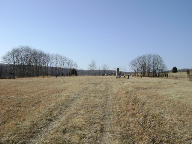
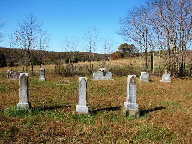
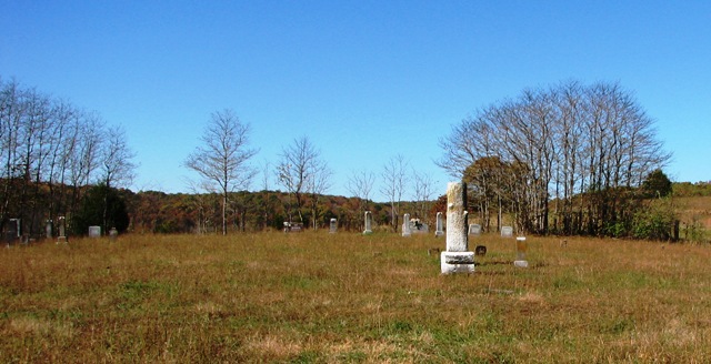
| Memorials | : | 0 |
| Location | : | Dongola, Bollinger County, USA |
| Coordinate | : | 37.1907997, -89.9891968 |
frequently asked questions (FAQ):
-
Where is Mansker Cemetery?
Mansker Cemetery is located at Dongola, Bollinger County ,Missouri ,USA.
-
Mansker Cemetery cemetery's updated grave count on graveviews.com?
0 memorials
-
Where are the coordinates of the Mansker Cemetery?
Latitude: 37.1907997
Longitude: -89.9891968
Nearby Cemetories:
1. Collins Cemetery
Dongola, Bollinger County, USA
Coordinate: 37.1720800, -89.9883900
2. Dongola Cemetery
Dongola, Bollinger County, USA
Coordinate: 37.1661750, -89.9630440
3. Kellion Cemetery
Schlatitz, Bollinger County, USA
Coordinate: 37.1582985, -89.9766998
4. Ladd Cemetery
Marble Hill, Bollinger County, USA
Coordinate: 37.1630340, -89.9601890
5. Balch Chapel Cemetery
Zalma, Bollinger County, USA
Coordinate: 37.1545105, -90.0145264
6. Hinkle-Crites Cemetery
Greenbrier, Bollinger County, USA
Coordinate: 37.1470900, -89.9843100
7. Clubb Creek Church Cemetery
Trowel, Bollinger County, USA
Coordinate: 37.2318306, -90.0125275
8. Crites Cemetery
Trowel, Bollinger County, USA
Coordinate: 37.2318993, -90.0164032
9. Saint Anthony Catholic Cemetery
Glennon, Bollinger County, USA
Coordinate: 37.1938800, -89.9193340
10. Speer Cemetery
Zalma, Bollinger County, USA
Coordinate: 37.1692009, -90.0550003
11. Virgin Burial Ground
Zalma, Bollinger County, USA
Coordinate: 37.1791930, -90.0630860
12. Union Hill Baptist Cemetery
Zalma, Bollinger County, USA
Coordinate: 37.1798100, -90.0643300
13. Patterson Family Cemetery
Bollinger County, USA
Coordinate: 37.2511100, -90.0107100
14. James Cemetery
Bollinger County, USA
Coordinate: 37.2346600, -90.0478900
15. Eakers Cemetery
Hahn, Bollinger County, USA
Coordinate: 37.1939011, -90.0736008
16. Cane Creek Cemetery
Huxie, Bollinger County, USA
Coordinate: 37.2468987, -90.0485992
17. Hebenstreit Farm Family Plot
Drum, Bollinger County, USA
Coordinate: 37.1886101, -89.8936081
18. Bollinger County Memorial Park Cemetery
Marble Hill, Bollinger County, USA
Coordinate: 37.2689018, -89.9871979
19. Shelton Cemetery
Huxie, Bollinger County, USA
Coordinate: 37.2556000, -90.0481033
20. Wayne Cemetery
Drum, Bollinger County, USA
Coordinate: 37.1925000, -89.8872000
21. Baker Cemetery
Marble Hill, Bollinger County, USA
Coordinate: 37.2722015, -89.9869003
22. White Cemetery
Hahn, Bollinger County, USA
Coordinate: 37.1782990, -90.0919037
23. Dry Creek Cemetery
Lutesville, Bollinger County, USA
Coordinate: 37.2675018, -90.0291977
24. Saint Johns Cemetery
Leopold, Bollinger County, USA
Coordinate: 37.2585983, -89.9282990