
| Memorials | : | 0 |
| Location | : | Zalma, Bollinger County, USA |
| Coordinate | : | 37.1791930, -90.0630860 |
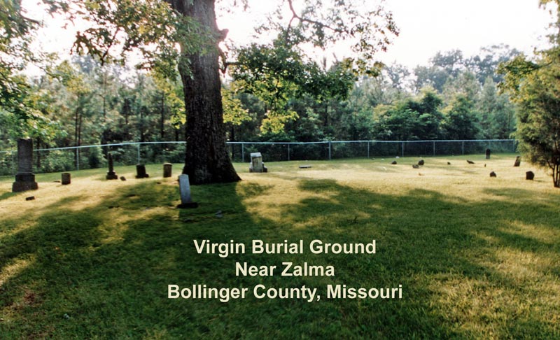
| Description | : | Located near Old Speer Cemetery, north of Zalma. From "Ye Old Virgin's Burial Ground", By Edward D. Virgin, Sr. (Article found in the Echo Vol IV, pages 174-176, St. Louis Genealogical Society). "A city block's distance beyond the Highway 51 and H junction on the north end of Rt. H, is a gravel road going east. Down the gravel road after crossing Hawkens Creek, formerly known as Jenkins Creek, is the old Speer Cemetery. After crossing the creek (going south) the road makes a 90 degree turn north and continues on the east line of section 16, about... Read More |
frequently asked questions (FAQ):
-
Where is Virgin Burial Ground?
Virgin Burial Ground is located at Zalma, Bollinger County ,Missouri ,USA.
-
Virgin Burial Ground cemetery's updated grave count on graveviews.com?
0 memorials
-
Where are the coordinates of the Virgin Burial Ground?
Latitude: 37.1791930
Longitude: -90.0630860
Nearby Cemetories:
1. Union Hill Baptist Cemetery
Zalma, Bollinger County, USA
Coordinate: 37.1798100, -90.0643300
2. Speer Cemetery
Zalma, Bollinger County, USA
Coordinate: 37.1692009, -90.0550003
3. Eakers Cemetery
Hahn, Bollinger County, USA
Coordinate: 37.1939011, -90.0736008
4. White Cemetery
Hahn, Bollinger County, USA
Coordinate: 37.1782990, -90.0919037
5. Zalma City Cemetery
Bollinger County, USA
Coordinate: 37.1453100, -90.0779900
6. Balch Chapel Cemetery
Zalma, Bollinger County, USA
Coordinate: 37.1545105, -90.0145264
7. James Cemetery
Bollinger County, USA
Coordinate: 37.2346600, -90.0478900
8. Hall Cemetery
Zalma, Bollinger County, USA
Coordinate: 37.1468200, -90.1217700
9. Patterson Cemetery
Grassy, Bollinger County, USA
Coordinate: 37.2228012, -90.1144028
10. Collins Cemetery
Dongola, Bollinger County, USA
Coordinate: 37.1720800, -89.9883900
11. Mansker Cemetery
Dongola, Bollinger County, USA
Coordinate: 37.1907997, -89.9891968
12. Clubb Cemetery
Zalma, Bollinger County, USA
Coordinate: 37.1775017, -90.1386032
13. King-Hinkle Cemetery
Bollinger County, USA
Coordinate: 37.1165833, -90.0547780
14. Crites Cemetery
Trowel, Bollinger County, USA
Coordinate: 37.2318993, -90.0164032
15. Clubb Creek Church Cemetery
Trowel, Bollinger County, USA
Coordinate: 37.2318306, -90.0125275
16. Cane Creek Cemetery
Huxie, Bollinger County, USA
Coordinate: 37.2468987, -90.0485992
17. Hinkle-Crites Cemetery
Greenbrier, Bollinger County, USA
Coordinate: 37.1470900, -89.9843100
18. Berrong Cemetery
Gipsy, Bollinger County, USA
Coordinate: 37.1343360, -90.1331770
19. Kellion Cemetery
Schlatitz, Bollinger County, USA
Coordinate: 37.1582985, -89.9766998
20. Greenbrier Zephyr Cemetery
Greenbrier, Bollinger County, USA
Coordinate: 37.1118240, -90.0263980
21. Shelton Cemetery
Huxie, Bollinger County, USA
Coordinate: 37.2556000, -90.0481033
22. Beatty Cemetery
Arab, Bollinger County, USA
Coordinate: 37.1015110, -90.0698550
23. Cato Cemetery
Greenbrier, Bollinger County, USA
Coordinate: 37.1016900, -90.0434100
24. Dongola Cemetery
Dongola, Bollinger County, USA
Coordinate: 37.1661750, -89.9630440