
| Memorials | : | 1 |
| Location | : | Kloetinge, Goes Municipality, Netherlands |
| Coordinate | : | 51.4971500, 3.9232100 |
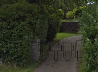
| Description | : | Kloetinge is a village on the Oosterschelde. It is part of the Goes Municipality, located in the province of Zeeland in the south-western Netherlands. It lies approx 2.5km east of Goes. In a park of honour at the front of the cemetery facing the road a Canadian soldier is buried with nine members of the Dutch Resistance, all commemorated by a single monument. |
frequently asked questions (FAQ):
-
Where is Kloetinge General Cemetery?
Kloetinge General Cemetery is located at Kapelseweg Kloetinge, Goes Municipality ,Zeeland ,Netherlands.
-
Kloetinge General Cemetery cemetery's updated grave count on graveviews.com?
1 memorials
-
Where are the coordinates of the Kloetinge General Cemetery?
Latitude: 51.4971500
Longitude: 3.9232100
Nearby Cemetories:
1. Kapelle French Military Cemetery
Kapelle, Kapelle Municipality, Netherlands
Coordinate: 51.4877370, 3.9482423
2. Crematorium en uitvaartcentrum Het Zeeuwse Land
Goes Municipality, Netherlands
Coordinate: 51.4810570, 3.8994665
3. Goes Algemene Begraafplaats
Goes, Goes Municipality, Netherlands
Coordinate: 51.5120600, 3.8866100
4. Biezelinge Algemene Begraafplaats
Biezelinge, Kapelle Municipality, Netherlands
Coordinate: 51.4777300, 3.9575600
5. Hervormde Gemeente te Kattendijke
Kattendijke, Goes Municipality, Netherlands
Coordinate: 51.5236607, 3.9446858
6. Kattendijke General Cemetery
Kattendijke, Goes Municipality, Netherlands
Coordinate: 51.5230400, 3.9476100
7. Wilhelminadorp General Cemetery
Wilhelminadorp, Goes Municipality, Netherlands
Coordinate: 51.5323600, 3.8916900
8. Wemeldinge Algemene Begraafplaats
Wemeldinge, Kapelle Municipality, Netherlands
Coordinate: 51.5126200, 3.9883100
9. Lenshoekdijk Old
's-Gravenpolder, Borsele Municipality, Netherlands
Coordinate: 51.4554900, 3.9012800
10. 's-Gravenpolder Algemene Begraafplaats
's-Gravenpolder, Borsele Municipality, Netherlands
Coordinate: 51.4556100, 3.9003500
11. 's-Heer-Hendrikskinderen Algemene Begraafplaats
's-Heer Hendrikskinderen, Goes Municipality, Netherlands
Coordinate: 51.5012100, 3.8463800
12. Schore Algemene Begraafplaats
Schore, Kapelle Municipality, Netherlands
Coordinate: 51.4658500, 3.9969800
13. Algemene Begraafplaats
Nisse, Borsele Municipality, Netherlands
Coordinate: 51.4584900, 3.8467600
14. Wolphaartsdijk Algemene Begraafplaats
Wolphaartsdijk, Goes Municipality, Netherlands
Coordinate: 51.5271200, 3.8191400
15. Heinkenszand Kerklaan Cemetery
Heinkenszand, Borsele Municipality, Netherlands
Coordinate: 51.4717900, 3.8139200
16. Hoedekenskerke Old Churchyard
Hoedekenskerke, Borsele Municipality, Netherlands
Coordinate: 51.4235320, 3.9121413
17. Hoedekenskerke Waardweg Cemetery
Hoedekenskerke, Borsele Municipality, Netherlands
Coordinate: 51.4224100, 3.9129400
18. Yerseke General Cemetery
Yerseke, Reimerswaal Municipality, Netherlands
Coordinate: 51.4949200, 4.0455800
19. Begraafplaats De Boschburg
Yerseke, Reimerswaal Municipality, Netherlands
Coordinate: 51.4970586, 4.0475950
20. Kats General Cemetery
Kats, Noord-Beveland Municipality, Netherlands
Coordinate: 51.5704500, 3.8825800
21. Kruiningen General Cemetery
Kruiningen, Reimerswaal Municipality, Netherlands
Coordinate: 51.4488400, 4.0277900
22. Baarland Steenweg Cemetery
Baarland, Borsele Municipality, Netherlands
Coordinate: 51.4072879, 3.8944024
23. Ovezande Bloemenstraat Cemetery
Ovezande, Borsele Municipality, Netherlands
Coordinate: 51.4274400, 3.8208500
24. Oudelande Algemene Begraafplaats
Oudelande, Borsele Municipality, Netherlands
Coordinate: 51.4095600, 3.8564700