
| Memorials | : | 0 |
| Location | : | Pine Mountain, Blount County, USA |
| Coordinate | : | 33.8127370, -86.5184610 |
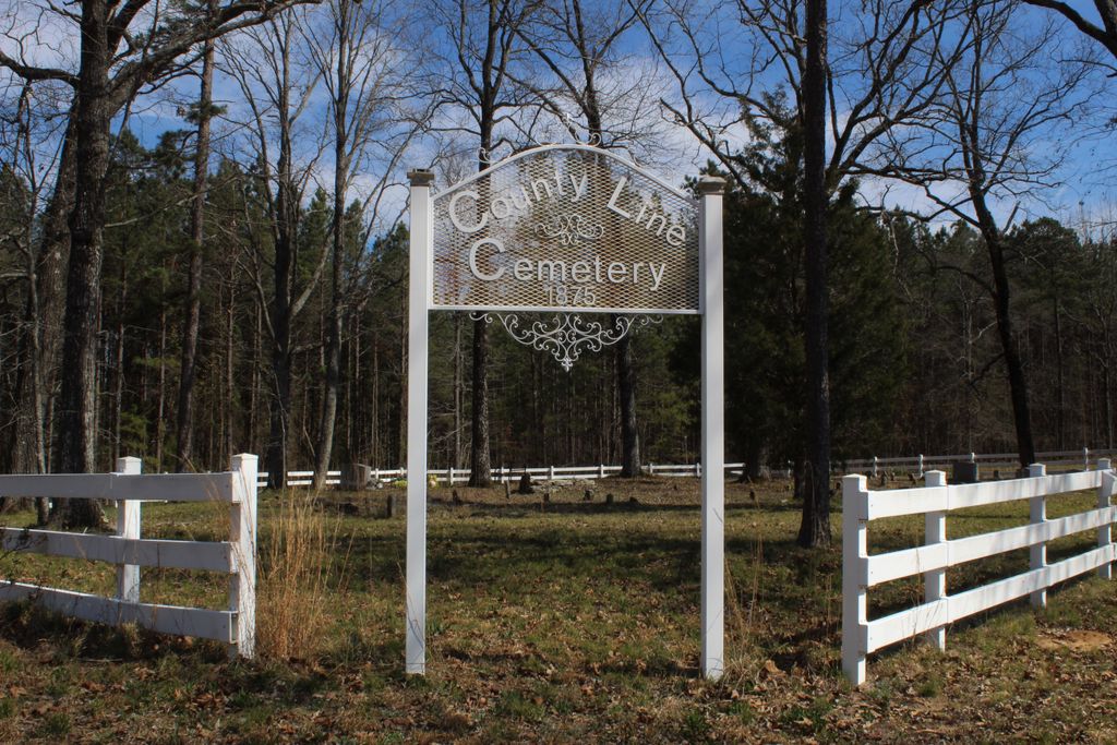
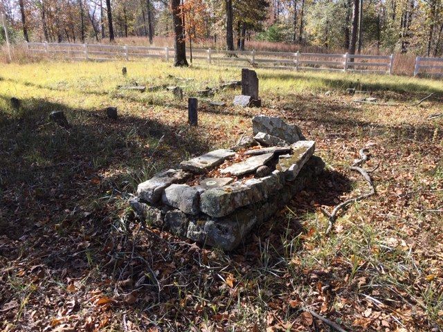
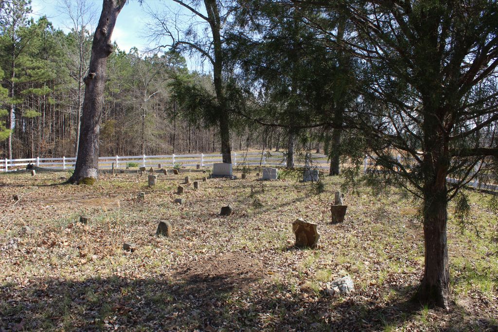
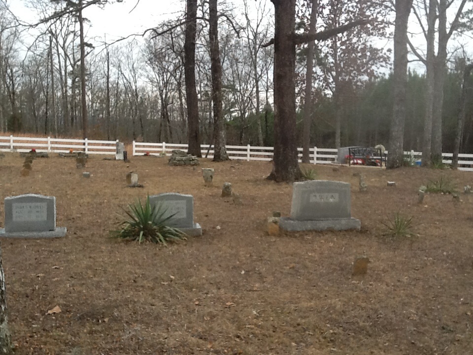
| Description | : | Also known as Phillips Cemetery and Buck Ridge Cemeyery. This is an old cemetery located on Buck Ridge Road off of Pine Mountain Road. There are only 11 marked graves with about 50 graves marked only with rock head and/ or foot stones. Until 2012, when my Dad was buried here, the most recent documented date of death was 1939. Would like for any one with information concerning this cemetery please contact us with your information. (205-966-0054 Ask for Ronnie or Jean) We are in the process of updating this list as best as possible. Work is... Read More |
frequently asked questions (FAQ):
-
Where is County Line Cemetery?
County Line Cemetery is located at Buck Ridge Road Pine Mountain, Blount County ,Alabama ,USA.
-
County Line Cemetery cemetery's updated grave count on graveviews.com?
0 memorials
-
Where are the coordinates of the County Line Cemetery?
Latitude: 33.8127370
Longitude: -86.5184610
Nearby Cemetories:
1. New Hope Methodist Church Cemetery
Holly Springs, Blount County, USA
Coordinate: 33.8307991, -86.4931030
2. Lees Chapel Cemetery
Pine Mountain, Blount County, USA
Coordinate: 33.8037682, -86.5629196
3. Pleasant Mount Cemetery
St. Clair County, USA
Coordinate: 33.8007090, -86.5648610
4. Hooper Cemetery
St. Clair County, USA
Coordinate: 33.8081017, -86.4697037
5. Pine Mountain Baptist Church Cemetery
Rainbow City, Etowah County, USA
Coordinate: 33.8096860, -86.5700600
6. Hulletts Chapel Cemetery
Springville, St. Clair County, USA
Coordinate: 33.7662410, -86.5159670
7. Springville Cemetery
Springville, St. Clair County, USA
Coordinate: 33.7795400, -86.4720630
8. Fuller Cemetery
Springville, St. Clair County, USA
Coordinate: 33.7647018, -86.4775009
9. Mount Zion Cemetery
Springville, St. Clair County, USA
Coordinate: 33.7774530, -86.4594680
10. Clear Springs Cemetery
Allgood, Blount County, USA
Coordinate: 33.8642006, -86.5642014
11. Truss-Bradford Cemetery
Springville, St. Clair County, USA
Coordinate: 33.7507840, -86.4924000
12. Remlap Methodist Church Cemetery
Remlap, Blount County, USA
Coordinate: 33.8182983, -86.5991974
13. Red Hill Baptist Church Cemetery
Springville, St. Clair County, USA
Coordinate: 33.7823610, -86.4296010
14. Mount Calvary Cemetery
Clay, Jefferson County, USA
Coordinate: 33.7352982, -86.5658035
15. Crump Cemetery
Blount County, USA
Coordinate: 33.8880997, -86.5813980
16. Pierce-Braden Cemetery
Odenville, St. Clair County, USA
Coordinate: 33.7532590, -86.4330390
17. New Lebanon Church Cemetery
Margaret, St. Clair County, USA
Coordinate: 33.7250150, -86.4798200
18. Cedar Mount Baptist Church Cemetery
Pinson, Jefferson County, USA
Coordinate: 33.7475014, -86.6007996
19. Presley Cemetery
Margaret, St. Clair County, USA
Coordinate: 33.7181150, -86.5095560
20. Shiloh Cemetery
Chepultepec, Blount County, USA
Coordinate: 33.9068413, -86.4983673
21. Tidwell Cemetery
Allgood, Blount County, USA
Coordinate: 33.9141998, -86.5109024
22. Hopewell United Methodist Church Cemetery
Remlap, Blount County, USA
Coordinate: 33.7719000, -86.6339000
23. Argo Presbyterian Church Cemetery
St. Clair County, USA
Coordinate: 33.7064018, -86.5175018
24. Mardis Cemetery
St. Clair County, USA
Coordinate: 33.7542000, -86.4088974