
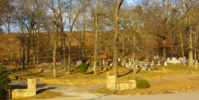
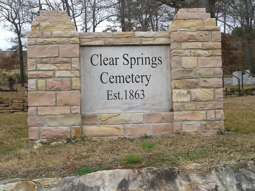
| Memorials | : | 1 |
| Location | : | Allgood, Blount County, USA |
| Coordinate | : | 33.8642006, -86.5642014 |
frequently asked questions (FAQ):
-
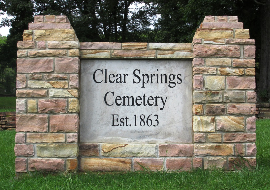
Where is Clear Springs Cemetery?
Clear Springs Cemetery is located at Allgood, Blount County ,Alabama ,USA.
-
Clear Springs Cemetery cemetery's updated grave count on graveviews.com?
1 memorials
-
Where are the coordinates of the Clear Springs Cemetery?
Latitude: 33.8642006
Longitude: -86.5642014
Nearby Cemetories:
1. Crump Cemetery
Blount County, USA
Coordinate: 33.8880997, -86.5813980
2. Remlap Methodist Church Cemetery
Remlap, Blount County, USA
Coordinate: 33.8182983, -86.5991974
3. Pine Mountain Baptist Church Cemetery
Rainbow City, Etowah County, USA
Coordinate: 33.8096860, -86.5700600
4. Pine Bluff Missionary Baptist Church Cemetery
Locust Fork, Blount County, USA
Coordinate: 33.8978004, -86.6175003
5. Marsh Cemetery
Locust Fork, Blount County, USA
Coordinate: 33.8993988, -86.6184998
6. Lees Chapel Cemetery
Pine Mountain, Blount County, USA
Coordinate: 33.8037682, -86.5629196
7. Brown-Hudson Cemetery
Locust Fork, Blount County, USA
Coordinate: 33.9152985, -86.6055984
8. Pleasant Mount Cemetery
St. Clair County, USA
Coordinate: 33.8007090, -86.5648610
9. County Line Cemetery
Pine Mountain, Blount County, USA
Coordinate: 33.8127370, -86.5184610
10. Tidwell Cemetery
Deavers Town, Blount County, USA
Coordinate: 33.9272003, -86.5868988
11. Tidwell Cemetery
Allgood, Blount County, USA
Coordinate: 33.9141998, -86.5109024
12. New Hope Methodist Church Cemetery
Holly Springs, Blount County, USA
Coordinate: 33.8307991, -86.4931030
13. Shiloh Cemetery
Chepultepec, Blount County, USA
Coordinate: 33.9068413, -86.4983673
14. Tabernacle United Methodist Church Cemetery
Locust Fork, Blount County, USA
Coordinate: 33.9025002, -86.6363983
15. Youngblood Family Cemetery
Dallas, Blount County, USA
Coordinate: 33.8614940, -86.6508190
16. Center Hill Independent Presbyterian Cemetery
Blount County, USA
Coordinate: 33.8775650, -86.6581700
17. William Cornelius Cemetery
Blount County, USA
Coordinate: 33.9302559, -86.5061798
18. Bethlehem United Methodist Church Cemetery
Locust Fork, Blount County, USA
Coordinate: 33.8428993, -86.6635971
19. Chitwood Cemetery
Blount County, USA
Coordinate: 33.9536018, -86.5513992
20. Edgewood Baptist Church Cemetery
Locust Fork, Blount County, USA
Coordinate: 33.9221992, -86.6483002
21. Love Family Cemetery
Locust Fork, Blount County, USA
Coordinate: 33.8326020, -86.6691210
22. Philadelphia Cemetery Old
Locust Fork, Blount County, USA
Coordinate: 33.8682251, -86.6792221
23. Hooper Cemetery
St. Clair County, USA
Coordinate: 33.8081017, -86.4697037
24. Easley Church of the Brethren Cemetery
Blount County, USA
Coordinate: 33.9602800, -86.5421800