
| Memorials | : | 0 |
| Location | : | Rawdon, Metropolitan Borough of Leeds, England |
| Coordinate | : | 53.8517260, -1.6919510 |
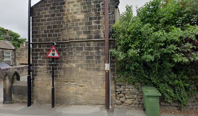
| Description | : | The Cragg Baptist Chapel was built on Micklefield Lane in 1765. This was the second Baptist Chapel built in the area; the first being Cragg Wood Baptist Chapel. The Micklefield Lane Chapel was likely built with stones from Cragg Wood. This building was demolished in 1895 and replaced by a new Chapel. The third building was closed in 1972 when the Baptists, Methodists and Congregationalists joined to form Trinity Church in Rawdon. The Cragg Baptist Chapel was demolished in 1992 and the land was sold for residential purposes. The memorial stones in the chapelyard were removed and the area grassed... Read More |
frequently asked questions (FAQ):
-
Where is Cragg Baptist Chapelyard?
Cragg Baptist Chapelyard is located at Micklefield Lane Rawdon, Metropolitan Borough of Leeds ,West Yorkshire , LS19 6AZEngland.
-
Cragg Baptist Chapelyard cemetery's updated grave count on graveviews.com?
0 memorials
-
Where are the coordinates of the Cragg Baptist Chapelyard?
Latitude: 53.8517260
Longitude: -1.6919510
Nearby Cemetories:
1. Friends Burial Ground
Rawdon, Metropolitan Borough of Leeds, England
Coordinate: 53.8562540, -1.6856120
2. Benton Park Congregational Chapelyard
Rawdon, Metropolitan Borough of Leeds, England
Coordinate: 53.8576300, -1.6881400
3. Cragg Wood Baptist Burial Ground
Rawdon, Metropolitan Borough of Leeds, England
Coordinate: 53.8453830, -1.6898020
4. Greenhill Wesleyan Methodist Chapelyard
Rawdon, Metropolitan Borough of Leeds, England
Coordinate: 53.8503020, -1.6771360
5. St John the Evangelist Churchyard
Yeadon, Metropolitan Borough of Leeds, England
Coordinate: 53.8610120, -1.6908590
6. Esholt Priory
Esholt, Metropolitan Borough of Bradford, England
Coordinate: 53.8529000, -1.7143700
7. Wesleyan Burial Ground
Yeadon, Metropolitan Borough of Leeds, England
Coordinate: 53.8655770, -1.6852220
8. St. Peter's Churchyard
Rawdon, Metropolitan Borough of Leeds, England
Coordinate: 53.8486800, -1.6658000
9. Friends Burial Ground
Yeadon, Metropolitan Borough of Leeds, England
Coordinate: 53.8659722, -1.7047778
10. St Paul Churchyard
Esholt, Metropolitan Borough of Bradford, England
Coordinate: 53.8571100, -1.7240300
11. Rawdon Crematorium
Rawdon, Metropolitan Borough of Leeds, England
Coordinate: 53.8401170, -1.6628580
12. St. Wilfrid Churchyard
Calverley, Metropolitan Borough of Leeds, England
Coordinate: 53.8303600, -1.6849920
13. Yeadon Cemetery
Yeadon, Metropolitan Borough of Leeds, England
Coordinate: 53.8716080, -1.6751690
14. Guiseley Primitive Methodist Chapelyard
Guiseley, Metropolitan Borough of Leeds, England
Coordinate: 53.8733790, -1.7119970
15. St. Oswald's Churchyard
Guiseley, Metropolitan Borough of Leeds, England
Coordinate: 53.8751330, -1.7062080
16. Thorpe Wesleyan Methodist Cemetery
Idle, Metropolitan Borough of Bradford, England
Coordinate: 53.8350900, -1.7259800
17. Holy Trinity Churchyard
Idle, Metropolitan Borough of Bradford, England
Coordinate: 53.8380900, -1.7318300
18. Thorpe Wesleyan Methodist Chapelyard
Idle, Metropolitan Borough of Bradford, England
Coordinate: 53.8343600, -1.7280700
19. Upper Chapel Congregational Old Cemetery
Idle, Metropolitan Borough of Bradford, England
Coordinate: 53.8374500, -1.7355600
20. Upper Chapel Congregational Chapelyard
Idle, Metropolitan Borough of Bradford, England
Coordinate: 53.8371300, -1.7353800
21. Upper Chapel Congregational New Cemetery
Idle, Metropolitan Borough of Bradford, England
Coordinate: 53.8375900, -1.7366700
22. Horsforth Cemetery
Horsforth, Metropolitan Borough of Leeds, England
Coordinate: 53.8334500, -1.6516100
23. Friends Burial Ground
Idle, Metropolitan Borough of Bradford, England
Coordinate: 53.8367910, -1.7397990
24. St Margaret's Burial Ground
Horsforth, Metropolitan Borough of Leeds, England
Coordinate: 53.8376300, -1.6428400