
| Memorials | : | 0 |
| Location | : | Guiseley, Metropolitan Borough of Leeds, England |
| Coordinate | : | 53.8733790, -1.7119970 |
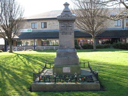
| Description | : | Guiseley Methodist Church Otley Road 1847 1956 DEMOLISHED Providence Chapel, so long a local landmark, was demolished in 1967; followed, in the winter of 1984/85 with the demolition of the Sunday School. Sadly bringing to an end an important chapter in Guiseleys local and family history. Burial Grounds Landscaped In 1973, The Burial Grounds was landscaped by the Aireborough Urban District Council under the Open Space act, this "Open Space" is still to be seen in front of Morrison's Supermarket, who when they developed their Supermarket buildings, made further improvements to the landscaped site. A single token monument remains, with a plaque... Read More |
frequently asked questions (FAQ):
-
Where is Guiseley Primitive Methodist Chapelyard?
Guiseley Primitive Methodist Chapelyard is located at Guiseley, Metropolitan Borough of Leeds ,West Yorkshire ,England.
-
Guiseley Primitive Methodist Chapelyard cemetery's updated grave count on graveviews.com?
0 memorials
-
Where are the coordinates of the Guiseley Primitive Methodist Chapelyard?
Latitude: 53.8733790
Longitude: -1.7119970
Nearby Cemetories:
1. St. Oswald's Churchyard
Guiseley, Metropolitan Borough of Leeds, England
Coordinate: 53.8751330, -1.7062080
2. Friends Burial Ground
Yeadon, Metropolitan Borough of Leeds, England
Coordinate: 53.8659722, -1.7047778
3. Guiseley Cemetery
Guiseley, Metropolitan Borough of Leeds, England
Coordinate: 53.8846820, -1.7192470
4. Menston Cemetery
Menston, Metropolitan Borough of Bradford, England
Coordinate: 53.8858550, -1.7278460
5. High Royds Memorial Garden
Menston, Metropolitan Borough of Bradford, England
Coordinate: 53.8866100, -1.7283200
6. St John the Evangelist Churchyard
Yeadon, Metropolitan Borough of Leeds, England
Coordinate: 53.8610120, -1.6908590
7. Wesleyan Burial Ground
Yeadon, Metropolitan Borough of Leeds, England
Coordinate: 53.8655770, -1.6852220
8. St Paul Churchyard
Esholt, Metropolitan Borough of Bradford, England
Coordinate: 53.8571100, -1.7240300
9. Esholt Priory
Esholt, Metropolitan Borough of Bradford, England
Coordinate: 53.8529000, -1.7143700
10. Benton Park Congregational Chapelyard
Rawdon, Metropolitan Borough of Leeds, England
Coordinate: 53.8576300, -1.6881400
11. Yeadon Cemetery
Yeadon, Metropolitan Borough of Leeds, England
Coordinate: 53.8716080, -1.6751690
12. Friends Burial Ground
Rawdon, Metropolitan Borough of Leeds, England
Coordinate: 53.8562540, -1.6856120
13. Cragg Baptist Chapelyard
Rawdon, Metropolitan Borough of Leeds, England
Coordinate: 53.8517260, -1.6919510
14. St John the Divine Churchyard
Menston, Metropolitan Borough of Bradford, England
Coordinate: 53.8919500, -1.7455200
15. God's Acre Cemetery
Burley-in-Wharfedale, Metropolitan Borough of Bradford, England
Coordinate: 53.8996500, -1.7393000
16. Cragg Wood Baptist Burial Ground
Rawdon, Metropolitan Borough of Leeds, England
Coordinate: 53.8453830, -1.6898020
17. Greenhill Wesleyan Methodist Chapelyard
Rawdon, Metropolitan Borough of Leeds, England
Coordinate: 53.8503020, -1.6771360
18. All Saints Churchyard
Otley, Metropolitan Borough of Leeds, England
Coordinate: 53.9040570, -1.6946780
19. Otley War Memorial
Otley, Metropolitan Borough of Leeds, England
Coordinate: 53.9041280, -1.6925650
20. Otley Methodist Church War Memorial
Otley, Metropolitan Borough of Leeds, England
Coordinate: 53.9057130, -1.6906820
21. Our Lady and All Saints Catholic Church
Otley, Metropolitan Borough of Leeds, England
Coordinate: 53.9070200, -1.6940970
22. Salem Independent Congregational Chapelyard
Otley, Metropolitan Borough of Leeds, England
Coordinate: 53.9073370, -1.6939380
23. St. Peter's Churchyard
Rawdon, Metropolitan Borough of Leeds, England
Coordinate: 53.8486800, -1.6658000
24. St John Churchyard
Baildon, Metropolitan Borough of Bradford, England
Coordinate: 53.8530330, -1.7641430