
| Memorials | : | 0 |
| Location | : | Rawdon, Metropolitan Borough of Leeds, England |
| Coordinate | : | 53.8562540, -1.6856120 |
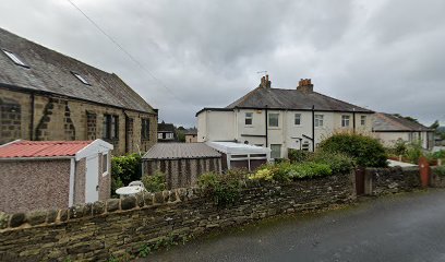
| Description | : | The present Meeting House was built in 1697 and is still actively used. The land for the buildings and burial ground were part of a plot of four acres leased from Francis Rawdon in 1632 by the Society of Friends for a term of 1,000 years. |
frequently asked questions (FAQ):
-
Where is Friends Burial Ground?
Friends Burial Ground is located at Quakers Lane Rawdon, Metropolitan Borough of Leeds ,West Yorkshire , LS19 6HUEngland.
-
Friends Burial Ground cemetery's updated grave count on graveviews.com?
0 memorials
-
Where are the coordinates of the Friends Burial Ground?
Latitude: 53.8562540
Longitude: -1.6856120
Nearby Cemetories:
1. Benton Park Congregational Chapelyard
Rawdon, Metropolitan Borough of Leeds, England
Coordinate: 53.8576300, -1.6881400
2. St John the Evangelist Churchyard
Yeadon, Metropolitan Borough of Leeds, England
Coordinate: 53.8610120, -1.6908590
3. Cragg Baptist Chapelyard
Rawdon, Metropolitan Borough of Leeds, England
Coordinate: 53.8517260, -1.6919510
4. Greenhill Wesleyan Methodist Chapelyard
Rawdon, Metropolitan Borough of Leeds, England
Coordinate: 53.8503020, -1.6771360
5. Wesleyan Burial Ground
Yeadon, Metropolitan Borough of Leeds, England
Coordinate: 53.8655770, -1.6852220
6. Cragg Wood Baptist Burial Ground
Rawdon, Metropolitan Borough of Leeds, England
Coordinate: 53.8453830, -1.6898020
7. St. Peter's Churchyard
Rawdon, Metropolitan Borough of Leeds, England
Coordinate: 53.8486800, -1.6658000
8. Friends Burial Ground
Yeadon, Metropolitan Borough of Leeds, England
Coordinate: 53.8659722, -1.7047778
9. Yeadon Cemetery
Yeadon, Metropolitan Borough of Leeds, England
Coordinate: 53.8716080, -1.6751690
10. Esholt Priory
Esholt, Metropolitan Borough of Bradford, England
Coordinate: 53.8529000, -1.7143700
11. Rawdon Crematorium
Rawdon, Metropolitan Borough of Leeds, England
Coordinate: 53.8401170, -1.6628580
12. St. Oswald's Churchyard
Guiseley, Metropolitan Borough of Leeds, England
Coordinate: 53.8751330, -1.7062080
13. St Paul Churchyard
Esholt, Metropolitan Borough of Bradford, England
Coordinate: 53.8571100, -1.7240300
14. Guiseley Primitive Methodist Chapelyard
Guiseley, Metropolitan Borough of Leeds, England
Coordinate: 53.8733790, -1.7119970
15. St. Wilfrid Churchyard
Calverley, Metropolitan Borough of Leeds, England
Coordinate: 53.8303600, -1.6849920
16. Horsforth Cemetery
Horsforth, Metropolitan Borough of Leeds, England
Coordinate: 53.8334500, -1.6516100
17. St Margaret's Burial Ground
Horsforth, Metropolitan Borough of Leeds, England
Coordinate: 53.8376300, -1.6428400
18. Thorpe Wesleyan Methodist Cemetery
Idle, Metropolitan Borough of Bradford, England
Coordinate: 53.8350900, -1.7259800
19. Horsforth Peace Gardens
Horsforth, Metropolitan Borough of Leeds, England
Coordinate: 53.8364395, -1.6430796
20. Holy Trinity Churchyard
Idle, Metropolitan Borough of Bradford, England
Coordinate: 53.8380900, -1.7318300
21. Thorpe Wesleyan Methodist Chapelyard
Idle, Metropolitan Borough of Bradford, England
Coordinate: 53.8343600, -1.7280700
22. Guiseley Cemetery
Guiseley, Metropolitan Borough of Leeds, England
Coordinate: 53.8846820, -1.7192470
23. Upper Chapel Congregational Old Cemetery
Idle, Metropolitan Borough of Bradford, England
Coordinate: 53.8374500, -1.7355600
24. Upper Chapel Congregational Chapelyard
Idle, Metropolitan Borough of Bradford, England
Coordinate: 53.8371300, -1.7353800