
| Memorials | : | 0 |
| Location | : | Beaverlick, Boone County, USA |
| Coordinate | : | 38.9064460, -84.8117250 |
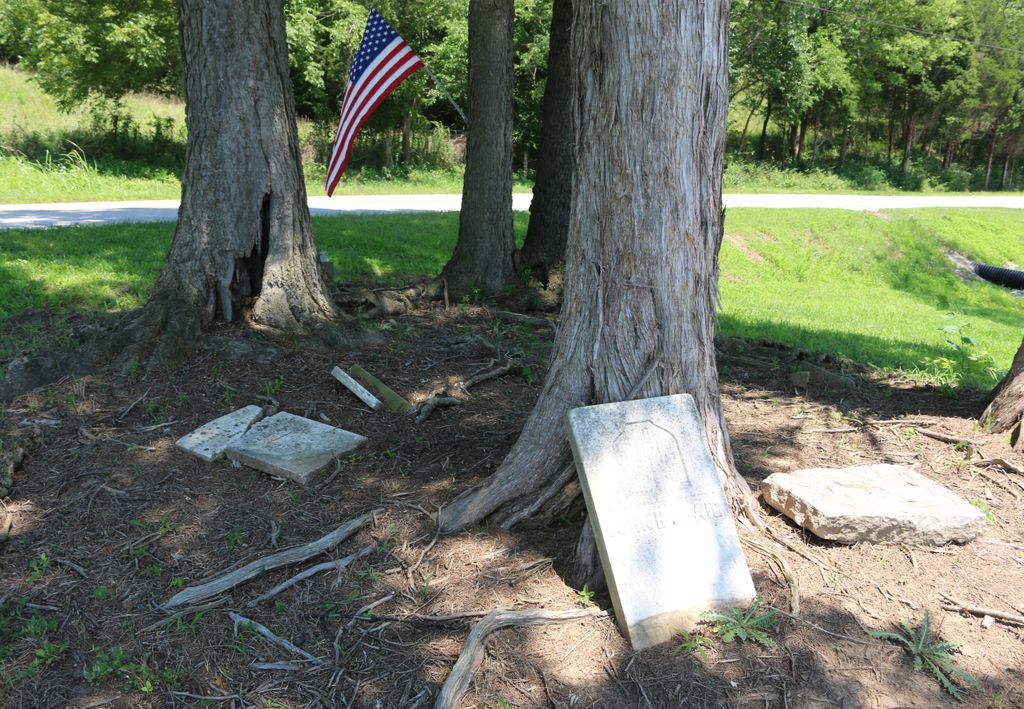
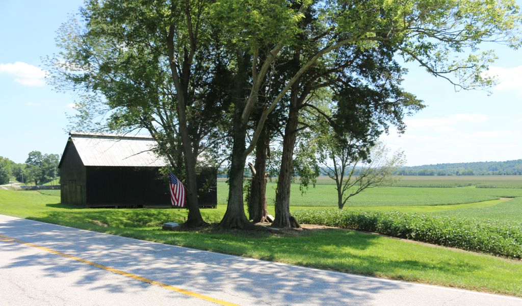
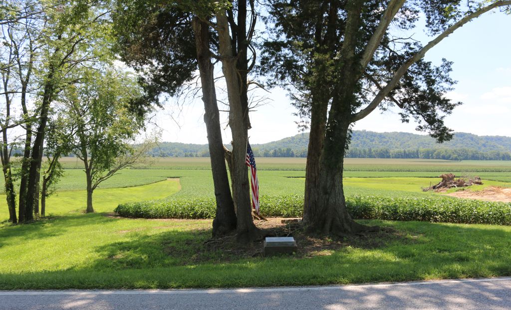
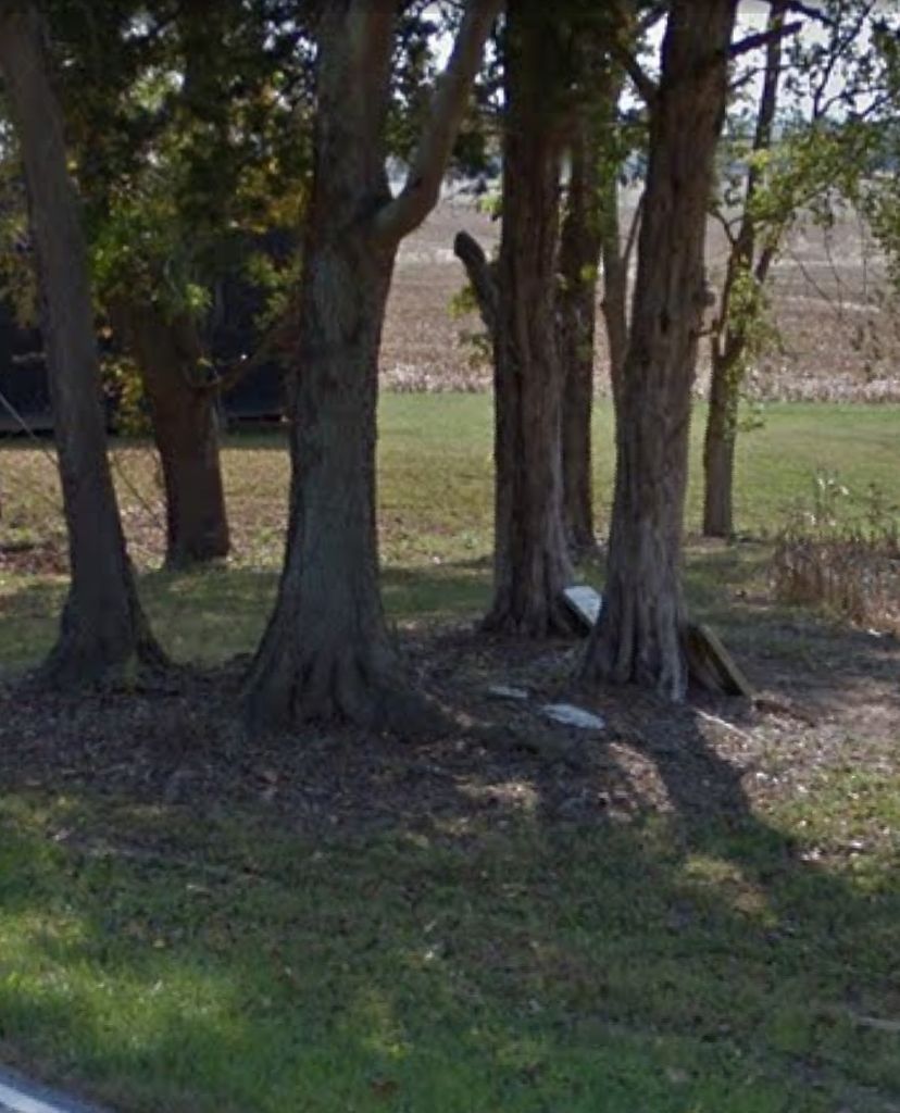
| Description | : | The cemetery is located on the south side of Beaver Road (Kentucky State Route 338) among trees about 0.8 miles west of its intersection with Kentucky State Route 2852. The Boone County GIS unique ID assigned to this cemetery is 53 (Craig, J. H. Cemetery). The cemetery has an index number of 54 (Craig Cemetery) on the Boone County Kentucky Cemetery Map published in 2005 by the Boone County Planning Commission in conjunction with Johnson-Wilson Cemetery Stewards Association. The cemetery is identified as the John Hawkins Craig Cemetery in the Boone County Family Cemetery Register, Volume 1, compiled... Read More |
frequently asked questions (FAQ):
-
Where is Craig Cemetery?
Craig Cemetery is located at Beaver Road (Kentucky State Route 338) Beaverlick, Boone County ,Kentucky , 41091USA.
-
Craig Cemetery cemetery's updated grave count on graveviews.com?
0 memorials
-
Where are the coordinates of the Craig Cemetery?
Latitude: 38.9064460
Longitude: -84.8117250
Nearby Cemetories:
1. Kirtley Cemetery (Defunct)
Rabbit Hash, Boone County, USA
Coordinate: 38.9064460, -84.8117250
2. Jimerson Craig Cemetery
Beaverlick, Boone County, USA
Coordinate: 38.9030560, -84.8041670
3. Kirtley Cemetery (Defunct)
Rabbit Hash, Boone County, USA
Coordinate: 38.9082985, -84.8202972
4. Gregory Cemetery
Rabbit Hash, Boone County, USA
Coordinate: 38.9007988, -84.8022003
5. Allen Cemetery
Union, Boone County, USA
Coordinate: 38.9126830, -84.8003430
6. Ryle Cemetery
Rabbit Hash, Boone County, USA
Coordinate: 38.9189500, -84.8080040
7. William Hodges Cemetery
Rabbit Hash, Boone County, USA
Coordinate: 38.9200000, -84.8322230
8. Ryle Cemetery
Rabbit Hash, Boone County, USA
Coordinate: 38.9289501, -84.8035591
9. East Bend Baptist Church Cemetery
Rabbit Hash, Boone County, USA
Coordinate: 38.9189339, -84.8530960
10. Stephens Cemetery
Rabbit Hash, Boone County, USA
Coordinate: 38.9308014, -84.8435974
11. Sullivan-Horton Cemetery
Rabbit Hash, Boone County, USA
Coordinate: 38.9353720, -84.7859060
12. Scott Cemetery
Rabbit Hash, Boone County, USA
Coordinate: 38.9427780, -84.8244440
13. Old Ryle Homeplace Cemetery
Union, Boone County, USA
Coordinate: 38.9427780, -84.7986110
14. East Bend Methodist Church Cemetery
Rabbit Hash, Boone County, USA
Coordinate: 38.9198000, -84.8583300
15. Warner Cemetery
Patriot, Switzerland County, USA
Coordinate: 38.8704000, -84.8313000
16. Wilson Cemetery
Rabbit Hash, Boone County, USA
Coordinate: 38.9446983, -84.8341980
17. Pearson Cemetery
Boone County, USA
Coordinate: 38.9491997, -84.8186035
18. Wright Carpenter Gravesite
Big Bone, Boone County, USA
Coordinate: 38.8862590, -84.7623330
19. Craig Cemetery
Rabbit Hash, Boone County, USA
Coordinate: 38.9458008, -84.8367004
20. Mead Cemetery
Switzerland County, USA
Coordinate: 38.8717003, -84.8531036
21. North Cemetery
Switzerland County, USA
Coordinate: 38.9007988, -84.8758011
22. Beech Grove Holiness Church Cemetery
Waterloo, Boone County, USA
Coordinate: 38.9518500, -84.7839100
23. Black Cemetery
Union, Boone County, USA
Coordinate: 38.8736000, -84.7605972
24. Grimsley Family Cemetery
Big Bone, Boone County, USA
Coordinate: 38.8581886, -84.7853546