
| Memorials | : | 1 |
| Location | : | Rabbit Hash, Boone County, USA |
| Coordinate | : | 38.9308014, -84.8435974 |
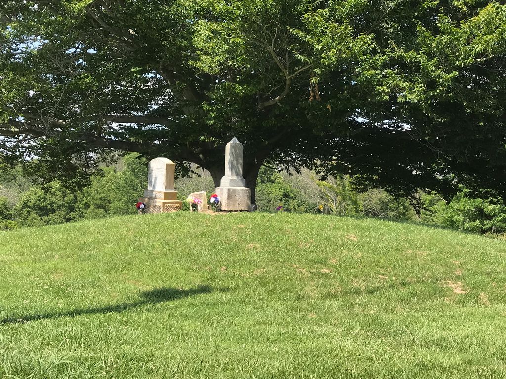
| Description | : | The cemetery is located on the northwest side of East Bend Road (Kentucky State Highway 338) about 1.2 miles south of its intersection with Rabbit Hash Road (Kentucky State Highway 536). The Boone County GIS unique ID assigned to this cemetery is 160 (Stephens Cemetery). The cemetery has an index number of 162 (Stephens) on the Boone County Kentucky Cemetery Map published in 2005 by the Boone County Planning Commission in conjunction with Johnson-Wilson Cemetery Stewards Association. The cemetery is identified as Stephens #1 in the index and listed as Stephens Cemetery on page 153 of the book “Boone County, Kentucky Cemeteries” by... Read More |
frequently asked questions (FAQ):
-
Where is Stephens Cemetery?
Stephens Cemetery is located at East Bend Road (Kentucky State Highway 338) Rabbit Hash, Boone County ,Kentucky , 41091USA.
-
Stephens Cemetery cemetery's updated grave count on graveviews.com?
1 memorials
-
Where are the coordinates of the Stephens Cemetery?
Latitude: 38.9308014
Longitude: -84.8435974
Nearby Cemetories:
1. William Hodges Cemetery
Rabbit Hash, Boone County, USA
Coordinate: 38.9200000, -84.8322230
2. East Bend Baptist Church Cemetery
Rabbit Hash, Boone County, USA
Coordinate: 38.9189339, -84.8530960
3. Wilson Cemetery
Rabbit Hash, Boone County, USA
Coordinate: 38.9446983, -84.8341980
4. East Bend Methodist Church Cemetery
Rabbit Hash, Boone County, USA
Coordinate: 38.9198000, -84.8583300
5. Craig Cemetery
Rabbit Hash, Boone County, USA
Coordinate: 38.9458008, -84.8367004
6. Scott Cemetery
Rabbit Hash, Boone County, USA
Coordinate: 38.9427780, -84.8244440
7. Cedar Hedge Cemetery
Rising Sun, Ohio County, USA
Coordinate: 38.9496994, -84.8621979
8. Union Cemetery
Rising Sun, Ohio County, USA
Coordinate: 38.9508896, -84.8610077
9. Pearson Cemetery
Boone County, USA
Coordinate: 38.9491997, -84.8186035
10. Rising Sun Cemetery
Rising Sun, Ohio County, USA
Coordinate: 38.9546350, -84.8632410
11. Kirtley Cemetery (Defunct)
Rabbit Hash, Boone County, USA
Coordinate: 38.9082985, -84.8202972
12. Rising Sun New Cemetery
Rising Sun, Ohio County, USA
Coordinate: 38.9547005, -84.8660965
13. Ryle Cemetery
Rabbit Hash, Boone County, USA
Coordinate: 38.9189500, -84.8080040
14. Ryle Cemetery
Rabbit Hash, Boone County, USA
Coordinate: 38.9289501, -84.8035591
15. Close Cemetery
Rising Sun, Ohio County, USA
Coordinate: 38.9602000, -84.8625000
16. Craig Cemetery
Beaverlick, Boone County, USA
Coordinate: 38.9064460, -84.8117250
17. Kirtley Cemetery (Defunct)
Rabbit Hash, Boone County, USA
Coordinate: 38.9064460, -84.8117250
18. Old Ryle Homeplace Cemetery
Union, Boone County, USA
Coordinate: 38.9427780, -84.7986110
19. Allen Cemetery
Union, Boone County, USA
Coordinate: 38.9126830, -84.8003430
20. North Cemetery
Switzerland County, USA
Coordinate: 38.9007988, -84.8758011
21. Jimerson Craig Cemetery
Beaverlick, Boone County, USA
Coordinate: 38.9030560, -84.8041670
22. Pickett Cemetery
Rising Sun, Ohio County, USA
Coordinate: 38.9243000, -84.8965000
23. Fulton Burying Ground
Rising Sun, Ohio County, USA
Coordinate: 38.9739150, -84.8498100
24. Gregory Cemetery
Rabbit Hash, Boone County, USA
Coordinate: 38.9007988, -84.8022003