
| Memorials | : | 0 |
| Location | : | Rabbit Hash, Boone County, USA |
| Coordinate | : | 38.9189339, -84.8530960 |
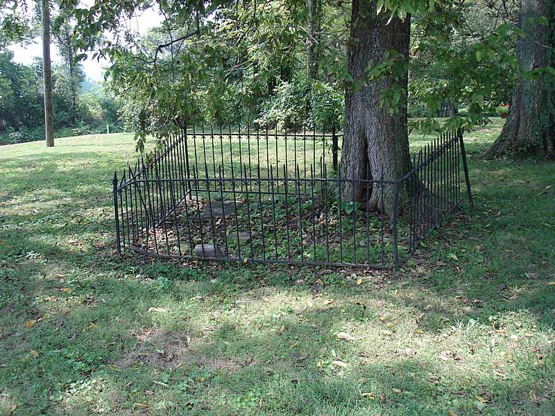
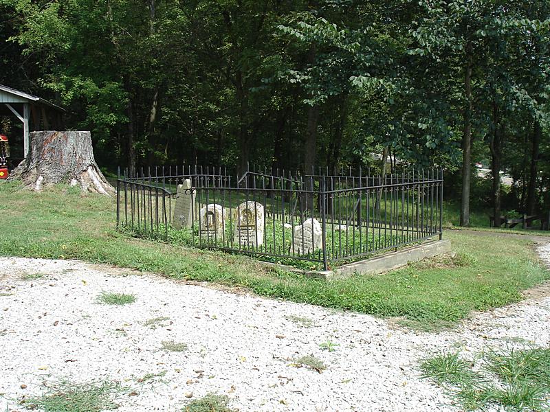
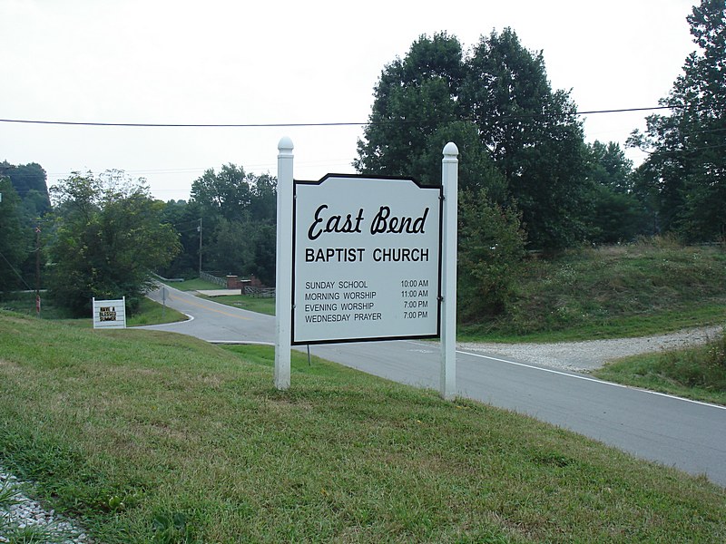
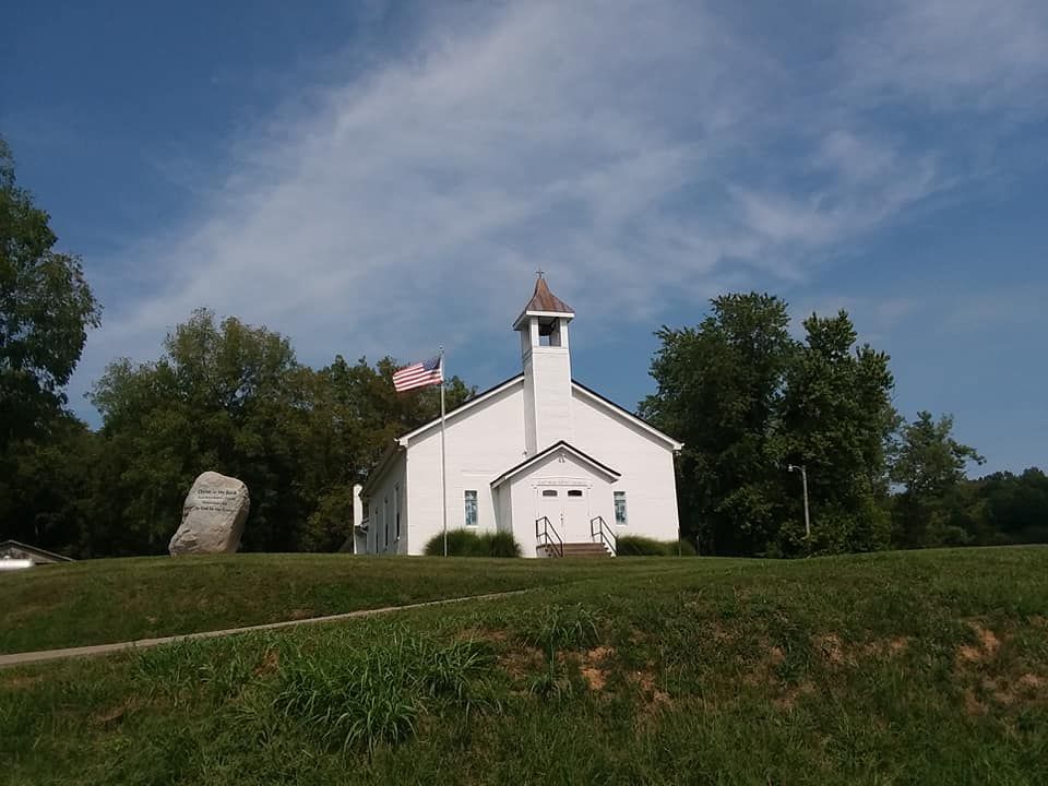
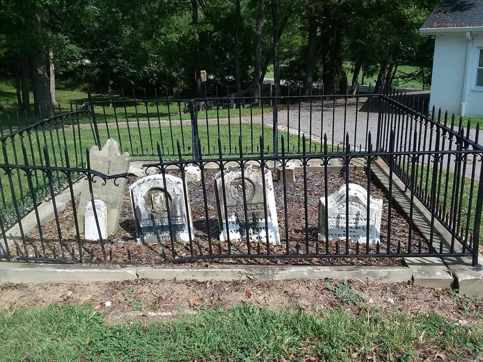
| Description | : | The cemetery is located on the northwest corner of the intersection of East Bend Road (Kentucky State Highway 338) and Lower River Road. Burials occurred from 1832 through 1868. The Boone County GIS unique ID assigned to this cemetery is 66 (East Bend Baptist Cemetery). The cemetery has an index number of 67 (East Bend Baptist) on the Boone County Kentucky Cemetery Map published in 2005 by the Boone County Planning Commission in conjunction with Johnson-Wilson Cemetery Stewards Association. The cemetery is identified as East End Baptist Church in the index and listed as East End Baptist Church Cemetery on page 54 of... Read More |
frequently asked questions (FAQ):
-
Where is East Bend Baptist Church Cemetery?
East Bend Baptist Church Cemetery is located at East Bend Road (Kentucky State Highway 338) and Lower River Road Rabbit Hash, Boone County ,Kentucky , 41091USA.
-
East Bend Baptist Church Cemetery cemetery's updated grave count on graveviews.com?
0 memorials
-
Where are the coordinates of the East Bend Baptist Church Cemetery?
Latitude: 38.9189339
Longitude: -84.8530960
Nearby Cemetories:
1. East Bend Methodist Church Cemetery
Rabbit Hash, Boone County, USA
Coordinate: 38.9198000, -84.8583300
2. Stephens Cemetery
Rabbit Hash, Boone County, USA
Coordinate: 38.9308014, -84.8435974
3. William Hodges Cemetery
Rabbit Hash, Boone County, USA
Coordinate: 38.9200000, -84.8322230
4. North Cemetery
Switzerland County, USA
Coordinate: 38.9007988, -84.8758011
5. Kirtley Cemetery (Defunct)
Rabbit Hash, Boone County, USA
Coordinate: 38.9082985, -84.8202972
6. Wilson Cemetery
Rabbit Hash, Boone County, USA
Coordinate: 38.9446983, -84.8341980
7. Craig Cemetery
Rabbit Hash, Boone County, USA
Coordinate: 38.9458008, -84.8367004
8. Cedar Hedge Cemetery
Rising Sun, Ohio County, USA
Coordinate: 38.9496994, -84.8621979
9. Union Cemetery
Rising Sun, Ohio County, USA
Coordinate: 38.9508896, -84.8610077
10. Scott Cemetery
Rabbit Hash, Boone County, USA
Coordinate: 38.9427780, -84.8244440
11. Pickett Cemetery
Rising Sun, Ohio County, USA
Coordinate: 38.9243000, -84.8965000
12. Craig Cemetery
Beaverlick, Boone County, USA
Coordinate: 38.9064460, -84.8117250
13. Kirtley Cemetery (Defunct)
Rabbit Hash, Boone County, USA
Coordinate: 38.9064460, -84.8117250
14. Ryle Cemetery
Rabbit Hash, Boone County, USA
Coordinate: 38.9189500, -84.8080040
15. Rising Sun Cemetery
Rising Sun, Ohio County, USA
Coordinate: 38.9546350, -84.8632410
16. Lostetter Cemetery
Switzerland County, USA
Coordinate: 38.9005800, -84.8940180
17. Rising Sun New Cemetery
Rising Sun, Ohio County, USA
Coordinate: 38.9547005, -84.8660965
18. Ryle Cemetery
Rabbit Hash, Boone County, USA
Coordinate: 38.9289501, -84.8035591
19. Pearson Cemetery
Boone County, USA
Coordinate: 38.9491997, -84.8186035
20. Jimerson Craig Cemetery
Beaverlick, Boone County, USA
Coordinate: 38.9030560, -84.8041670
21. Allen Cemetery
Union, Boone County, USA
Coordinate: 38.9126830, -84.8003430
22. Close Cemetery
Rising Sun, Ohio County, USA
Coordinate: 38.9602000, -84.8625000
23. Gregory Cemetery
Rabbit Hash, Boone County, USA
Coordinate: 38.9007988, -84.8022003
24. Mead Cemetery
Switzerland County, USA
Coordinate: 38.8717003, -84.8531036