
| Memorials | : | 0 |
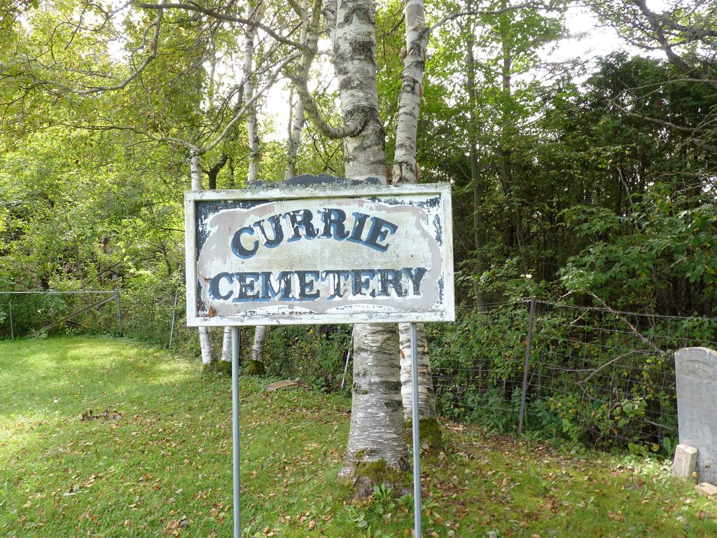
| Location | : | Bath, Carleton County, Canada |
| Coordinate | : | 46.5293370, -67.6286000 |
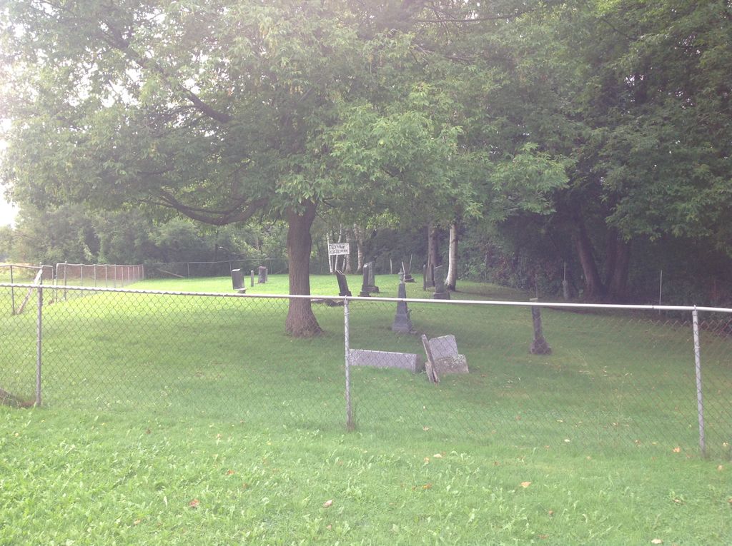
| Description | : | If you have information to update the Currie Cemetery, please send them to Eileen Lentz [Contributor #46845642], creator of the Currie Cemetery on Find A Grave. My cousin Eric Erickson gave me the following description of where he remembered visiting a few decades ago the cemetery where our great great grandparents were buried: "Currie Cemetery is situated on the bend of the Saint John River, just above the road that leads to Holmsville Corner on the No. 2 Highway (now No. 105) about 1-1.25 miles above the town of Bath, Carleton Co. New Brunswick. The Cemetery is in a pasture." Thanks... Read More |
frequently asked questions (FAQ):
-
Where is Currie Cemetery?
Currie Cemetery is located at Bath, Carleton County ,New Brunswick ,Canada.
-
Currie Cemetery cemetery's updated grave count on graveviews.com?
0 memorials
-
Where are the coordinates of the Currie Cemetery?
Latitude: 46.5293370
Longitude: -67.6286000
Nearby Cemetories:
1. Gee Flat Cemetery
Bath, Carleton County, Canada
Coordinate: 46.5213340, -67.6162040
2. Pine Tree Cemetery
Bath, Carleton County, Canada
Coordinate: 46.5164370, -67.6046100
3. Taylor Cemetery
Piercemont, Carleton County, Canada
Coordinate: 46.5548580, -67.6317020
4. Beechwood United Baptist Cemetery
Beechwood, Carleton County, Canada
Coordinate: 46.5433300, -67.6625000
5. Barker Cemetery
Bath, Carleton County, Canada
Coordinate: 46.5102780, -67.5961110
6. Pomphrey Cemetery
Wicklow, Carleton County, Canada
Coordinate: 46.5437840, -67.6802360
7. Lower Wicklow Cemetery
Wicklow, Carleton County, Canada
Coordinate: 46.4916000, -67.5862200
8. Free Will Baptist Church Cemetery
Holmesville, Carleton County, Canada
Coordinate: 46.5748720, -67.6033510
9. Buckley Cemetery
Holmesville, Carleton County, Canada
Coordinate: 46.5781683, -67.6194186
10. Summerfield Cemetery
Wicklow, Carleton County, Canada
Coordinate: 46.5249990, -67.7083540
11. Greenfield Anglican Cemetery
Greenfield, Carleton County, Canada
Coordinate: 46.4900710, -67.6862390
12. Wharton Cemetery
Upper Kent, Carleton County, Canada
Coordinate: 46.5583300, -67.7011100
13. Middle Greenfield Cemetery
Wicklow, Carleton County, Canada
Coordinate: 46.4711250, -67.6328790
14. Pioneer Cemetery
Wicklow, Carleton County, Canada
Coordinate: 46.4678970, -67.6316370
15. Bristol United Church Cemetery
Florenceville-Bristol, Carleton County, Canada
Coordinate: 46.4722370, -67.5787790
16. Bristol Free Baptist Church Cemetery
Florenceville-Bristol, Carleton County, Canada
Coordinate: 46.4714600, -67.5754500
17. Pomphrey Island Cemetery
Clearview, Carleton County, Canada
Coordinate: 46.5637693, -67.7153083
18. Mineral Cemetery
Kent, Carleton County, Canada
Coordinate: 46.5918753, -67.5843827
19. Bristol Old Cemetery
Florenceville-Bristol, Carleton County, Canada
Coordinate: 46.4662680, -67.5852480
20. Greenfield Cemetery
Wicklow, Carleton County, Canada
Coordinate: 46.4582068, -67.6370988
21. Bristol Community Cemetery
Florenceville-Bristol, Carleton County, Canada
Coordinate: 46.4661420, -67.5732070
22. Moose Mountain Pioneer Cemetery
Moose Mountain, Carleton County, Canada
Coordinate: 46.6007340, -67.6610030
23. Old McCain Cemetery
Florenceville, Carleton County, Canada
Coordinate: 46.4542710, -67.6167580
24. St Bartholomew Catholic Cemetery
Clearview, Carleton County, Canada
Coordinate: 46.5730900, -67.7196300