
| Memorials | : | 0 |
| Location | : | Moose Mountain, Carleton County, Canada |
| Coordinate | : | 46.6007340, -67.6610030 |
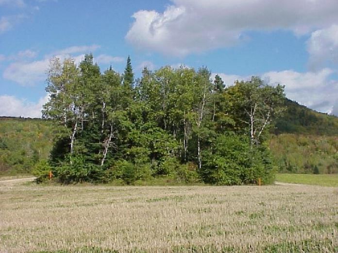
| Description | : | This overgrown cemetery is located off the Maplehurst Road, located on the westward facing side of Moose Mountain surrounded by grain fields. It is believed that this burial ground was active from the mid-19th century until sometime in 1931, but this has yet to be confirmed. The land was originally owned by John Cox a few years before the cemetery began in the 1830s, and has since been worn down by the next several owners and their workers of the land until there are no more headstones found. In 2005, the H.J.Crabbe & Sons Ltd. has had the cemetery surveyed, and... Read More |
frequently asked questions (FAQ):
-
Where is Moose Mountain Pioneer Cemetery?
Moose Mountain Pioneer Cemetery is located at Moose Mountain, Carleton County ,New Brunswick ,Canada.
-
Moose Mountain Pioneer Cemetery cemetery's updated grave count on graveviews.com?
0 memorials
-
Where are the coordinates of the Moose Mountain Pioneer Cemetery?
Latitude: 46.6007340
Longitude: -67.6610030
Nearby Cemetories:
1. Melville Cemetery
Kincardine, Victoria County, Canada
Coordinate: 46.6366790, -67.6660930
2. Buckley Cemetery
Holmesville, Carleton County, Canada
Coordinate: 46.5781683, -67.6194186
3. Hawthorne Cemetery
Upper Kent, Carleton County, Canada
Coordinate: 46.5833177, -67.7179017
4. Bairdsville Anglican Cemetery
Bairdsville, Victoria County, Canada
Coordinate: 46.6269606, -67.7164698
5. Free Will Baptist Church Cemetery
Holmesville, Carleton County, Canada
Coordinate: 46.5748720, -67.6033510
6. St Bartholomew Catholic Cemetery
Clearview, Carleton County, Canada
Coordinate: 46.5730900, -67.7196300
7. Taylor Cemetery
Piercemont, Carleton County, Canada
Coordinate: 46.5548580, -67.6317020
8. Kilburn Community Cemetery
Kilburn, Victoria County, Canada
Coordinate: 46.6406400, -67.7061800
9. Wharton Cemetery
Upper Kent, Carleton County, Canada
Coordinate: 46.5583300, -67.7011100
10. Pomphrey Island Cemetery
Clearview, Carleton County, Canada
Coordinate: 46.5637693, -67.7153083
11. Mineral Cemetery
Kent, Carleton County, Canada
Coordinate: 46.5918753, -67.5843827
12. Beechwood United Baptist Cemetery
Beechwood, Carleton County, Canada
Coordinate: 46.5433300, -67.6625000
13. Pomphrey Cemetery
Wicklow, Carleton County, Canada
Coordinate: 46.5437840, -67.6802360
14. River de Chute Cemetery
Carleton County, Canada
Coordinate: 46.5935500, -67.7500700
15. Currie Cemetery
Bath, Carleton County, Canada
Coordinate: 46.5293370, -67.6286000
16. Johnville Cemetery
Johnville, Carleton County, Canada
Coordinate: 46.5870263, -67.5493302
17. Summerfield Cemetery
Wicklow, Carleton County, Canada
Coordinate: 46.5249990, -67.7083540
18. Bishop Cemetery
Kilburn, Victoria County, Canada
Coordinate: 46.6748150, -67.7192446
19. Gee Flat Cemetery
Bath, Carleton County, Canada
Coordinate: 46.5213340, -67.6162040
20. Pine Tree Cemetery
Bath, Carleton County, Canada
Coordinate: 46.5164370, -67.6046100
21. Upper Knoxford Cemetery
Upper Knoxford, Carleton County, Canada
Coordinate: 46.5205700, -67.7492700
22. Barker Cemetery
Bath, Carleton County, Canada
Coordinate: 46.5102780, -67.5961110
23. Beaconsfield Baptist Church Cemetery
Beaconsfield, Victoria County, Canada
Coordinate: 46.6640360, -67.7803850
24. Greenfield Anglican Cemetery
Greenfield, Carleton County, Canada
Coordinate: 46.4900710, -67.6862390