
| Memorials | : | 16 |
| Location | : | Holmesville, Carleton County, Canada |
| Coordinate | : | 46.5748720, -67.6033510 |
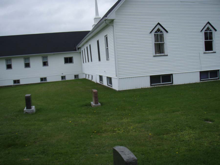
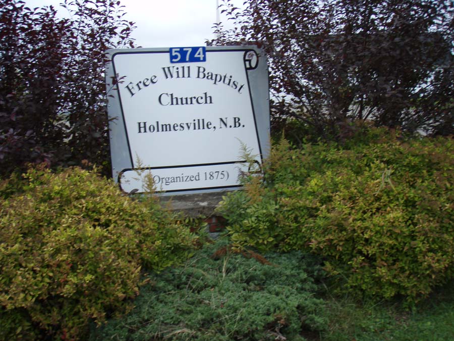
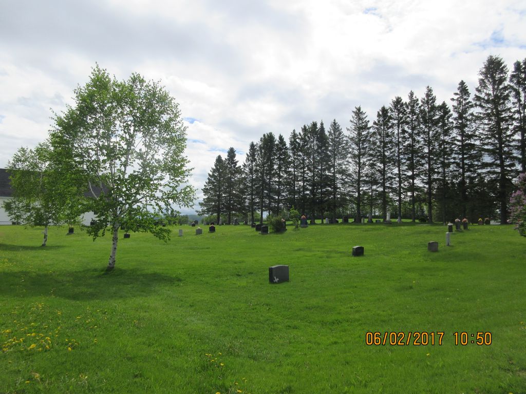
| Description | : | Located at 574 NB-565 N in Holmesville, Carleton County, New Brunswick. Here is a link for Driving directions to 574 NB 565 N from Johnsville Road. Free Will Baptist Church Cemetery is behind and toward the crossroad of McElroy Road. Use the street view to see different views of the church and the cemetery. George H. Hayward's (35) Holmesville Cemetery transcription, data recorded by George and Maxine Hayward, 13 Sep 1987 and published in Northern Carleton County, N.B., Cemeteries, Volume 1 (1988, 1996) pages 238-240, provided stone inscriptions for many of the memorials in this cemetery. Additional data, family links, and pictures will... Read More |
frequently asked questions (FAQ):
-
Where is Free Will Baptist Church Cemetery?
Free Will Baptist Church Cemetery is located at 574 NB 565 N Holmesville, Carleton County ,New Brunswick , E7J 2H1Canada.
-
Free Will Baptist Church Cemetery cemetery's updated grave count on graveviews.com?
16 memorials
-
Where are the coordinates of the Free Will Baptist Church Cemetery?
Latitude: 46.5748720
Longitude: -67.6033510
Nearby Cemetories:
1. Buckley Cemetery
Holmesville, Carleton County, Canada
Coordinate: 46.5781683, -67.6194186
2. Mineral Cemetery
Kent, Carleton County, Canada
Coordinate: 46.5918753, -67.5843827
3. Taylor Cemetery
Piercemont, Carleton County, Canada
Coordinate: 46.5548580, -67.6317020
4. Johnville Cemetery
Johnville, Carleton County, Canada
Coordinate: 46.5870263, -67.5493302
5. Moose Mountain Pioneer Cemetery
Moose Mountain, Carleton County, Canada
Coordinate: 46.6007340, -67.6610030
6. Currie Cemetery
Bath, Carleton County, Canada
Coordinate: 46.5293370, -67.6286000
7. Beechwood United Baptist Cemetery
Beechwood, Carleton County, Canada
Coordinate: 46.5433300, -67.6625000
8. Gee Flat Cemetery
Bath, Carleton County, Canada
Coordinate: 46.5213340, -67.6162040
9. Pine Tree Cemetery
Bath, Carleton County, Canada
Coordinate: 46.5164370, -67.6046100
10. Pomphrey Cemetery
Wicklow, Carleton County, Canada
Coordinate: 46.5437840, -67.6802360
11. Barker Cemetery
Bath, Carleton County, Canada
Coordinate: 46.5102780, -67.5961110
12. Wharton Cemetery
Upper Kent, Carleton County, Canada
Coordinate: 46.5583300, -67.7011100
13. Melville Cemetery
Kincardine, Victoria County, Canada
Coordinate: 46.6366790, -67.6660930
14. Pomphrey Island Cemetery
Clearview, Carleton County, Canada
Coordinate: 46.5637693, -67.7153083
15. Hawthorne Cemetery
Upper Kent, Carleton County, Canada
Coordinate: 46.5833177, -67.7179017
16. St Bartholomew Catholic Cemetery
Clearview, Carleton County, Canada
Coordinate: 46.5730900, -67.7196300
17. Lower Wicklow Cemetery
Wicklow, Carleton County, Canada
Coordinate: 46.4916000, -67.5862200
18. Summerfield Cemetery
Wicklow, Carleton County, Canada
Coordinate: 46.5249990, -67.7083540
19. Bairdsville Anglican Cemetery
Bairdsville, Victoria County, Canada
Coordinate: 46.6269606, -67.7164698
20. Kilburn Community Cemetery
Kilburn, Victoria County, Canada
Coordinate: 46.6406400, -67.7061800
21. Greenfield Anglican Cemetery
Greenfield, Carleton County, Canada
Coordinate: 46.4900710, -67.6862390
22. River de Chute Cemetery
Carleton County, Canada
Coordinate: 46.5935500, -67.7500700
23. Bristol United Church Cemetery
Florenceville-Bristol, Carleton County, Canada
Coordinate: 46.4722370, -67.5787790
24. Bristol Free Baptist Church Cemetery
Florenceville-Bristol, Carleton County, Canada
Coordinate: 46.4714600, -67.5754500