
| Memorials | : | 0 |
| Location | : | Tettenhall, Metropolitan Borough of Wolverhampton, England |
| Coordinate | : | 52.6033840, -2.1789160 |
frequently asked questions (FAQ):
-
Where is Danescourt Cemetery?
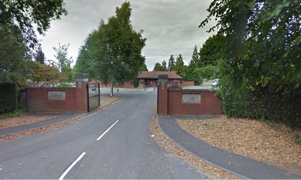
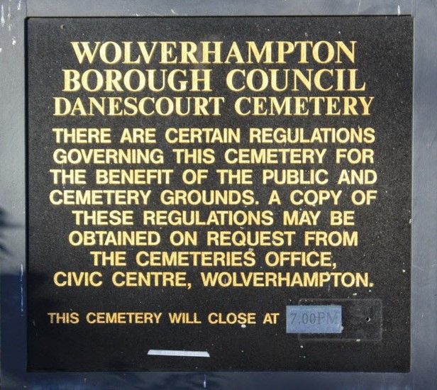
Danescourt Cemetery is located at Wergs Road Tettenhall, Metropolitan Borough of Wolverhampton ,West Midlands , WV6 9BSEngland.
-
Danescourt Cemetery cemetery's updated grave count on graveviews.com?
0 memorials
-
Where are the coordinates of the Danescourt Cemetery?
Latitude: 52.6033840
Longitude: -2.1789160
Nearby Cemetories:
1. St. Michael and All Angels Churchyard
Tettenhall, Metropolitan Borough of Wolverhampton, England
Coordinate: 52.6003380, -2.1619170
2. Christ Church
Tettenhall Wood, Metropolitan Borough of Wolverhampton, England
Coordinate: 52.5895828, -2.1805506
3. Merridale Cemetery
Wolverhampton, Metropolitan Borough of Wolverhampton, England
Coordinate: 52.5791660, -2.1504960
4. St. Nicholas' Churchyard
Codsall, South Staffordshire Borough, England
Coordinate: 52.6342500, -2.1992300
5. St. Philip Churchyard Penn Fields
Penn, Metropolitan Borough of Wolverhampton, England
Coordinate: 52.5703200, -2.1552400
6. St. John in the Square Churchyard
Wolverhampton, Metropolitan Borough of Wolverhampton, England
Coordinate: 52.5812300, -2.1292900
7. St. Mary's Churchyard
Bushbury, Metropolitan Borough of Wolverhampton, England
Coordinate: 52.6199160, -2.1130120
8. Holy Trinity Churchyard
Heath Town, Metropolitan Borough of Wolverhampton, England
Coordinate: 52.5962450, -2.1029310
9. Penn Cemetery
Penn, Metropolitan Borough of Wolverhampton, England
Coordinate: 52.5563850, -2.1641210
10. Bushbury Cemetery and Crematorium
Bushbury, Metropolitan Borough of Wolverhampton, England
Coordinate: 52.6247480, -2.1083690
11. St Bartholomew Churchyard
Penn, Metropolitan Borough of Wolverhampton, England
Coordinate: 52.5554900, -2.1569250
12. Wednesfield New Burial Ground
Wednesfield, Metropolitan Borough of Wolverhampton, England
Coordinate: 52.6003500, -2.0918900
13. St Chad Churchyard
Pattingham, South Staffordshire Borough, England
Coordinate: 52.5897150, -2.2656570
14. St. Thomas Churchyard
Wednesfield, Metropolitan Borough of Wolverhampton, England
Coordinate: 52.5997080, -2.0835350
15. St. Chad
Boningale, Shropshire Unitary Authority, England
Coordinate: 52.6208330, -2.2795110
16. Bilston Cemetery
Bilston, Metropolitan Borough of Wolverhampton, England
Coordinate: 52.5709000, -2.0862800
17. St Benedict Biscop Churchyard
Wombourne, South Staffordshire Borough, England
Coordinate: 52.5361394, -2.1834008
18. St Mary Patshull Burnhill Green
Pattingham, South Staffordshire Borough, England
Coordinate: 52.6056540, -2.2916790
19. Beacon Hill Cemetery
Bilston, Metropolitan Borough of Wolverhampton, England
Coordinate: 52.5488910, -2.1104340
20. All Saints Churchyard Extension
Sedgley, Metropolitan Borough of Dudley, England
Coordinate: 52.5402915, -2.1243976
21. All Saints Churchyard
Sedgley, Metropolitan Borough of Dudley, England
Coordinate: 52.5402410, -2.1228180
22. St Mary Magdalene Churchyard
Albrighton, Shropshire Unitary Authority, England
Coordinate: 52.6373060, -2.2831290
23. St Mary and St Chad Churchyard
Brewood, South Staffordshire Borough, England
Coordinate: 52.6754850, -2.1738520
24. St. Leonard's Churchyard
Bilston, Metropolitan Borough of Wolverhampton, England
Coordinate: 52.5665580, -2.0752470