
| Memorials | : | 0 |
| Location | : | Wednesfield, Metropolitan Borough of Wolverhampton, England |
| Coordinate | : | 52.5997080, -2.0835350 |
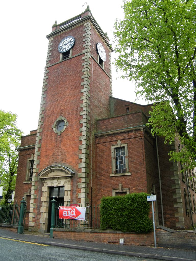
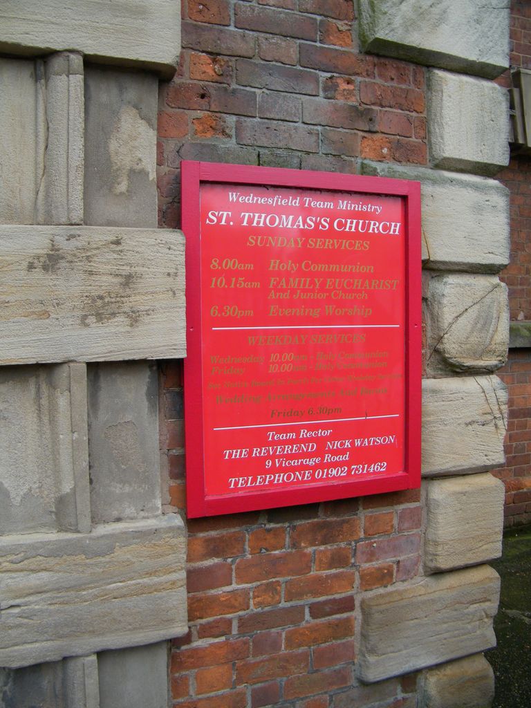
| Description | : | The Church of St Thomas was originally consecrated in August 1750 as a chapel of ease of St. Peter's Collegiate Church Wolverhampton and was known as the Chapel of St. Thomas in Wednesfield. It became a separate parish in 1849. The church was almost completely destroyed by fire on 18 January 1902 as a result of which the tower is the only remaining part of the original building. The church was reconstructed in similar style to the original and continues in active use as a place of worship, serving most of the town along with its sister churches of St.... Read More |
frequently asked questions (FAQ):
-
Where is St. Thomas Churchyard?
St. Thomas Churchyard is located at Church Street Wednesfield, Metropolitan Borough of Wolverhampton ,West Midlands , WV11 1SREngland.
-
St. Thomas Churchyard cemetery's updated grave count on graveviews.com?
0 memorials
-
Where are the coordinates of the St. Thomas Churchyard?
Latitude: 52.5997080
Longitude: -2.0835350
Nearby Cemetories:
1. Wednesfield New Burial Ground
Wednesfield, Metropolitan Borough of Wolverhampton, England
Coordinate: 52.6003500, -2.0918900
2. Holy Trinity Churchyard
Heath Town, Metropolitan Borough of Wolverhampton, England
Coordinate: 52.5962450, -2.1029310
3. Wood Street Cemetery
Willenhall, Metropolitan Borough of Walsall, England
Coordinate: 52.5867500, -2.0528900
4. St. Giles Church Cholera Burial Ground
Willenhall, Metropolitan Borough of Coventry, England
Coordinate: 52.5851060, -2.0498580
5. St Giles Church Cemetery
Willenhall, Metropolitan Borough of Walsall, England
Coordinate: 52.5841600, -2.0504000
6. St. Mary's Churchyard
Bushbury, Metropolitan Borough of Wolverhampton, England
Coordinate: 52.6199160, -2.1130120
7. Bilston Cemetery
Bilston, Metropolitan Borough of Wolverhampton, England
Coordinate: 52.5709000, -2.0862800
8. Holy Trinity Churchyard Shortheath
Willenhall, Metropolitan Borough of Walsall, England
Coordinate: 52.6047160, -2.0364190
9. Bushbury Cemetery and Crematorium
Bushbury, Metropolitan Borough of Wolverhampton, England
Coordinate: 52.6247480, -2.1083690
10. Willenhall Lawn Cemetery
Willenhall, Metropolitan Borough of Walsall, England
Coordinate: 52.6001870, -2.0327110
11. St. John in the Square Churchyard
Wolverhampton, Metropolitan Borough of Wolverhampton, England
Coordinate: 52.5812300, -2.1292900
12. St. Leonard's Churchyard
Bilston, Metropolitan Borough of Wolverhampton, England
Coordinate: 52.5665580, -2.0752470
13. Bentley Cemetery
Willenhall, Metropolitan Borough of Walsall, England
Coordinate: 52.5868880, -2.0299620
14. St. Mary's
Bilston, Metropolitan Borough of Wolverhampton, England
Coordinate: 52.5639000, -2.0681000
15. All Saints Churchyard
Moxley, Metropolitan Borough of Walsall, England
Coordinate: 52.5666000, -2.0350200
16. Merridale Cemetery
Wolverhampton, Metropolitan Borough of Wolverhampton, England
Coordinate: 52.5791660, -2.1504960
17. James Bridge Cemetery
Darlaston, Metropolitan Borough of Walsall, England
Coordinate: 52.5765076, -2.0185659
18. St. Michael and All Angels Churchyard
Tettenhall, Metropolitan Borough of Wolverhampton, England
Coordinate: 52.6003380, -2.1619170
19. Hall Green Cemetery
Bradley, Stafford Borough, England
Coordinate: 52.5525360, -2.0728930
20. All Saints Church Cemetery
Bloxwich, Metropolitan Borough of Walsall, England
Coordinate: 52.6147940, -2.0050330
21. Darkhouse Baptist Chapel Cemetery
Sedgley, Metropolitan Borough of Dudley, England
Coordinate: 52.5495697, -2.0834915
22. Fallings Heath Cemetery
Wednesbury, Metropolitan Borough of Sandwell, England
Coordinate: 52.5689100, -2.0182820
23. St. Philip Churchyard Penn Fields
Penn, Metropolitan Borough of Wolverhampton, England
Coordinate: 52.5703200, -2.1552400
24. North Walsall Cemetery
Bloxwich, Metropolitan Borough of Walsall, England
Coordinate: 52.6321680, -2.0151070