
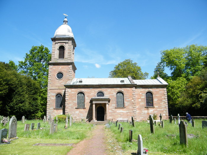
| Memorials | : | 1 |
| Location | : | Pattingham, South Staffordshire Borough, England |
| Coordinate | : | 52.6056540, -2.2916790 |
frequently asked questions (FAQ):
-
Where is St Mary Patshull Burnhill Green?
St Mary Patshull Burnhill Green is located at Pattingham, South Staffordshire Borough ,Staffordshire , WV67HYEngland.
-
St Mary Patshull Burnhill Green cemetery's updated grave count on graveviews.com?
1 memorials
-
Where are the coordinates of the St Mary Patshull Burnhill Green?
Latitude: 52.6056540
Longitude: -2.2916790
Nearby Cemetories:
1. St. Chad
Boningale, Shropshire Unitary Authority, England
Coordinate: 52.6208330, -2.2795110
2. St Chad Churchyard
Pattingham, South Staffordshire Borough, England
Coordinate: 52.5897150, -2.2656570
3. St Mary Magdalene Churchyard
Albrighton, Shropshire Unitary Authority, England
Coordinate: 52.6373060, -2.2831290
4. St. Giles Churchyard
Badger, Shropshire Unitary Authority, England
Coordinate: 52.5936507, -2.3438993
5. St. Cuthbert's Churchyard
Albrighton, Shropshire Unitary Authority, England
Coordinate: 52.6392906, -2.2838705
6. St Milburga's Churchyard
Beckbury, Shropshire Unitary Authority, England
Coordinate: 52.6113140, -2.3481180
7. St. Nicholas' Churchyard
Codsall, South Staffordshire Borough, England
Coordinate: 52.6342500, -2.1992300
8. White Ladies Priory
Boscobel, Shropshire Unitary Authority, England
Coordinate: 52.6657000, -2.2584000
9. All Saints Churchyard
Claverley, Shropshire Unitary Authority, England
Coordinate: 52.5382800, -2.3069010
10. Danescourt Cemetery
Tettenhall, Metropolitan Borough of Wolverhampton, England
Coordinate: 52.6033840, -2.1789160
11. Christ Church
Tettenhall Wood, Metropolitan Borough of Wolverhampton, England
Coordinate: 52.5895828, -2.1805506
12. St. Michael and All Angels Churchyard
Tettenhall, Metropolitan Borough of Wolverhampton, England
Coordinate: 52.6003380, -2.1619170
13. Saint Johns Church
Bishops Wood, Shropshire Unitary Authority, England
Coordinate: 52.6810030, -2.2369880
14. St Andrew Church
Weston-under-Lizard, South Staffordshire Borough, England
Coordinate: 52.6932000, -2.2883000
15. Merridale Cemetery
Wolverhampton, Metropolitan Borough of Wolverhampton, England
Coordinate: 52.5791660, -2.1504960
16. St. Philip Churchyard Penn Fields
Penn, Metropolitan Borough of Wolverhampton, England
Coordinate: 52.5703200, -2.1552400
17. Penn Cemetery
Penn, Metropolitan Borough of Wolverhampton, England
Coordinate: 52.5563850, -2.1641210
18. St. Calixtus Churchyard
Astley Abbotts, Shropshire Unitary Authority, England
Coordinate: 52.5631160, -2.4312720
19. St Benedict Biscop Churchyard
Wombourne, South Staffordshire Borough, England
Coordinate: 52.5361394, -2.1834008
20. St Bartholomew Churchyard
Penn, Metropolitan Borough of Wolverhampton, England
Coordinate: 52.5554900, -2.1569250
21. Bridgnorth Cemetery
Bridgnorth, Shropshire Unitary Authority, England
Coordinate: 52.5387350, -2.4078250
22. St Mary and St Chad Churchyard
Brewood, South Staffordshire Borough, England
Coordinate: 52.6754850, -2.1738520
23. St. Michael's Churchyard
Madeley, Telford and Wrekin Unitary Authority, England
Coordinate: 52.6337300, -2.4503010
24. Sytch Lane Cemetery
Wombourne, South Staffordshire Borough, England
Coordinate: 52.5261590, -2.1892040