
| Memorials | : | 5 |
| Location | : | Deal, Dover District, England |
| Coordinate | : | 51.2264163, 1.4024282 |
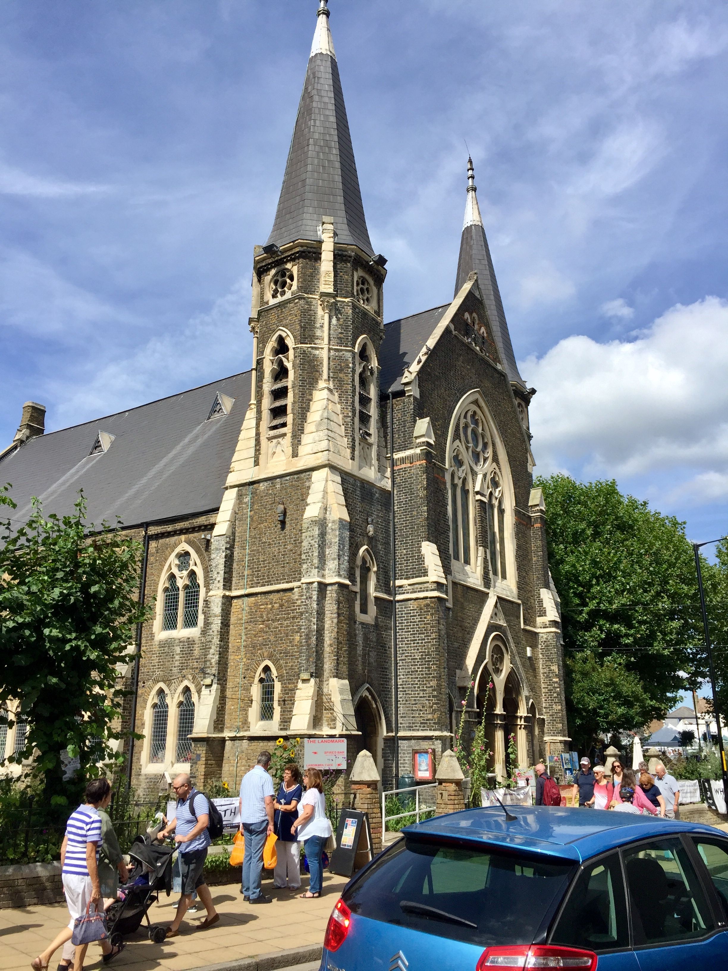
| Description | : | The Congregational church, on the corner of High Street and Union Road, has been redundant want for several years and has now been converted into The Landmark Centre, a popular venue for craft fairs, wedding receptions, coffee shop and bar. |
frequently asked questions (FAQ):
-
Where is Deal Congregational Church?
Deal Congregational Church is located at 129 High Street Deal, Dover District ,Kent , CT14 6BBEngland.
-
Deal Congregational Church cemetery's updated grave count on graveviews.com?
5 memorials
-
Where are the coordinates of the Deal Congregational Church?
Latitude: 51.2264163
Longitude: 1.4024282
Nearby Cemetories:
1. Hamilton Road Cemetery
Deal, Dover District, England
Coordinate: 51.2140870, 1.3923380
2. St Leonard Churchyard
Deal, Dover District, England
Coordinate: 51.2169940, 1.3817700
3. St. Nicholas Churchyard
Sholden, Dover District, England
Coordinate: 51.2198600, 1.3769300
4. Old St Mary's Churchyard
Walmer, Dover District, England
Coordinate: 51.2032261, 1.3870063
5. St Martin Churchyard
Great Mongeham, Dover District, England
Coordinate: 51.2145160, 1.3581010
6. St Mary the Virgin Churchyard
Ripple, Dover District, England
Coordinate: 51.2027080, 1.3629570
7. St Augustine Churchyard
Northbourne, Dover District, England
Coordinate: 51.2221700, 1.3403500
8. St John the Evangelist Churchyard
Deal, Dover District, England
Coordinate: 51.1862200, 1.4016700
9. St John Churchyard
Kingsdown, Dover District, England
Coordinate: 51.1860700, 1.4023200
10. St. Nicholas' Churchyard
Ringwould, Dover District, England
Coordinate: 51.1853300, 1.3754880
11. Church of Saint George at Ham
Eastry, Dover District, England
Coordinate: 51.2444830, 1.3319350
12. St. Peter and St. Paul Churchyard
Sutton, Dover District, England
Coordinate: 51.1955800, 1.3397700
13. St Mary the Virgin Churchyard
Betteshanger, Dover District, England
Coordinate: 51.2251200, 1.3118800
14. St Clement's Church
Sandwich, Dover District, England
Coordinate: 51.2736510, 1.3427270
15. St Mary the Virgin Churchyard
Eastry, Dover District, England
Coordinate: 51.2453000, 1.3100000
16. St. Peter's Churchyard
Sandwich, Dover District, England
Coordinate: 51.2747680, 1.3405120
17. St .Mary's Churchyard
Sandwich, Dover District, England
Coordinate: 51.2771930, 1.3386580
18. Saint Andrew Churchyard
Tilmanstone, Dover District, England
Coordinate: 51.2159790, 1.2950400
19. Saint Mary The Virgin Churchyard
Woodnesborough, Dover District, England
Coordinate: 51.2628240, 1.3073810
20. St Augustine's Church
East Langdon, Dover District, England
Coordinate: 51.1654990, 1.3357270
21. St. Margaret of Antioch Churchyard
St Margarets at Cliffe, Dover District, England
Coordinate: 51.1534950, 1.3714350
22. Saint Peters Church
Westcliffe, Dover District, England
Coordinate: 51.1542430, 1.3573340
23. All Saints Churchyard
Waldershare, Dover District, England
Coordinate: 51.1875170, 1.2857870
24. St Clement Church
Knowlton, Dover District, England
Coordinate: 51.2348930, 1.2652130