
| Memorials | : | 0 |
| Location | : | Marquardt, Stadtkreis Potsdam, Germany |
| Website | : | www.kirche-toeplitz.de/gemeinden/marquardt/index.html |
| Coordinate | : | 52.4570051, 12.9653982 |
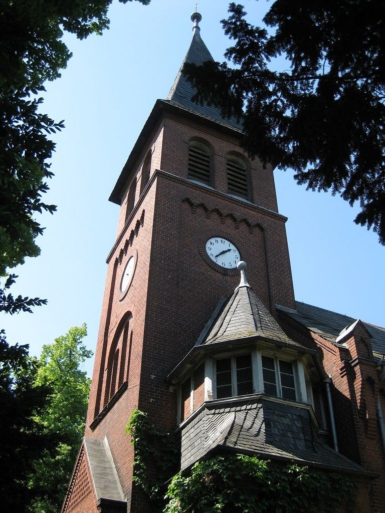
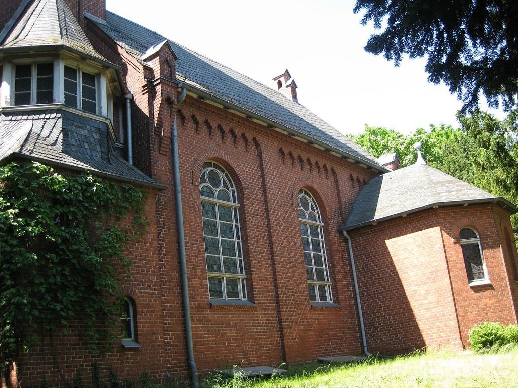
| Description | : | Marquardt Ludwig von Printzen (1675-1725), a Prussian Minister of State, owned the village of Schorin for two years. Since then, the village was called "Marquardt". The Berlin rail manufacturer, Louis Ravené, Jr., became laird there in 1892. He contracted the architect, Paul Stegmüller (1850-1891), to build the village church in a Neo-Gothic style. |
frequently asked questions (FAQ):
-
Where is Dorfkirche Marquardt?
Dorfkirche Marquardt is located at Im Park 3, Marquardt, Potsdam, Potsdamer Stadtkreis, Brandenburg, Germany Marquardt, Stadtkreis Potsdam ,Brandenburg , 14476Germany.
-
Dorfkirche Marquardt cemetery's updated grave count on graveviews.com?
0 memorials
-
Where are the coordinates of the Dorfkirche Marquardt?
Latitude: 52.4570051
Longitude: 12.9653982
Nearby Cemetories:
1. Friedhof Marquardt
Potsdam, Stadtkreis Potsdam, Germany
Coordinate: 52.4568330, 12.9712780
2. Dorfkirche Grube
Grube, Stadtkreis Potsdam, Germany
Coordinate: 52.4322272, 12.9534421
3. Friedhof Bornim
Bornim, Stadtkreis Potsdam, Germany
Coordinate: 52.4245726, 12.9858348
4. Dorfkirche Nattwerder
Nattwerder, Stadtkreis Potsdam, Germany
Coordinate: 52.4249230, 12.9389027
5. Friedhof Krampnitz
Krampnitz, Stadtkreis Potsdam, Germany
Coordinate: 52.4582241, 13.0584814
6. Bornstedter Friedhof
Potsdam, Stadtkreis Potsdam, Germany
Coordinate: 52.4083900, 13.0275100
7. Antikentempel
Potsdam, Stadtkreis Potsdam, Germany
Coordinate: 52.4022320, 13.0188040
8. Jüdischer Friedhof Pfingstberg
Potsdam, Stadtkreis Potsdam, Germany
Coordinate: 52.4167700, 13.0577300
9. Sanssouci Palace
Potsdam, Stadtkreis Potsdam, Germany
Coordinate: 52.4040730, 13.0397810
10. Friedenskirche
Potsdam, Stadtkreis Potsdam, Germany
Coordinate: 52.4008330, 13.0433330
11. Friedhof vor dem Nauener Tor (Defunct)
Potsdam, Stadtkreis Potsdam, Germany
Coordinate: 52.4074890, 13.0620740
12. Soviet War Cemetery
Potsdam, Stadtkreis Potsdam, Germany
Coordinate: 52.4011892, 13.0610859
13. Friedhof Sacrow
Potsdam, Stadtkreis Potsdam, Germany
Coordinate: 52.4283800, 13.0920600
14. Werder Havel Neuer Friedhof
Werder, Landkreis Potsdam-Mittelmark, Germany
Coordinate: 52.3766025, 12.9254958
15. Friedhof Elstal
Elstal, Landkreis Havelland, Germany
Coordinate: 52.5455000, 12.9911000
16. Prinzenfriedhof Klein-Glienicke
Wannsee, Steglitz-Zehlendorf, Germany
Coordinate: 52.4171810, 13.1001030
17. Friedhof Klein Glienicke
Klein Glienicke, Stadtkreis Potsdam, Germany
Coordinate: 52.4131750, 13.0997759
18. Alter Friedhof
Potsdam, Stadtkreis Potsdam, Germany
Coordinate: 52.3867620, 13.0735090
19. Neuer Friedhof Potsdam
Potsdam, Stadtkreis Potsdam, Germany
Coordinate: 52.3843750, 13.0712200
20. St. Peter und Paul auf Nikolskoe
Wannsee, Steglitz-Zehlendorf, Germany
Coordinate: 52.4244440, 13.1191670
21. Friedhof der Pfaueninsel am Nikolskoe
Wannsee, Steglitz-Zehlendorf, Germany
Coordinate: 52.4232064, 13.1186031
22. Sowjetischer Garnisonsfriedhof Potsdam
Potsdam, Stadtkreis Potsdam, Germany
Coordinate: 52.3693255, 13.0503467
23. Evang. Friedhof am Plantagenplatz
Babelsberg, Stadtkreis Potsdam, Germany
Coordinate: 52.3934945, 13.1011823
24. Friedhof Goethestraße
Potsdam, Stadtkreis Potsdam, Germany
Coordinate: 52.3969700, 13.1054900