
| Memorials | : | 0 |
| Location | : | Wannsee, Steglitz-Zehlendorf, Germany |
| Website | : | www.kirche-nikolskoe.de/startseite.html |
| Coordinate | : | 52.4244440, 13.1191670 |
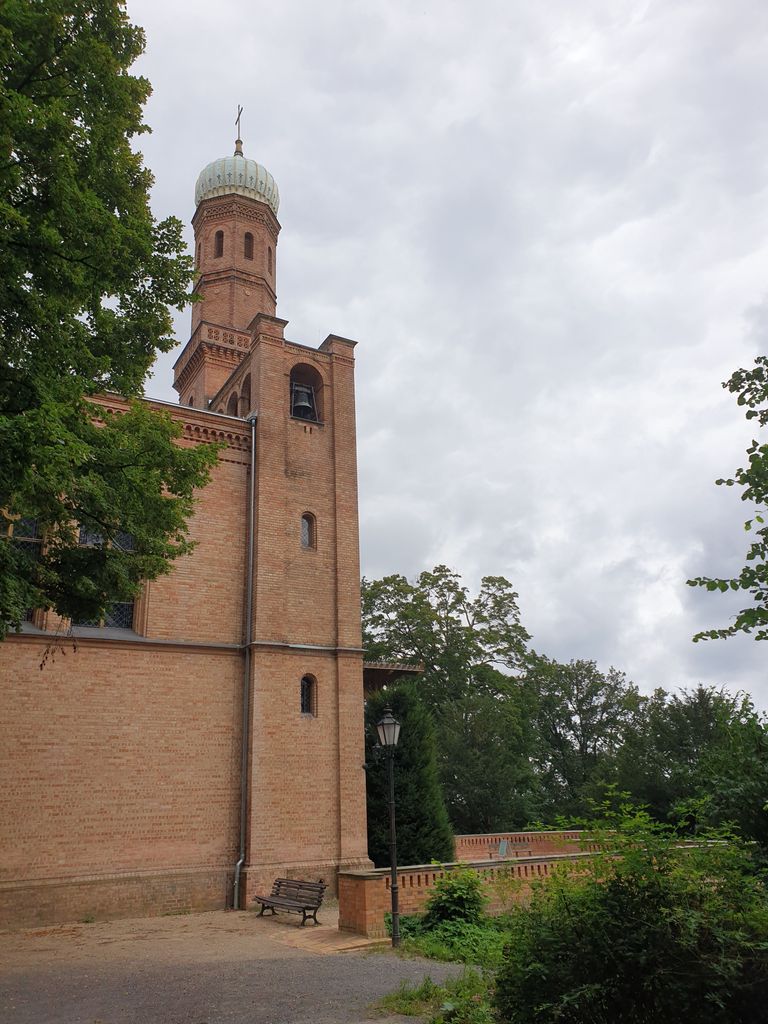
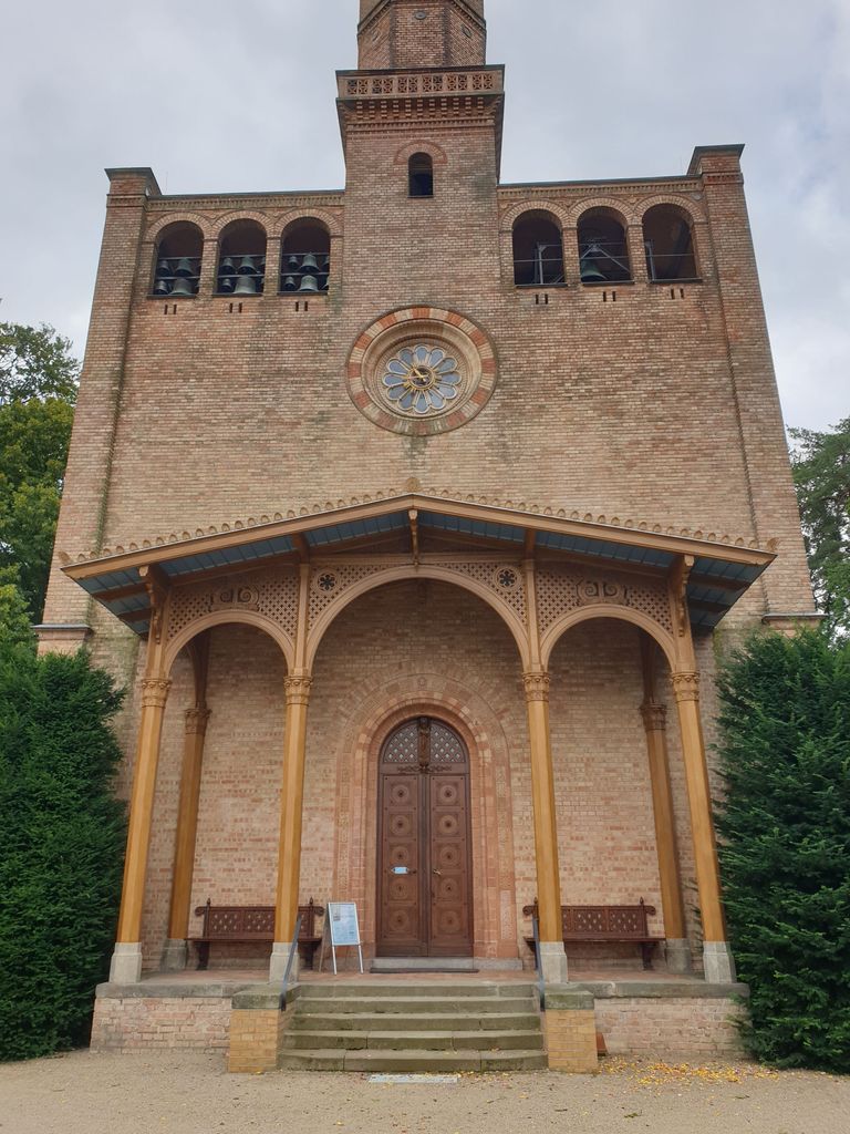
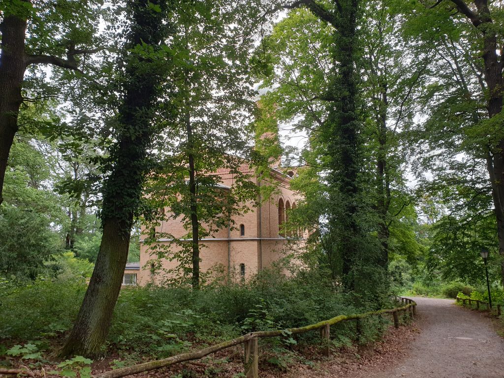
| Description | : | Lutheran church north of Glienicker parc. King Friedrich Wilhelm III had built the church for the residents of Klein-Glienicke and Pfaueninsel. It was designed by the architects Friedrich August Stüler and Albert Dietrich Schadow. Inauguration was on August 13, 1837. |
frequently asked questions (FAQ):
-
Where is St. Peter und Paul auf Nikolskoe?
St. Peter und Paul auf Nikolskoe is located at Berlin-Wannsee Nikolskoer Weg 17 Wannsee, Steglitz-Zehlendorf ,Berlin , 14109Germany.
-
St. Peter und Paul auf Nikolskoe cemetery's updated grave count on graveviews.com?
0 memorials
-
Where are the coordinates of the St. Peter und Paul auf Nikolskoe?
Latitude: 52.4244440
Longitude: 13.1191670
Nearby Cemetories:
1. Friedhof der Pfaueninsel am Nikolskoe
Wannsee, Steglitz-Zehlendorf, Germany
Coordinate: 52.4232064, 13.1186031
2. Prinzenfriedhof Klein-Glienicke
Wannsee, Steglitz-Zehlendorf, Germany
Coordinate: 52.4171810, 13.1001030
3. Friedhof Klein Glienicke
Klein Glienicke, Stadtkreis Potsdam, Germany
Coordinate: 52.4131750, 13.0997759
4. Friedhof Wannsee I - Friedenstrasse
Wannsee, Steglitz-Zehlendorf, Germany
Coordinate: 52.4142265, 13.1408291
5. Friedhof Sacrow
Potsdam, Stadtkreis Potsdam, Germany
Coordinate: 52.4283800, 13.0920600
6. Friedhof Wannsee II - Lindenstrasse
Wannsee, Steglitz-Zehlendorf, Germany
Coordinate: 52.4252243, 13.1538744
7. Friedhof Goethestraße
Potsdam, Stadtkreis Potsdam, Germany
Coordinate: 52.3969700, 13.1054900
8. Dorfkirchhof Kladow
Kladow, Spandau, Germany
Coordinate: 52.4526620, 13.1417730
9. Evang. Friedhof am Plantagenplatz
Babelsberg, Stadtkreis Potsdam, Germany
Coordinate: 52.3934945, 13.1011823
10. Jüdischer Friedhof Pfingstberg
Potsdam, Stadtkreis Potsdam, Germany
Coordinate: 52.4167700, 13.0577300
11. Friedhof vor dem Nauener Tor (Defunct)
Potsdam, Stadtkreis Potsdam, Germany
Coordinate: 52.4074890, 13.0620740
12. Friedhof Großbeerenstraße in Potsdam-Babelsberg
Babelsberg, Stadtkreis Potsdam, Germany
Coordinate: 52.3856519, 13.1002058
13. Soviet War Cemetery
Potsdam, Stadtkreis Potsdam, Germany
Coordinate: 52.4011892, 13.0610859
14. Alter Friedhof
Potsdam, Stadtkreis Potsdam, Germany
Coordinate: 52.3867620, 13.0735090
15. Wilmersdorfer Waldfriedhof Stahnsdorf
Landkreis Potsdam-Mittelmark, Germany
Coordinate: 52.3942100, 13.1808010
16. Neuer Friedhof Potsdam
Potsdam, Stadtkreis Potsdam, Germany
Coordinate: 52.3843750, 13.0712200
17. Friedhof Krampnitz
Krampnitz, Stadtkreis Potsdam, Germany
Coordinate: 52.4582241, 13.0584814
18. Südwestkirchhof Stahnsdorf
Stahnsdorf, Landkreis Potsdam-Mittelmark, Germany
Coordinate: 52.3888893, 13.1805563
19. Friedenskirche
Potsdam, Stadtkreis Potsdam, Germany
Coordinate: 52.4008330, 13.0433330
20. Friedhof Nikolassee
Nikolassee, Steglitz-Zehlendorf, Germany
Coordinate: 52.4262900, 13.2045100
21. Sanssouci Palace
Potsdam, Stadtkreis Potsdam, Germany
Coordinate: 52.4040730, 13.0397810
22. Südwestfriedhof der Berliner Synode Military
Stahnsdorf, Landkreis Potsdam-Mittelmark, Germany
Coordinate: 52.3833313, 13.1752081
23. Südwestfriedhof Berliner Synode Italian Military
Stahnsdorf, Landkreis Potsdam-Mittelmark, Germany
Coordinate: 52.3828000, 13.1766600
24. Wilmersdorfer Waldfriedhof Güterfelde
Landkreis Potsdam-Mittelmark, Germany
Coordinate: 52.3808990, 13.1733360