
| Memorials | : | 0 |
| Location | : | Babelsberg, Stadtkreis Potsdam, Germany |
| Website | : | www.evkirchepotsdam.de/gemeinden/babelsberg/friedhof/place/70 |
| Coordinate | : | 52.3934945, 13.1011823 |
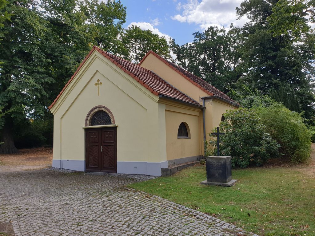
| Description | : | The Evangelical Cemetery on Plantagenplatz is located in the Babelsberg district of Potsdam, on the southeastern part of Wichgrafstrasse, directly on Plantagenplatz. The cemetery is also known as the Wichgrafstrasse cemetery and belongs to the Babelsberg Evangelical Church. It is the oldest of the three cemeteries in the former Nowawes city. It was inaugurated in 1754 and served as a burial place for the Bohemian weavers of Nowawes. |
frequently asked questions (FAQ):
-
Where is Evang. Friedhof am Plantagenplatz?
Evang. Friedhof am Plantagenplatz is located at Wichgrafstraße 28 Babelsberg, Stadtkreis Potsdam ,Brandenburg , 14482Germany.
-
Evang. Friedhof am Plantagenplatz cemetery's updated grave count on graveviews.com?
0 memorials
-
Where are the coordinates of the Evang. Friedhof am Plantagenplatz?
Latitude: 52.3934945
Longitude: 13.1011823
Nearby Cemetories:
1. Friedhof Goethestraße
Potsdam, Stadtkreis Potsdam, Germany
Coordinate: 52.3969700, 13.1054900
2. Friedhof Großbeerenstraße in Potsdam-Babelsberg
Babelsberg, Stadtkreis Potsdam, Germany
Coordinate: 52.3856519, 13.1002058
3. Alter Friedhof
Potsdam, Stadtkreis Potsdam, Germany
Coordinate: 52.3867620, 13.0735090
4. Friedhof Klein Glienicke
Klein Glienicke, Stadtkreis Potsdam, Germany
Coordinate: 52.4131750, 13.0997759
5. Neuer Friedhof Potsdam
Potsdam, Stadtkreis Potsdam, Germany
Coordinate: 52.3843750, 13.0712200
6. Prinzenfriedhof Klein-Glienicke
Wannsee, Steglitz-Zehlendorf, Germany
Coordinate: 52.4171810, 13.1001030
7. Soviet War Cemetery
Potsdam, Stadtkreis Potsdam, Germany
Coordinate: 52.4011892, 13.0610859
8. Friedhof vor dem Nauener Tor (Defunct)
Potsdam, Stadtkreis Potsdam, Germany
Coordinate: 52.4074890, 13.0620740
9. Friedhof der Pfaueninsel am Nikolskoe
Wannsee, Steglitz-Zehlendorf, Germany
Coordinate: 52.4232064, 13.1186031
10. Friedhof Wannsee I - Friedenstrasse
Wannsee, Steglitz-Zehlendorf, Germany
Coordinate: 52.4142265, 13.1408291
11. St. Peter und Paul auf Nikolskoe
Wannsee, Steglitz-Zehlendorf, Germany
Coordinate: 52.4244440, 13.1191670
12. Jüdischer Friedhof Pfingstberg
Potsdam, Stadtkreis Potsdam, Germany
Coordinate: 52.4167700, 13.0577300
13. Friedhof Sacrow
Potsdam, Stadtkreis Potsdam, Germany
Coordinate: 52.4283800, 13.0920600
14. Friedenskirche
Potsdam, Stadtkreis Potsdam, Germany
Coordinate: 52.4008330, 13.0433330
15. Sanssouci Palace
Potsdam, Stadtkreis Potsdam, Germany
Coordinate: 52.4040730, 13.0397810
16. Sowjetischer Garnisonsfriedhof Potsdam
Potsdam, Stadtkreis Potsdam, Germany
Coordinate: 52.3693255, 13.0503467
17. Friedhof Drewitz
Drewitz, Stadtkreis Potsdam, Germany
Coordinate: 52.3569540, 13.1322360
18. Friedhof Wannsee II - Lindenstrasse
Wannsee, Steglitz-Zehlendorf, Germany
Coordinate: 52.4252243, 13.1538744
19. Wilmersdorfer Waldfriedhof Güterfelde
Landkreis Potsdam-Mittelmark, Germany
Coordinate: 52.3808990, 13.1733360
20. Südwestfriedhof der Berliner Synode Military
Stahnsdorf, Landkreis Potsdam-Mittelmark, Germany
Coordinate: 52.3833313, 13.1752081
21. Südwestfriedhof Berliner Synode Italian Military
Stahnsdorf, Landkreis Potsdam-Mittelmark, Germany
Coordinate: 52.3828000, 13.1766600
22. Bornstedter Friedhof
Potsdam, Stadtkreis Potsdam, Germany
Coordinate: 52.4083900, 13.0275100
23. Wilmersdorfer Waldfriedhof Stahnsdorf
Landkreis Potsdam-Mittelmark, Germany
Coordinate: 52.3942100, 13.1808010
24. Südwestkirchhof Stahnsdorf
Stahnsdorf, Landkreis Potsdam-Mittelmark, Germany
Coordinate: 52.3888893, 13.1805563