
| Memorials | : | 1 |
| Location | : | Dover, Dover District, England |
| Coordinate | : | 51.1258370, 1.3053770 |
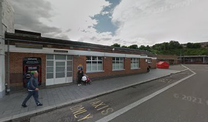
| Description | : | The full name of the priory is The Priory of St. Mary the Virgin and St. Martin of the New Work, or Newark. It was founded in the early seventh century by King Eadbald of Kent (616-640). Toward the end of the century, the 22 secular canons were transferred by King Wihtred to a small church dedicated to St. Martin. After the Norman Conquest, the church was granted to Odo, Bishop of Bayeux (d. 1097). Archbishop of Canterbury William de Corbeil (d. 1136) extended his influence to St. Martin's by persuading Henry I to allow him to transfer the... Read More |
frequently asked questions (FAQ):
-
Where is Dover Priory (Defunct)?
Dover Priory (Defunct) is located at Dover, Dover District ,Kent ,England.
-
Dover Priory (Defunct) cemetery's updated grave count on graveviews.com?
0 memorials
-
Where are the coordinates of the Dover Priory (Defunct)?
Latitude: 51.1258370
Longitude: 1.3053770
Nearby Cemetories:
1. Dover War Memorial
Dover, Dover District, England
Coordinate: 51.1277847, 1.3091190
2. Cowgate Cemetery
Dover, Dover District, England
Coordinate: 51.1237970, 1.3101560
3. St Mary the Virgin Churchyard
Dover, Dover District, England
Coordinate: 51.1259842, 1.3127910
4. St Peter and St Paul Churchyard
Dover, Dover District, England
Coordinate: 51.1331673, 1.3062360
5. St. James Old Churchyard
Dover, Dover District, England
Coordinate: 51.1261340, 1.3177210
6. St Marys New Cemetery
Dover, Dover District, England
Coordinate: 51.1345300, 1.3073700
7. Charlton Cemetery
Dover, Dover District, England
Coordinate: 51.1366920, 1.3101200
8. Dover Jewish Cemetery
Dover, Dover District, England
Coordinate: 51.1366310, 1.3106850
9. St Mary in Castro Churchyard
Dover, Dover District, England
Coordinate: 51.1283490, 1.3232430
10. St James Cemetery
Dover, Dover District, England
Coordinate: 51.1361389, 1.3146530
11. St Andrew Churchyard
Buckland, Dover District, England
Coordinate: 51.1373749, 1.2937800
12. St Peter and St Paul Churchyard
River, Dover District, England
Coordinate: 51.1447480, 1.2733710
13. St Laurence the Martyr Churchyard
Church Hougham, Dover District, England
Coordinate: 51.1137180, 1.2536650
14. St. Peter and St. Paul's Churchyard
Temple Ewell, Dover District, England
Coordinate: 51.1515565, 1.2675213
15. St Peter Churchyard
Whitfield, Dover District, England
Coordinate: 51.1655000, 1.3037000
16. Saint Peters Church
Westcliffe, Dover District, England
Coordinate: 51.1542430, 1.3573340
17. St Augustine's Church
East Langdon, Dover District, England
Coordinate: 51.1654990, 1.3357270
18. St. Margaret of Antioch Churchyard
St Margarets at Cliffe, Dover District, England
Coordinate: 51.1534950, 1.3714350
19. St. Mary's Churchyard
Capel-le-Ferne, Dover District, England
Coordinate: 51.1149650, 1.2235540
20. St Anthony Churchyard
Alkham, Dover District, England
Coordinate: 51.1360930, 1.2226440
21. Saint Mary the Virgin Churchyard
Lydden, Dover District, England
Coordinate: 51.1658200, 1.2373050
22. All Saints Churchyard
Waldershare, Dover District, England
Coordinate: 51.1875170, 1.2857870
23. Saint Pancras Churchyard
Coldred, Dover District, England
Coordinate: 51.1822600, 1.2529260
24. National Battle of Britain Memorial
Capel-le-Ferne, Dover District, England
Coordinate: 51.0984880, 1.2059130