
| Memorials | : | 141 |
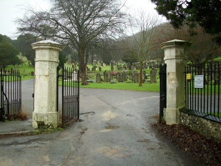
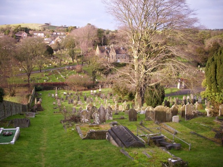
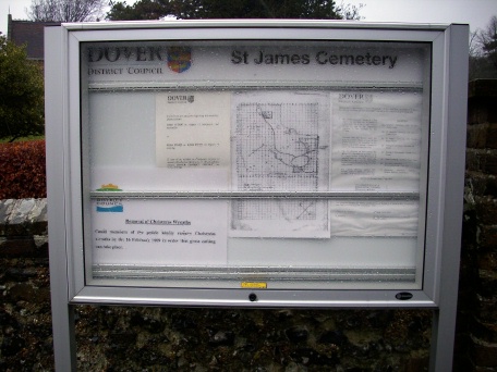
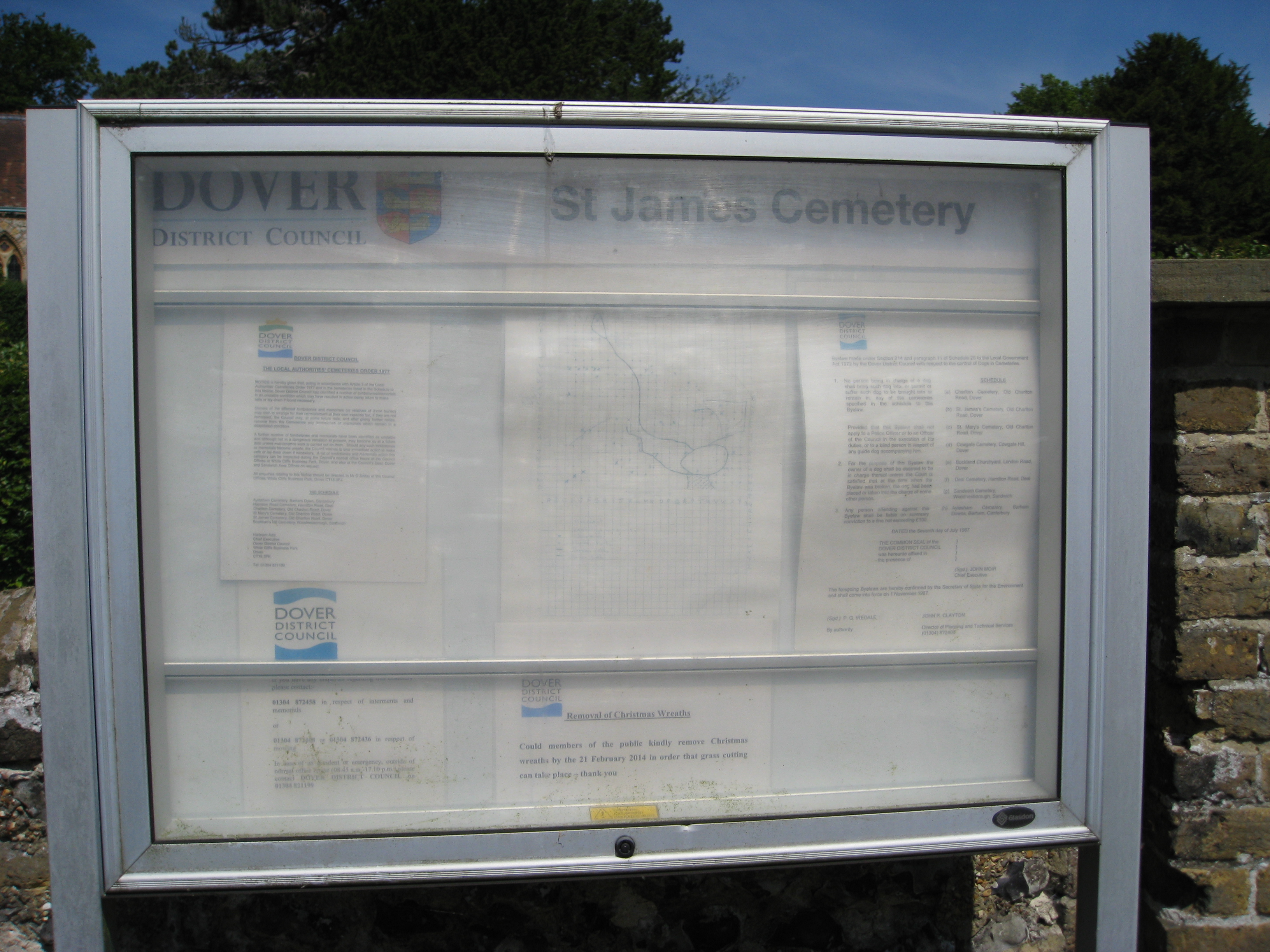
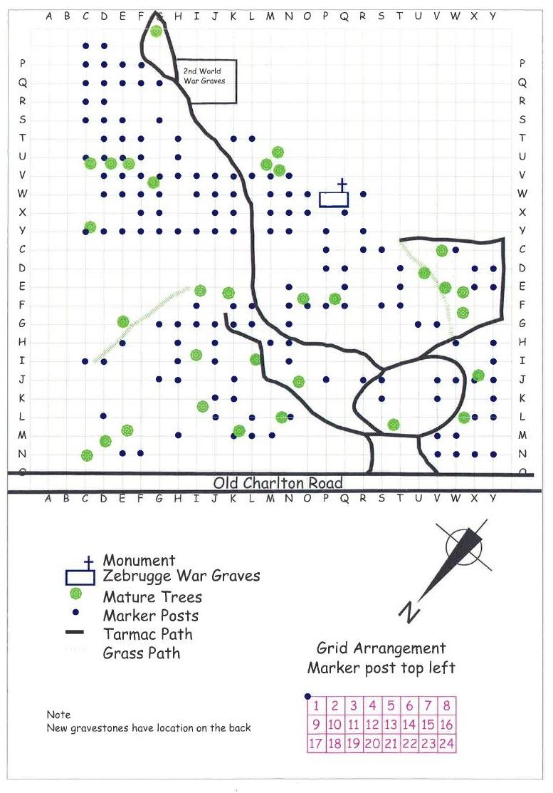
| Location | : | Dover, Dover District, England |
| Coordinate | : | 51.1361389, 1.3146530 |
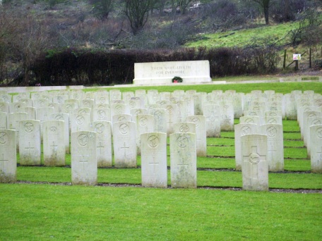
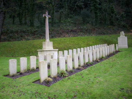
| Description | : | During the First World War, Dover was a port of embarkation for troops bound for the Western Front and between August 1914 and August 1919 some 1,300,000 Commonwealth sick and wounded were landed there. The port was bombed in 1915 and again in August 1916. There are 373 identified burials of the 1914-1918 war here. In addition there are 19 unidentified burials, 9 of whom can be named as victims of the Zeebrugge Raid, and these 9 are inscribed on a Special Memorial on the Cross of Sacrifice in the Zeebrugge Plot. In 1940, Dover was the headquarters for the... Read More |
frequently asked questions (FAQ):
-
Where is St James Cemetery?
St James Cemetery is located at Dover, Dover District ,Kent ,England.
-
St James Cemetery cemetery's updated grave count on graveviews.com?
100 memorials
-
Where are the coordinates of the St James Cemetery?
Latitude: 51.1361389
Longitude: 1.3146530
Nearby Cemetories:
1. Dover Jewish Cemetery
Dover, Dover District, England
Coordinate: 51.1366310, 1.3106850
2. Charlton Cemetery
Dover, Dover District, England
Coordinate: 51.1366920, 1.3101200
3. St Marys New Cemetery
Dover, Dover District, England
Coordinate: 51.1345300, 1.3073700
4. St Peter and St Paul Churchyard
Dover, Dover District, England
Coordinate: 51.1331673, 1.3062360
5. Dover War Memorial
Dover, Dover District, England
Coordinate: 51.1277847, 1.3091190
6. St Mary in Castro Churchyard
Dover, Dover District, England
Coordinate: 51.1283490, 1.3232430
7. St. James Old Churchyard
Dover, Dover District, England
Coordinate: 51.1261340, 1.3177210
8. St Mary the Virgin Churchyard
Dover, Dover District, England
Coordinate: 51.1259842, 1.3127910
9. Dover Priory (Defunct)
Dover, Dover District, England
Coordinate: 51.1258370, 1.3053770
10. Cowgate Cemetery
Dover, Dover District, England
Coordinate: 51.1237970, 1.3101560
11. St Andrew Churchyard
Buckland, Dover District, England
Coordinate: 51.1373749, 1.2937800
12. St Peter and St Paul Churchyard
River, Dover District, England
Coordinate: 51.1447480, 1.2733710
13. St Peter Churchyard
Whitfield, Dover District, England
Coordinate: 51.1655000, 1.3037000
14. St Augustine's Church
East Langdon, Dover District, England
Coordinate: 51.1654990, 1.3357270
15. Saint Peters Church
Westcliffe, Dover District, England
Coordinate: 51.1542430, 1.3573340
16. St. Peter and St. Paul's Churchyard
Temple Ewell, Dover District, England
Coordinate: 51.1515565, 1.2675213
17. St. Margaret of Antioch Churchyard
St Margarets at Cliffe, Dover District, England
Coordinate: 51.1534950, 1.3714350
18. St Laurence the Martyr Churchyard
Church Hougham, Dover District, England
Coordinate: 51.1137180, 1.2536650
19. All Saints Churchyard
Waldershare, Dover District, England
Coordinate: 51.1875170, 1.2857870
20. Saint Mary the Virgin Churchyard
Lydden, Dover District, England
Coordinate: 51.1658200, 1.2373050
21. St Anthony Churchyard
Alkham, Dover District, England
Coordinate: 51.1360930, 1.2226440
22. Saint Pancras Churchyard
Coldred, Dover District, England
Coordinate: 51.1822600, 1.2529260
23. St. Mary's Churchyard
Capel-le-Ferne, Dover District, England
Coordinate: 51.1149650, 1.2235540
24. St. Peter and St. Paul Churchyard
Sutton, Dover District, England
Coordinate: 51.1955800, 1.3397700