
| Memorials | : | 4 |
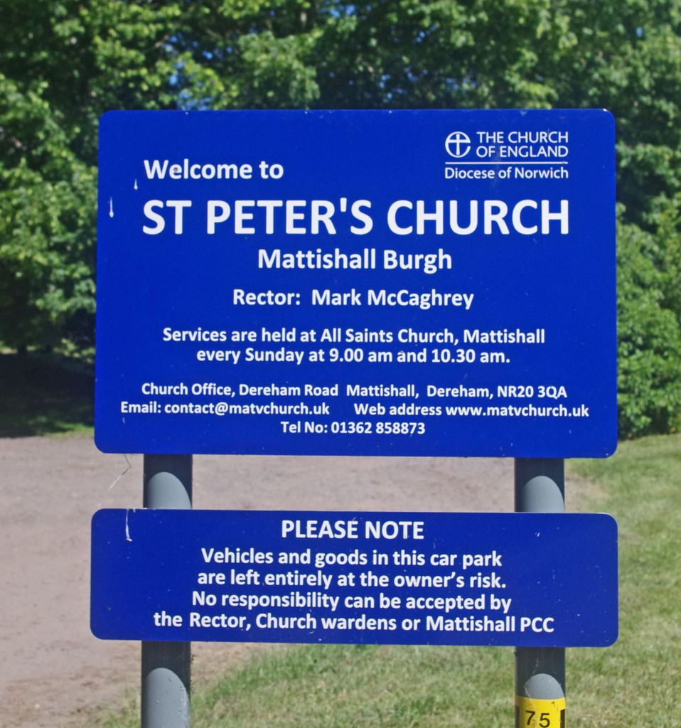
| Location | : | Mattishall, Breckland Borough, England |
| Phone | : | 01362-858873 |
| Website | : | www.mattishall-village.co.uk/church_peter-1.htm |
| Coordinate | : | 52.6647174, 1.0396513 |
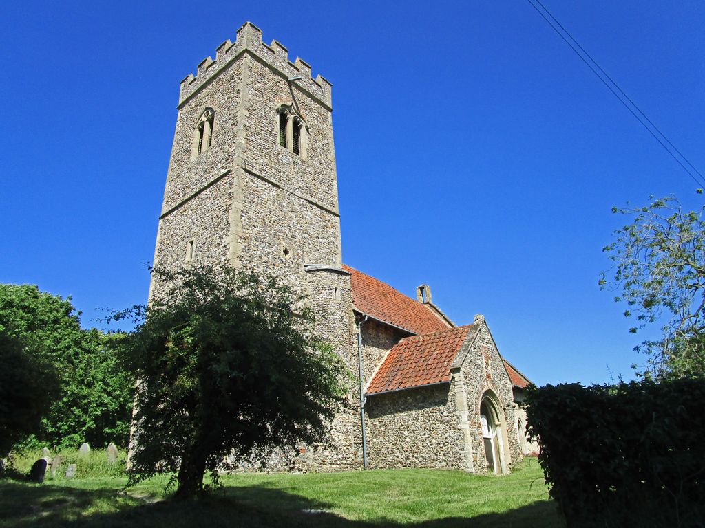
| Description | : | Now rarely used for services, St Peter's Church is rarely used for Services and is hidden from the road up a track (Church Lane). It is surrounded by houses and gardens, and has a car parking area at the front, to one side. A small church when looking from the outside, but actually a remodelling of something older dating from the 14th Century. The church has a rare surviving Sanctus bell turret on the nave east gable. On the other side, there is a huge north transept, which is also 14th Century. It is encircled by a number of... Read More |
frequently asked questions (FAQ):
-
Where is St Peter's Church Mattishall Burgh?
St Peter's Church Mattishall Burgh is located at Church Lane Mattishall Mattishall, Breckland Borough ,Norfolk , NR20 3QZEngland.
-
St Peter's Church Mattishall Burgh cemetery's updated grave count on graveviews.com?
4 memorials
-
Where are the coordinates of the St Peter's Church Mattishall Burgh?
Latitude: 52.6647174
Longitude: 1.0396513
Nearby Cemetories:
1. Mattishall cemetery
Mattishall, Breckland Borough, England
Coordinate: 52.6597100, 1.0353800
2. All Saints' Churchyard
Mattishall, Breckland Borough, England
Coordinate: 52.6580670, 1.0346230
3. St. Mary's Churchyard
North Tuddenham, Breckland Borough, England
Coordinate: 52.6753000, 1.0389600
4. All Saints, Welborne
South Norfolk District, England
Coordinate: 52.6496860, 1.0546670
5. All Saints Churchyard
Mattishall, Breckland Borough, England
Coordinate: 52.6498440, 1.0551390
6. St. Michael's Churchyard
Hockering, Breckland Borough, England
Coordinate: 52.6771691, 1.0629078
7. All Saints Churchyard
East Tuddenham, Breckland Borough, England
Coordinate: 52.6602410, 1.0813620
8. St. Peter and St. Paul Churchyard
Barnham Broom, South Norfolk District, England
Coordinate: 52.6281830, 1.0749820
9. Saint Mary the Virgin Churchyard
Elsing, Breckland Borough, England
Coordinate: 52.7076070, 1.0354460
10. All Saints Churchyard
Runhall, South Norfolk District, England
Coordinate: 52.6209876, 1.0390341
11. St Paul's Church Thuxton
Dereham, Breckland Borough, England
Coordinate: 52.6239060, 1.0013630
12. St. Andrew's Churchyard
Colton, South Norfolk District, England
Coordinate: 52.6407700, 1.1089300
13. St. Margaret's Churchyard
Garvestone, Breckland Borough, England
Coordinate: 52.6264200, 0.9889550
14. St Andrew's Churchyard
Honingham, Broadland District, England
Coordinate: 52.6573170, 1.1244600
15. Lyng, St. Margaret.
Lyng, Breckland Borough, England
Coordinate: 52.7185190, 1.0619570
16. St Botolphs
Barford, South Norfolk District, England
Coordinate: 52.6287000, 1.1118000
17. St. Peter's Churchyard
Reymerston, Breckland Borough, England
Coordinate: 52.6144500, 0.9827500
18. St Mary's Churchyard
Carleton Forehoe, South Norfolk District, England
Coordinate: 52.6100400, 1.0847490
19. East Dereham Cemetery
East Dereham, Breckland Borough, England
Coordinate: 52.6861090, 0.9446600
20. St Mary's Churchyard
Bylaugh, Breckland Borough, England
Coordinate: 52.7245880, 1.0136460
21. All Saints Churchyard
Weston Longville, Broadland District, England
Coordinate: 52.6990630, 1.1257670
22. St. George's Churchyard
Hardingham, Breckland Borough, England
Coordinate: 52.6058090, 1.0040050
23. All Saints Churchyard
Weston Longville, Broadland District, England
Coordinate: 52.6993460, 1.1262510
24. St Nicholas Churchyard
East Dereham, Breckland Borough, England
Coordinate: 52.6810280, 0.9379390