| Memorials | : | 24 |
| Location | : | Winterbourne, South Gloucestershire Unitary Authority, England |
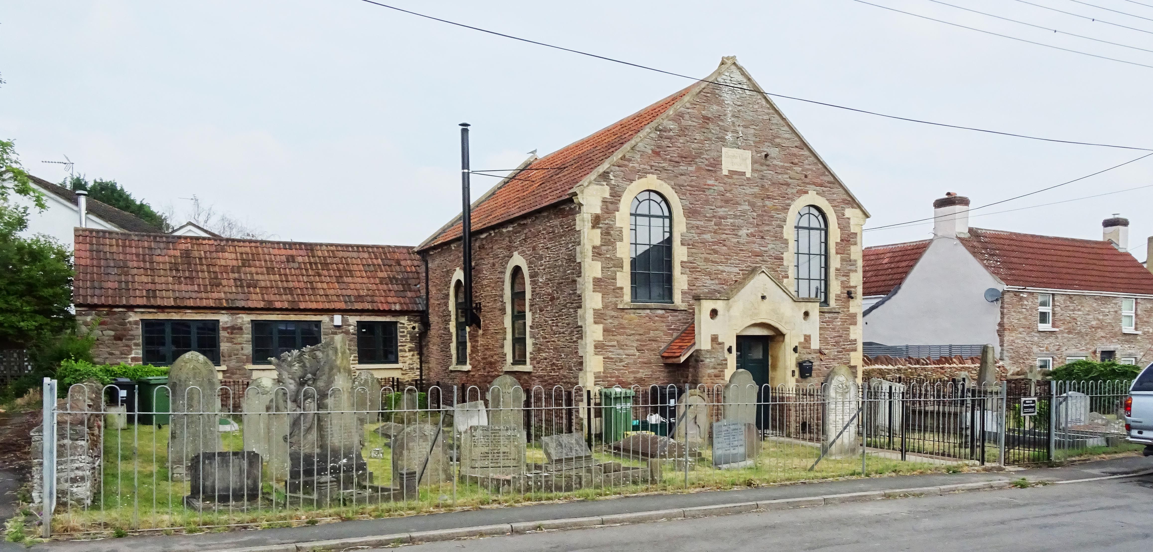
| Description | : | The Chapel is now a private dwelling The small graveyard at the front of the building is maintained by the nearby Salem Methodist Church and can be access by gates at either side. |
frequently asked questions (FAQ):
-
Where is Ebenezer Chapel Cemetery?
Ebenezer Chapel Cemetery is located at No GPS information available Add GPSWatleys End Road, Winterbourne Winterbourne, South Gloucestershire Unitary Authority ,Gloucestershire , BS36 1QQEngland.
-
Ebenezer Chapel Cemetery cemetery's updated grave count on graveviews.com?
24 memorials
Nearby Cemetories:
1. Bristol Memorial Woodlands
Alveston, South Gloucestershire Unitary Authority, England
Coordinate: 51.5932110, -2.4799250
2. St Helen Churchyard
Alveston, South Gloucestershire Unitary Authority, England
3. St Saviour's Church
Coalpit Heath, South Gloucestershire Unitary Authority, England
4. St Peter's Churchyard
Dyrham, South Gloucestershire Unitary Authority, England
Coordinate: 51.5400900, -2.2818500
5. St Mary Churchyard
Hawkesbury, South Gloucestershire Unitary Authority, England
Coordinate: 51.5442200, -2.2800310
6. Holy Trinity Churchyard
Kingswood, South Gloucestershire Unitary Authority, England
Coordinate: 51.6121930, -2.4456930
7. Kingswood Methodist Church Burial Ground
Kingswood, South Gloucestershire Unitary Authority, England
8. Kingwood Wesleyan Chapel
Kingswood, South Gloucestershire Unitary Authority, England
Coordinate: 51.4484992, -2.5222650
9. Master's Church Cemetery
Kingswood, South Gloucestershire Unitary Authority, England
Coordinate: 51.4474802, -2.5107480
10. Moravian Chapel
Kingswood, South Gloucestershire Unitary Authority, England
Coordinate: 51.4509706, -2.5189809
11. Wesleyan Methodist Church
Kingswood, South Gloucestershire Unitary Authority, England
12. St Anne's Churchyard
Siston, South Gloucestershire Unitary Authority, England
13. St James Parish Churchyard
Tytherington, South Gloucestershire Unitary Authority, England
Coordinate: 51.5932110, -2.4799250
14. St. Bartholomew Churchyard
Wick, South Gloucestershire Unitary Authority, England
15. Essex House Grounds, Badminton Estate
Badminton, South Gloucestershire Unitary Authority, England
16. Saint Michael's
Badminton, South Gloucestershire Unitary Authority, England
Coordinate: 51.5400900, -2.2818500
17. St Michael and All Angels Churchyard
Badminton, South Gloucestershire Unitary Authority, England
Coordinate: 51.5442200, -2.2800310
18. St Andrew Churchyard
Cromhall, South Gloucestershire Unitary Authority, England
Coordinate: 51.6121930, -2.4456930
19. Elberton St. John the Evangalist
Elberton, South Gloucestershire Unitary Authority, England
20. Christ Church Churchyard
Hanham, South Gloucestershire Unitary Authority, England
Coordinate: 51.4484992, -2.5222650
21. Hanham Baptist Church Cemetery
Hanham, South Gloucestershire Unitary Authority, England
Coordinate: 51.4474802, -2.5107480
22. Hanham United Reform Church Cemetery
Hanham, South Gloucestershire Unitary Authority, England
Coordinate: 51.4509706, -2.5189809
23. Church of St. Mary of Malmesbury
Littleton-upon-Severn, South Gloucestershire Unitary Authority, England
24. St. Arilda's Churchyard
Oldbury-on-Severn, South Gloucestershire Unitary Authority, England


