
| Memorials | : | 0 |
| Location | : | Chesterfield, Chesterfield County, USA |
| Coordinate | : | 34.7602997, -80.1343994 |
frequently asked questions (FAQ):
-
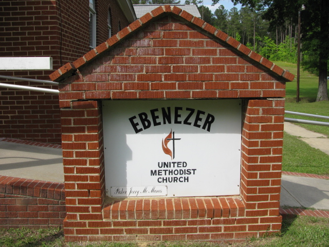
Where is Ebenezer United Methodist Church Cemetery?
Ebenezer United Methodist Church Cemetery is located at State Road S-13-59/Wamble Hill Road Chesterfield, Chesterfield County ,South Carolina , 29709USA.
-
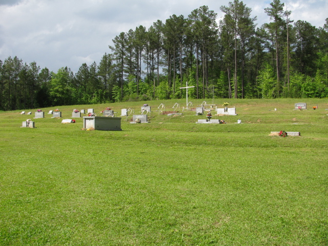
Ebenezer United Methodist Church Cemetery cemetery's updated grave count on graveviews.com?
0 memorials
-
Where are the coordinates of the Ebenezer United Methodist Church Cemetery?
Latitude: 34.7602997
Longitude: -80.1343994
Nearby Cemetories:
1. Davidson Grove Baptist Church Cemetery
Chesterfield, Chesterfield County, USA
Coordinate: 34.7645660, -80.1405070
2. Hurst Family Cemetery
Chesterfield, Chesterfield County, USA
Coordinate: 34.7704190, -80.1322070
3. Wamble Hill Cemetery
Chesterfield, Chesterfield County, USA
Coordinate: 34.7495290, -80.1292780
4. Hurst Cemetery
Chesterfield, Chesterfield County, USA
Coordinate: 34.7552910, -80.1179504
5. Griggs Cemetery
Chesterfield, Chesterfield County, USA
Coordinate: 34.7757988, -80.1382980
6. Gaddy-Sellers Cemetery
Ruby, Chesterfield County, USA
Coordinate: 34.7500840, -80.1534820
7. Sellers Family Cemetery
Chesterfield, Chesterfield County, USA
Coordinate: 34.7437060, -80.1537960
8. Thompson Creek Baptist Church Cemetery New
Chesterfield County, USA
Coordinate: 34.7756004, -80.1575012
9. Berkley Family Cemetery
Chesterfield, Chesterfield County, USA
Coordinate: 34.7376230, -80.1478220
10. Thompson Creek Baptist Church Cemetery Old
Chesterfield, Chesterfield County, USA
Coordinate: 34.7771740, -80.1573740
11. Melton Family Cemetery
Ruby, Chesterfield County, USA
Coordinate: 34.7428650, -80.1607650
12. Hopewell Baptist Church Cemetery
Chesterfield, Chesterfield County, USA
Coordinate: 34.7330600, -80.1486970
13. Mount Airy A.M.E. Zion Church Cemetery
Chesterfield, Chesterfield County, USA
Coordinate: 34.7315780, -80.1514510
14. Sowell Cemetery
Chesterfield, Chesterfield County, USA
Coordinate: 34.7654220, -80.0933680
15. Moore Cemetery
Ruby, Chesterfield County, USA
Coordinate: 34.7932060, -80.1473880
16. Massey Cemetery
Ruby, Chesterfield County, USA
Coordinate: 34.7783050, -80.1735600
17. Friendship United Methodist Church Cemetery
Chesterfield, Chesterfield County, USA
Coordinate: 34.7655983, -80.0883026
18. Ruby Cemetery
Ruby, Chesterfield County, USA
Coordinate: 34.7447014, -80.1769028
19. Smith Cemetery
Ruby, Chesterfield County, USA
Coordinate: 34.7451040, -80.1773000
20. Gulledge Family Cemetery
Ruby, Chesterfield County, USA
Coordinate: 34.7685860, -80.1802830
21. Burch Family Cemetery
Maysville, Chesterfield County, USA
Coordinate: 34.7976160, -80.1581110
22. Bittle Family Cemetery
Chesterfield, Chesterfield County, USA
Coordinate: 34.7535050, -80.0828380
23. Chesterfield Cemetery
Chesterfield, Chesterfield County, USA
Coordinate: 34.7338982, -80.0911026
24. Brantley Family Cemetery
Ruby, Chesterfield County, USA
Coordinate: 34.7468360, -80.1879220