
| Memorials | : | 0 |
| Location | : | Ruby, Chesterfield County, USA |
| Coordinate | : | 34.7783050, -80.1735600 |
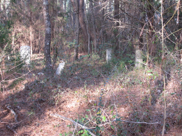
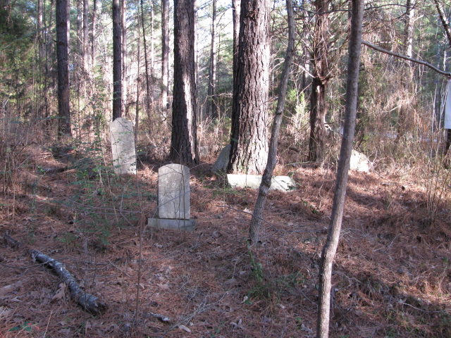
| Description | : | Massey Cemetery is a family burial ground on the old William Massey Plantation located in Ruby, South Carolina in Chesterfield County. It is known to contain about 15 graves of the Masseys and the McNairs. Directions to Massey Cemetery: From Chesterfield, S.C. take Highway 9 West. Just outside the city limits turn right on Wamble Hill Road. When you get to the intersection of Wexford Road there will be two roads when you cross Wexford Road. The left one will be Rambling Road. Take this road and go past a small brick house on the right next to the road. There will... Read More |
frequently asked questions (FAQ):
-
Where is Massey Cemetery?
Massey Cemetery is located at Rambling Road Ruby, Chesterfield County ,South Carolina , 29741USA.
-
Massey Cemetery cemetery's updated grave count on graveviews.com?
0 memorials
-
Where are the coordinates of the Massey Cemetery?
Latitude: 34.7783050
Longitude: -80.1735600
Nearby Cemetories:
1. Gulledge Family Cemetery
Ruby, Chesterfield County, USA
Coordinate: 34.7685860, -80.1802830
2. Thompson Creek Baptist Church Cemetery Old
Chesterfield, Chesterfield County, USA
Coordinate: 34.7771740, -80.1573740
3. Thompson Creek Baptist Church Cemetery New
Chesterfield County, USA
Coordinate: 34.7756004, -80.1575012
4. Timmonsville Baptist Church Cemetery Old
Mount Croghan, Chesterfield County, USA
Coordinate: 34.7789940, -80.1903360
5. Timmonsville Baptist Church Cemetery
Mount Croghan, Chesterfield County, USA
Coordinate: 34.7825050, -80.1944070
6. Burch Family Cemetery
Maysville, Chesterfield County, USA
Coordinate: 34.7976160, -80.1581110
7. Hancock Cemetery
Ruby, Chesterfield County, USA
Coordinate: 34.7579830, -80.1923260
8. Moore Cemetery
Ruby, Chesterfield County, USA
Coordinate: 34.7932060, -80.1473880
9. Griggs Cemetery
Chesterfield, Chesterfield County, USA
Coordinate: 34.7757988, -80.1382980
10. Davidson Grove Baptist Church Cemetery
Chesterfield, Chesterfield County, USA
Coordinate: 34.7645660, -80.1405070
11. Sellers Cemetery
Ruby, Chesterfield County, USA
Coordinate: 34.7590400, -80.2025340
12. Campbell Cemetery
Ruby, Chesterfield County, USA
Coordinate: 34.7502340, -80.1913550
13. Elizabeth Baptist Church Cemetery
Mount Croghan, Chesterfield County, USA
Coordinate: 34.7806015, -80.2130966
14. Gaddy-Sellers Cemetery
Ruby, Chesterfield County, USA
Coordinate: 34.7500840, -80.1534820
15. Smith Cemetery
Ruby, Chesterfield County, USA
Coordinate: 34.7451040, -80.1773000
16. Brantley Family Cemetery
Ruby, Chesterfield County, USA
Coordinate: 34.7468360, -80.1879220
17. Ruby Cemetery
Ruby, Chesterfield County, USA
Coordinate: 34.7447014, -80.1769028
18. Hurst Family Cemetery
Chesterfield, Chesterfield County, USA
Coordinate: 34.7704190, -80.1322070
19. Ebenezer United Methodist Church Cemetery
Chesterfield, Chesterfield County, USA
Coordinate: 34.7602997, -80.1343994
20. Melton Family Cemetery
Ruby, Chesterfield County, USA
Coordinate: 34.7428650, -80.1607650
21. Smith Family Cemetery
Ruby, Chesterfield County, USA
Coordinate: 34.7451960, -80.1958290
22. Sellers Family Cemetery
Chesterfield, Chesterfield County, USA
Coordinate: 34.7437060, -80.1537960
23. Niven Cemetery
Deep Creek, Anson County, USA
Coordinate: 34.8161812, -80.1607742
24. Smith Cemetery
Ruby, Chesterfield County, USA
Coordinate: 34.7449670, -80.2004310