| Memorials | : | 0 |
| Location | : | Chesterfield, Chesterfield County, USA |
| Coordinate | : | 34.7654220, -80.0933680 |
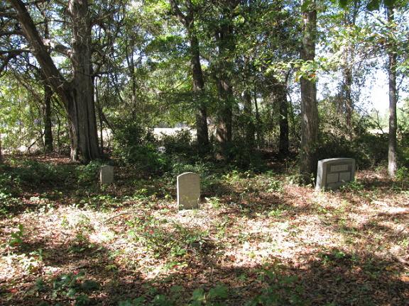
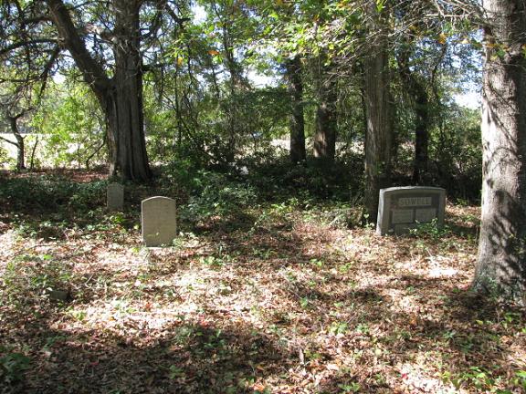
| Description | : | Take Highway 145 north from Chesterfield, S.C. for about one mile. Take the left fork which is Highway 742. Go about 1/4 mile. Turn left at Friendship United Methodist Church onto Don Hill Road (S-13-59). Go three tenths of a mile. There will be a small dirt drive to the right. About 500 yards down this drive next to a very large cedar tree is the cemetery. |
frequently asked questions (FAQ):
-
Where is Sowell Cemetery?
Sowell Cemetery is located at Chesterfield, Chesterfield County ,South Carolina ,USA.
-
Sowell Cemetery cemetery's updated grave count on graveviews.com?
0 memorials
-
Where are the coordinates of the Sowell Cemetery?
Latitude: 34.7654220
Longitude: -80.0933680
Nearby Cemetories:
1. Friendship United Methodist Church Cemetery
Chesterfield, Chesterfield County, USA
Coordinate: 34.7655983, -80.0883026
2. Bittle Family Cemetery
Chesterfield, Chesterfield County, USA
Coordinate: 34.7535050, -80.0828380
3. Dred Cemetery
Chesterfield, Chesterfield County, USA
Coordinate: 34.7821920, -80.0837230
4. Hurst Cemetery
Chesterfield, Chesterfield County, USA
Coordinate: 34.7552910, -80.1179504
5. Davids Grove Baptist Church Cemetery
Chesterfield, Chesterfield County, USA
Coordinate: 34.7928009, -80.0903015
6. Stroud Family Cemetery
Chesterfield, Chesterfield County, USA
Coordinate: 34.7919380, -80.0813360
7. Craig Family Cemetery
Chesterfield County, USA
Coordinate: 34.7349520, -80.0847960
8. Chesterfield Cemetery
Chesterfield, Chesterfield County, USA
Coordinate: 34.7338982, -80.0911026
9. Hurst Family Cemetery
Chesterfield, Chesterfield County, USA
Coordinate: 34.7704190, -80.1322070
10. Wamble Hill Cemetery
Chesterfield, Chesterfield County, USA
Coordinate: 34.7495290, -80.1292780
11. Mount Level Baptist Church Cemetery
Chesterfield, Chesterfield County, USA
Coordinate: 34.7990910, -80.0970350
12. Ebenezer United Methodist Church Cemetery
Chesterfield, Chesterfield County, USA
Coordinate: 34.7602997, -80.1343994
13. Rivers Family Cemetery
Chesterfield, Chesterfield County, USA
Coordinate: 34.7484950, -80.0539370
14. Davis Family Cemetery
Chesterfield, Chesterfield County, USA
Coordinate: 34.7402992, -80.0605774
15. Griggs Cemetery
Chesterfield, Chesterfield County, USA
Coordinate: 34.7757988, -80.1382980
16. Davidson Grove Baptist Church Cemetery
Chesterfield, Chesterfield County, USA
Coordinate: 34.7645660, -80.1405070
17. Davis Cemetery
Chesterfield, Chesterfield County, USA
Coordinate: 34.7676600, -80.0456570
18. Teal Family Cemetery
Chesterfield, Chesterfield County, USA
Coordinate: 34.7583530, -80.0463330
19. Chesterfield Community Cemetery
Chesterfield, Chesterfield County, USA
Coordinate: 34.7245210, -80.0822480
20. Griggs Family Cemetery
Chesterfield, Chesterfield County, USA
Coordinate: 34.8042150, -80.0732200
21. Rivers Cemetery
Chesterfield, Chesterfield County, USA
Coordinate: 34.7433100, -80.0484090
22. Adams Family Cemetery
Chesterfield, Chesterfield County, USA
Coordinate: 34.8073080, -80.1096060
23. Pine Grove Baptist Church Cemetery
Chesterfield County, USA
Coordinate: 34.7366982, -80.0500031
24. Chesterfield County Memorial Garden
Chesterfield, Chesterfield County, USA
Coordinate: 34.7189250, -80.0960830


