
| Memorials | : | 384 |
| Location | : | Grayson County, USA |
| Coordinate | : | 36.7403970, -81.0702860 |
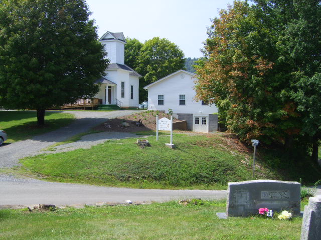
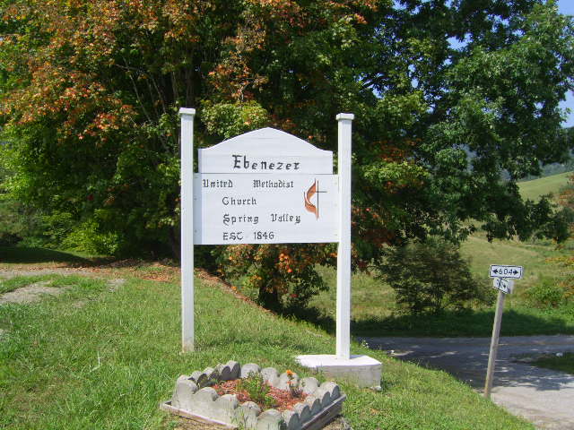
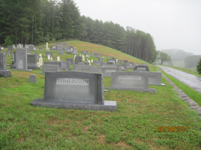
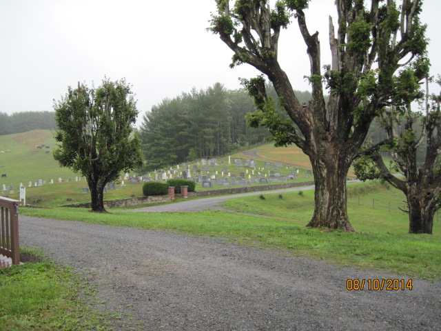
| Description | : | This cemetery consists of two sections. The older section is located across the road from the Ebenezer Methodist Church, the new section is located beside the church and has a plaque on the gate post which designates it as the "Vaughan Memorial Cemetery," "Memorial to the C. Marvin Vaughan Family." The original church, built in 1846, stood in the old section. |
frequently asked questions (FAQ):
-
Where is Ebenezer United Methodist Church Cemetery?
Ebenezer United Methodist Church Cemetery is located at 6138 Liberty Hill Road (Rt. 760) Grayson County ,Virginia , 24330USA.
-
Ebenezer United Methodist Church Cemetery cemetery's updated grave count on graveviews.com?
61 memorials
-
Where are the coordinates of the Ebenezer United Methodist Church Cemetery?
Latitude: 36.7403970
Longitude: -81.0702860

Nearby Cemetories:
1. Ebenezer Cemetery
Grayson County, USA
Coordinate: 36.7400017, -81.0717010
2. Stephen G. Bourne Cemetery
Fries, Grayson County, USA
Coordinate: 36.7353430, -81.0753090
3. Fielder Cemetery
Fallville, Grayson County, USA
Coordinate: 36.7433790, -81.1012350
4. Byrd Family Cemetery
Fallville, Grayson County, USA
Coordinate: 36.7509003, -81.1037979
5. Old Pool Cemetery
Elk Creek, Grayson County, USA
Coordinate: 36.7288370, -81.1073930
6. Jerusalem United Methodist Church Cemetery
Elk Creek, Grayson County, USA
Coordinate: 36.7456017, -81.1125031
7. Atkins Memorial United Methodist Church Cemetery
Providence, Grayson County, USA
Coordinate: 36.7177040, -81.0300000
8. Joel Mallory Family Cemetery
Providence, Grayson County, USA
Coordinate: 36.7219470, -81.0259030
9. Isaac Moore Cemetery
Oldtown, Grayson County, USA
Coordinate: 36.7308480, -81.0213280
10. William Billy Buck Bourne Cemetery
Elk Creek, Grayson County, USA
Coordinate: 36.7402740, -81.1241160
11. Combs Family Cemetery
Fries, Grayson County, USA
Coordinate: 36.6982817, -81.0476962
12. Cold Springs United Methodist Church Cemetery
Grayson County, USA
Coordinate: 36.7808920, -81.0422940
13. Taylor's Chapel Cemetery
Fries, Grayson County, USA
Coordinate: 36.7229260, -81.0160700
14. Hines Branch Cemetery
Elk Creek, Grayson County, USA
Coordinate: 36.7105480, -81.1155940
15. Liberty Hill United Methodist Church Cemetery
Fries, Grayson County, USA
Coordinate: 36.7426380, -81.0113680
16. Wysong Family Cemetery
Fallville, Grayson County, USA
Coordinate: 36.7551450, -81.1275500
17. Reece Vaught Family Cemetery
Fallville, Grayson County, USA
Coordinate: 36.7417580, -81.1311460
18. Andrew Funk Cemetery
Elk Creek, Grayson County, USA
Coordinate: 36.7189360, -81.1254560
19. Tolbert Wright Cemetery
Carsonville, Grayson County, USA
Coordinate: 36.6915240, -81.0799330
20. Francis Cornett Family Cemetery
Fallville, Grayson County, USA
Coordinate: 36.7354430, -81.1344060
21. Summerfield United Methodist Church Cemetery
Fries, Grayson County, USA
Coordinate: 36.6963200, -81.1046600
22. Creed Carrico Family Cemetery
Oldtown, Grayson County, USA
Coordinate: 36.7291980, -81.0045550
23. Jackson Family Cemetery
Elk Creek, Grayson County, USA
Coordinate: 36.7258090, -81.1352080
24. Stevens Creek United Methodist Church Cemetery
Fries, Grayson County, USA
Coordinate: 36.7319400, -80.9993500