
| Memorials | : | 774 |
| Location | : | Glaisdale, Scarborough Borough, England |
| Coordinate | : | 54.4373700, -0.8083400 |
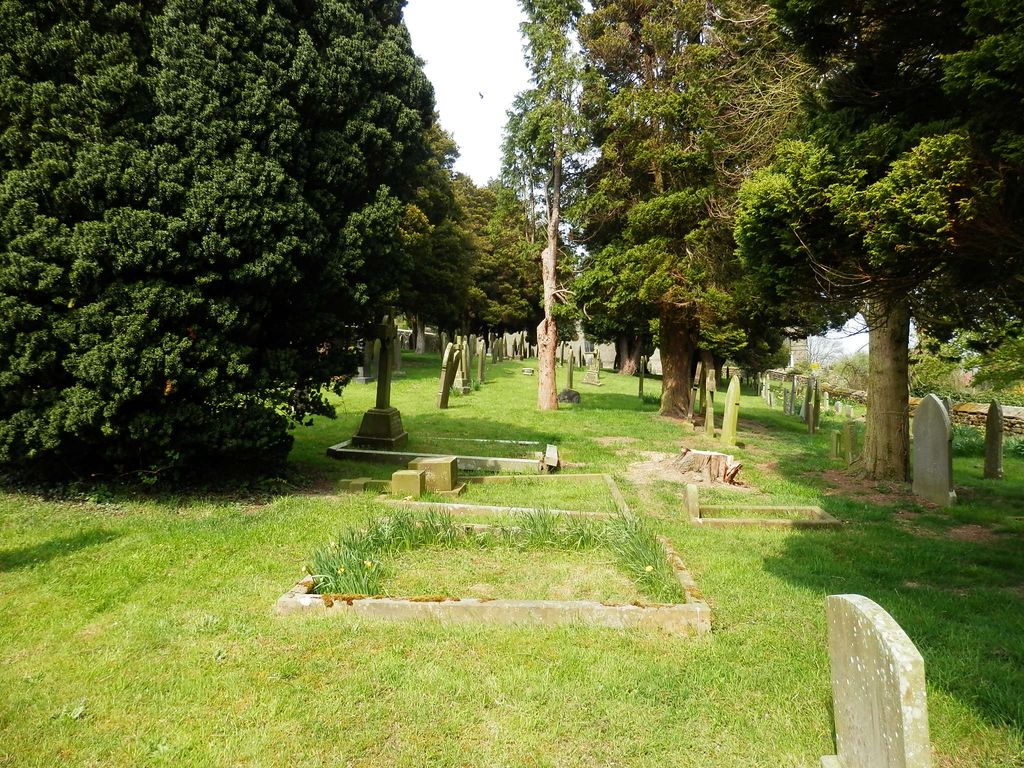
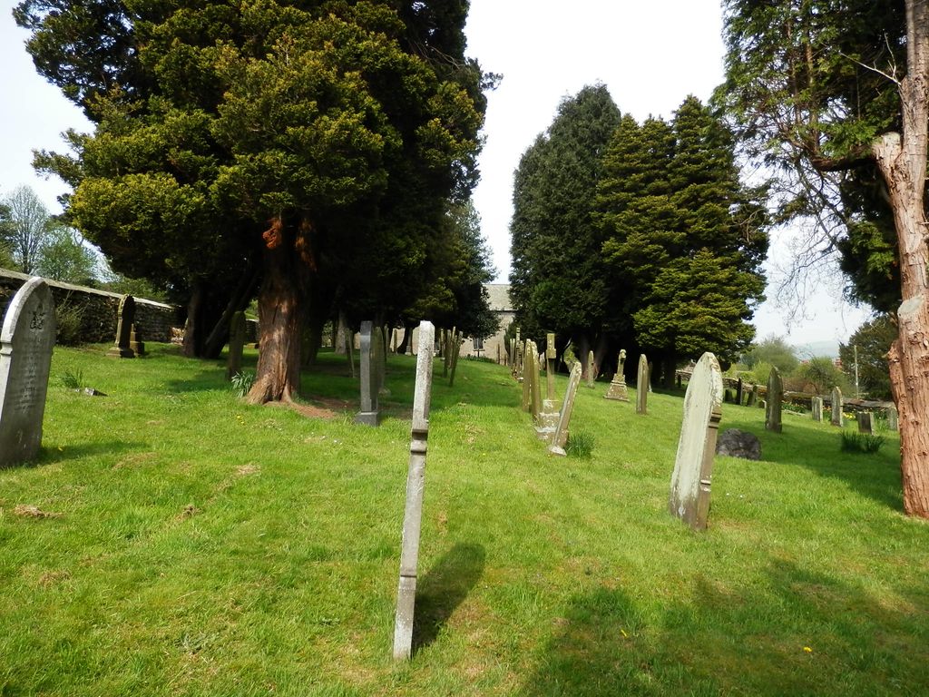
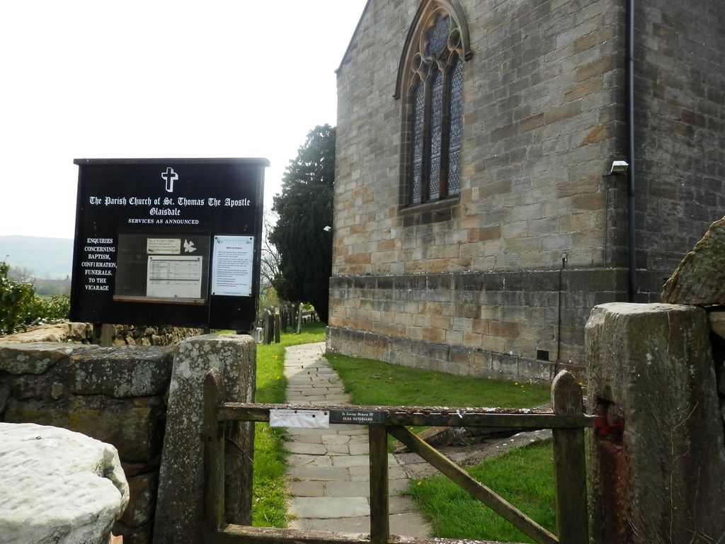
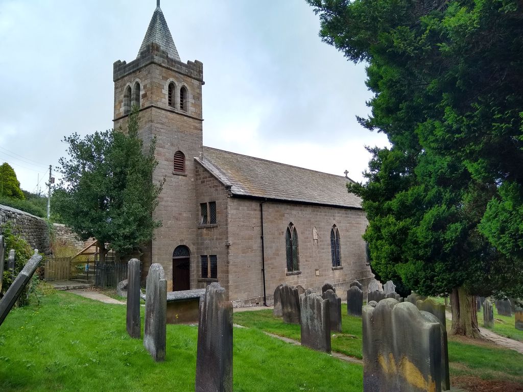
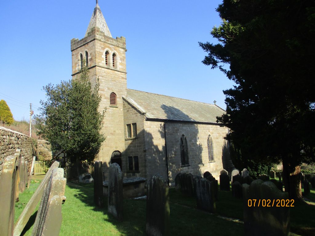
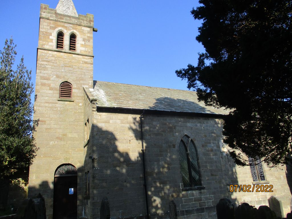
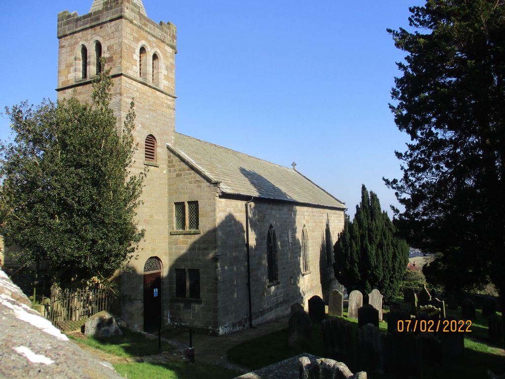
| Description | : | Glaisdale is an old ironstone mining village and civil parish in the Scarborough district of North Yorkshire, England, in the heart of the North York Moors National Park. The village has no other places of worship following the closure of the Methodist chapel, but the Glaisdale dale Methodist Chapel is still active. The present church dates from 1793 and was pre-dated by the 'Chappell of Glaisdale', a cruciform straw-thatched building, for which a date stone of 1585 may be seen in the side of the steps leading to the present tower. Thomas Ferries, alderman of Hull, the builder of the... Read More |
frequently asked questions (FAQ):
-
Where is St Thomas Churchyard?
St Thomas Churchyard is located at Glaisdale, Scarborough Borough ,North Yorkshire ,England.
-
St Thomas Churchyard cemetery's updated grave count on graveviews.com?
774 memorials
-
Where are the coordinates of the St Thomas Churchyard?
Latitude: 54.4373700
Longitude: -0.8083400
Nearby Cemetories:
1. Glaisdale Head Methodist Church
Glaisdale, Scarborough Borough, England
Coordinate: 54.4294940, -0.8331749
2. St James the Greater Churchyard
Lealholm, Scarborough Borough, England
Coordinate: 54.4586200, -0.8240300
3. Quaker Burial Ground
Lealholm, Scarborough Borough, England
Coordinate: 54.4575270, -0.8285030
4. Our Lady of Sacred Heart Roman Catholic Churchyard
Lealholm, Scarborough Borough, England
Coordinate: 54.4592200, -0.8234600
5. Egton Cemetery
Egton, Scarborough Borough, England
Coordinate: 54.4482300, -0.7690700
6. St Hilda Churchyard
Egton, Scarborough Borough, England
Coordinate: 54.4414240, -0.7535720
7. St Matthew Churchyard
Grosmont, Scarborough Borough, England
Coordinate: 54.4348410, -0.7243950
8. Christ Church Churchyard
Ugthorpe, Scarborough Borough, England
Coordinate: 54.4892300, -0.7672700
9. St Mary Churchyard
Goathland, Scarborough Borough, England
Coordinate: 54.3950300, -0.7266400
10. Botton Village Cemetery
Danby, Scarborough Borough, England
Coordinate: 54.4290000, -0.9282700
11. St Hilda Churchyard
Danby, Scarborough Borough, England
Coordinate: 54.4475240, -0.9281480
12. St. Margaret's Churchyard
Aislaby, Scarborough Borough, England
Coordinate: 54.4653900, -0.6792400
13. St John the Evangelist Churchyard
Sleights, Scarborough Borough, England
Coordinate: 54.4503500, -0.6651200
14. Quakers Burial Ground
Castleton, Scarborough Borough, England
Coordinate: 54.4614010, -0.9478360
15. Westerdale Green Burial Ground
Westerdale, Scarborough Borough, England
Coordinate: 54.4409040, -0.9555864
16. St Mary and St Laurence Churchyard
Rosedale Abbey, Ryedale District, England
Coordinate: 54.3537300, -0.8872700
17. All Saints Churchyard
Ugglebarnby, Scarborough Borough, England
Coordinate: 54.4522340, -0.6446610
18. St Oswald Churchyard
Lythe, Scarborough Borough, England
Coordinate: 54.5065120, -0.6885870
19. Christ Church Churchyard Westerdale
Westerdale, Scarborough Borough, England
Coordinate: 54.4450870, -0.9781360
20. St Nicholas Churchyard
Roxby, Scarborough Borough, England
Coordinate: 54.5365810, -0.8256590
21. St Hilda Priory Cemetery
Whitby, Scarborough Borough, England
Coordinate: 54.4823300, -0.6431400
22. St. Hilda Churchyard
Hinderwell, Scarborough Borough, England
Coordinate: 54.5422400, -0.7784600
23. Hinderwell Cemetery
Hinderwell, Scarborough Borough, England
Coordinate: 54.5430090, -0.7781630
24. Ebenezers Baptist Church
Scarborough Borough, England
Coordinate: 54.3744655, -0.6557164