
| Memorials | : | 0 |
| Location | : | Enkhuizen, Enkhuizen Municipality, Netherlands |
| Coordinate | : | 52.7089800, 5.2887500 |
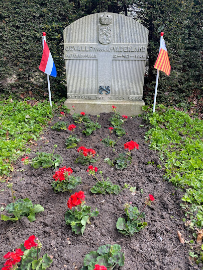
| Description | : | Enkhuizen is 57 kilometres north-north-east of Amsterdam and 48 kilometres east-north-east of Alkmaar, on the west bank of Ijsselmeer (Zuider Zee). The cemetery is on the northern outskirts of the town, on the east side of the dyke road to Andijk. |
frequently asked questions (FAQ):
-
Where is Enkhuizen General Cemetery?
Enkhuizen General Cemetery is located at Enkhuizen, Enkhuizen Municipality ,Noord-Holland ,Netherlands.
-
Enkhuizen General Cemetery cemetery's updated grave count on graveviews.com?
0 memorials
-
Where are the coordinates of the Enkhuizen General Cemetery?
Latitude: 52.7089800
Longitude: 5.2887500
Nearby Cemetories:
1. Joodse Begraafplaats
Enkhuizen Municipality, Netherlands
Coordinate: 52.7000800, 5.2778000
2. Bovenkarspel General Cemetery
Bovenkarspel, Stede Broec Municipality, Netherlands
Coordinate: 52.6994300, 5.2488900
3. Andijk Eastern General Cemetery
Andijk, Medemblik Municipality, Netherlands
Coordinate: 52.7451600, 5.2369700
4. Andijk Western General Cemetery
Andijk, Medemblik Municipality, Netherlands
Coordinate: 52.7413700, 5.1819400
5. Medemblik General Cemetery
Medemblik, Medemblik Municipality, Netherlands
Coordinate: 52.7664000, 5.1051200
6. Schellinkhout Protestant Churchyard
Schellinkhout, Drechterland Municipality, Netherlands
Coordinate: 52.6345800, 5.1218900
7. Rooms-Katholiek Kerkhof Welgelegen
Medemblik, Medemblik Municipality, Netherlands
Coordinate: 52.7717300, 5.0996890
8. Algemene Begraafplaats Opperdoes
Opperdoes, Medemblik Municipality, Netherlands
Coordinate: 52.7638451, 5.0742310
9. Twisk Churchyard
Twisk, Medemblik Municipality, Netherlands
Coordinate: 52.7442300, 5.0603400
10. Rooms Katholieke Begraafplaats
Hoorn, Hoorn Municipality, Netherlands
Coordinate: 52.6494000, 5.0737800
11. Drieboomlaan
Hoorn, Hoorn Municipality, Netherlands
Coordinate: 52.6524706, 5.0707404
12. Hoorn General Cemetery
Hoorn, Hoorn Municipality, Netherlands
Coordinate: 52.6461800, 5.0486800
13. Wognum Protestant Churchyard
Wognum, Medemblik Municipality, Netherlands
Coordinate: 52.6802100, 5.0260100
14. Nieuwe Algemene Begraafplaats
Hoorn Municipality, Netherlands
Coordinate: 52.6459000, 5.0378800
15. Scharl General Cemetery
Skarl, Sudwest Fryslan Municipality, Netherlands
Coordinate: 52.8672300, 5.3909200
16. Staveren General Cemetery
Stavoren, Sudwest Fryslan Municipality, Netherlands
Coordinate: 52.8820900, 5.3600500
17. Bakhuizen Roman Catholic Cemetery
Bakhuizen, De Fryske Marren Municipality, Netherlands
Coordinate: 52.8692200, 5.4557500
18. Oude Begraafplaats Kerkje aan de Zee
Urk, Urk Municipality, Netherlands
Coordinate: 52.6621322, 5.5935175
19. Vormtweg 11
Urk, Urk Municipality, Netherlands
Coordinate: 52.6722645, 5.6091134
20. Molkwerum Protestant Churchyard
Molkwerum, Sudwest Fryslan Municipality, Netherlands
Coordinate: 52.9001600, 5.3992000
21. Middenmeer General Cemetery
Middenmeer, Hollands Kroon Municipality, Netherlands
Coordinate: 52.8112900, 4.9980200
22. Gemeentelijke begraafplaats Middenmeer
Middenmeer, Hollands Kroon Municipality, Netherlands
Coordinate: 52.8112000, 4.9979100
23. Rooms Katholieke Begraafplaats Middenmeer
Middenmeer, Hollands Kroon Municipality, Netherlands
Coordinate: 52.8122672, 4.9981428
24. Kerkhof Oudemirdum
Oudemirdum, De Fryske Marren Municipality, Netherlands
Coordinate: 52.8498364, 5.5332713