
| Memorials | : | 0 |
| Location | : | Szczecin, Miasto Szczecin, Poland |
| Coordinate | : | 53.5573402, 14.8215340 |
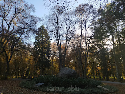
| Description | : | In Polish the name would be Cemetarz Ewangelicki-Lutheryjski w Goleniów. The cemetery was destroyed after World War II. Goleniów (German: Gollnow) is a town in Pomerania, northwestern Poland with 22,399 inhabitants (2004). It is the capital of Goleniów County in West Pomeranian Voivodeship (since 1999); previously it was in Szczecin Voivodeship (1975–1998). Town area is 12.5 square kilometres (4.8 sq mi), geographical situation 53°33'N and 14°49'E. It is situated in the centre of Goleniowska Forest on Goleniów Plain, near main roads numbers 3 and 6. Before 1945 the area was part of Germany. After World War II the area became part of... Read More |
frequently asked questions (FAQ):
-
Where is Evangelisch-Lutheranischer Friedhof von Gollnow?
Evangelisch-Lutheranischer Friedhof von Gollnow is located at Szczecin, Miasto Szczecin ,Zachodniopomorskie ,Poland.
-
Evangelisch-Lutheranischer Friedhof von Gollnow cemetery's updated grave count on graveviews.com?
0 memorials
-
Where are the coordinates of the Evangelisch-Lutheranischer Friedhof von Gollnow?
Latitude: 53.5573402
Longitude: 14.8215340
Nearby Cemetories:
1. Cmentarz w Borzysławcu
Powiat goleniowski, Poland
Coordinate: 53.5190030, 14.7191929
2. Ev.-lutherischer Friedhof von Glewitz (Glewice)
Powiat goleniowski, Poland
Coordinate: 53.6069373, 14.9132945
3. Lubczyna Lapidarium
Powiat goleniowski, Poland
Coordinate: 53.5073500, 14.7100500
4. Ev.-lutherischer Kirchfriedhof Kriewitz (Krzywice)
Powiat goleniowski, Poland
Coordinate: 53.6012116, 14.9643436
5. Ev.-lutherischer Kirchfriedhof Basenthin (Bodzęcin
Powiat goleniowski, Poland
Coordinate: 53.6348427, 14.9268505
6. Evangelisch-Lutheranischer Friedhof von Karlsbach
Powiat stargardzki, Poland
Coordinate: 53.4465560, 14.8874502
7. Ev.-lutherischer Friedhof Dischenhagen (Dzisna)
Powiat goleniowski, Poland
Coordinate: 53.6846897, 14.8439832
8. Evangelisch-Lutheranischer Friedhof von Fanger
Powiat goleniowski, Poland
Coordinate: 53.6602298, 14.9775693
9. Cmentarz w Poczernin
Powiat stargardzki, Poland
Coordinate: 53.4244760, 14.9547506
10. Cmentarz Komunalny w Policach
Powiat poznański, Poland
Coordinate: 53.5404500, 14.5577000
11. Cmentarz Komunalny w Strzelewie
Powiat goleniowski, Poland
Coordinate: 53.6756662, 14.9990416
12. Dabie
Szczecin, Miasto Szczecin, Poland
Coordinate: 53.3975520, 14.7656270
13. Cmentarz Komunaly Wielgowo
Szczecin, Miasto Szczecin, Poland
Coordinate: 53.3974730, 14.7657970
14. Evangelisch-Lutheranischer Friedhof von Züllchow
Szczecin, Miasto Szczecin, Poland
Coordinate: 53.4660394, 14.5772902
15. Cmentarz Dąbie
Szczecin, Miasto Szczecin, Poland
Coordinate: 53.3991720, 14.6854910
16. Evangelisch-Lutheranischer Friedhof von Roggow
Powiat stargardzki, Poland
Coordinate: 53.4015718, 14.9828398
17. Cmentarz w Małkocin
Powiat stargardzki, Poland
Coordinate: 53.4042790, 15.0290288
18. Evangelisch-Lutheranischer Friedhof von Trechel
Powiat goleniowski, Poland
Coordinate: 53.7346668, 14.9650317
19. Evangelisch-Lutheranischer Friedhof von Saarow
Powiat stargardzki, Poland
Coordinate: 53.3844372, 14.9905812
20. Castle Church
Szczecin, Miasto Szczecin, Poland
Coordinate: 53.4264440, 14.5600560
21. Cmentarz Komunalny w Nowogard
Szczecin, Miasto Szczecin, Poland
Coordinate: 53.6628579, 15.1180895
22. Cmentarz w Grzędzicach
Powiat stargardzki, Poland
Coordinate: 53.3686129, 14.9688987
23. Cmentarz Komunalny
Szczecin, Miasto Szczecin, Poland
Coordinate: 53.3538020, 14.7367000
24. Bethanien Hospital Cemetery
Szczecin, Miasto Szczecin, Poland
Coordinate: 53.4384183, 14.5289236