
| Memorials | : | 301 |
| Location | : | Sugar Grove, Fairfield County, USA |
| Coordinate | : | 39.6211761, -82.5423817 |
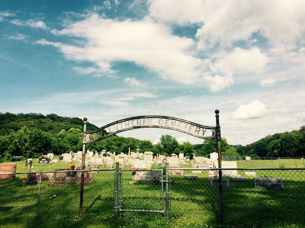
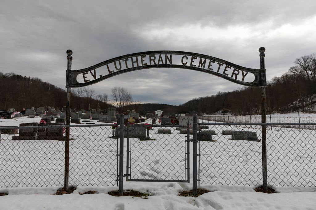
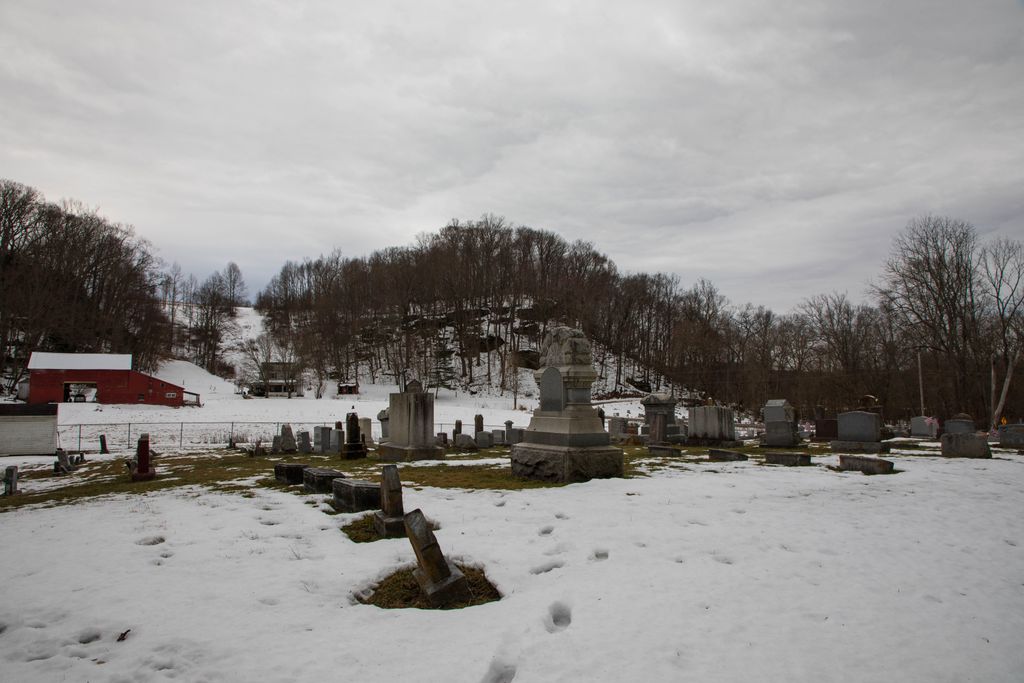
| Description | : | The cemetery is located on the east side of Buckeye Road SE about 0.1 miles south of its intersection with Sugar Grove Road SE (County Road 50). The cemetery is located in Berne Township, Fairfield County, Ohio, and is # 3099 (Saint Matthews Evangelical Lutheran Cemetery / Saint Matthews Lutheran Cemetery / Lutheran Cemetery) in “Ohio Cemeteries 1803-2003”, compiled by the Ohio Genealogical Society. The U.S. Geological Survey (USGS) Geographic Names Information System (GNIS) feature ID for the cemetery is 1806867 (Saint Matthews Lutheran Cemetery / Lutheran Cemetery). |
frequently asked questions (FAQ):
-
Where is Evangelical Lutheran Cemetery?
Evangelical Lutheran Cemetery is located at Buckeye Road SE Sugar Grove, Fairfield County ,Ohio , 43155USA.
-
Evangelical Lutheran Cemetery cemetery's updated grave count on graveviews.com?
301 memorials
-
Where are the coordinates of the Evangelical Lutheran Cemetery?
Latitude: 39.6211761
Longitude: -82.5423817
Nearby Cemetories:
1. Sugar Grove Cemetery
Sugar Grove, Fairfield County, USA
Coordinate: 39.6203003, -82.5436020
2. Sharp Cemetery
Sugar Grove, Fairfield County, USA
Coordinate: 39.6203003, -82.5535965
3. Stukey Cemetery
Fairfield County, USA
Coordinate: 39.6343994, -82.5558014
4. Ream Cemetery
Sugar Grove, Fairfield County, USA
Coordinate: 39.6513610, -82.5546500
5. Trinity Sponagle Lutheran Church Cemetery
Sugar Grove, Fairfield County, USA
Coordinate: 39.6159600, -82.4993000
6. Phillips Cemetery
Horns Mill, Fairfield County, USA
Coordinate: 39.6475640, -82.5144030
7. Brushy Fork Cemetery
Sugar Grove, Fairfield County, USA
Coordinate: 39.6150017, -82.5871964
8. Richards Family Cemetery
Rockbridge, Hocking County, USA
Coordinate: 39.5853680, -82.5390430
9. Union Grove Cemetery
Rockbridge, Hocking County, USA
Coordinate: 39.5776520, -82.5558070
10. Union Church Cemetery
Good Hope Township, Hocking County, USA
Coordinate: 39.5774498, -82.5608368
11. Our Lady of Good Hope Catholic Cemetery
Good Hope Township, Hocking County, USA
Coordinate: 39.6036797, -82.6033020
12. Whippoorwill Cemetery
Good Hope Township, Hocking County, USA
Coordinate: 39.5677986, -82.5430984
13. Tarkiln Cemetery
Berne Township, Fairfield County, USA
Coordinate: 39.6653000, -82.5842240
14. Centenary Cemetery
Enterprise, Hocking County, USA
Coordinate: 39.5802994, -82.4946976
15. Pleasant Hill Cemetery
Berne Township, Fairfield County, USA
Coordinate: 39.6717239, -82.5084873
16. Crawfis-Emery Cemetery
Lancaster, Fairfield County, USA
Coordinate: 39.6787000, -82.5580000
17. Baron-Graham Family Cemetery
Hideaway Hills, Hocking County, USA
Coordinate: 39.6385070, -82.4657110
18. Saint Emanuel Lutheran Cemetery
Marion Township, Hocking County, USA
Coordinate: 39.6433900, -82.4628000
19. Saint Jacobus Evangelical Lutheran Cemetery
Hideaway Hills, Hocking County, USA
Coordinate: 39.6434700, -82.4607900
20. Dawley Wood Cemetery
Enterprise, Hocking County, USA
Coordinate: 39.5731670, -82.4818100
21. Fairfield School For Boys Cemetery
Lancaster, Fairfield County, USA
Coordinate: 39.6447301, -82.6249481
22. Fairview Memorial Gardens
Rockbridge, Hocking County, USA
Coordinate: 39.5594510, -82.5028920
23. Kline Cemetery
Good Hope Township, Hocking County, USA
Coordinate: 39.5588070, -82.5035510
24. Fairview Methodist Church Cemetery
Good Hope Township, Hocking County, USA
Coordinate: 39.5592499, -82.5011902