
| Memorials | : | 0 |
| Location | : | Good Hope Township, Hocking County, USA |
| Coordinate | : | 39.5677986, -82.5430984 |
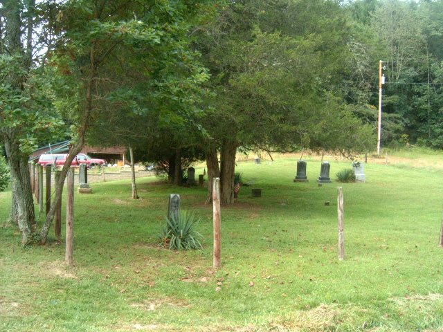
| Description | : | The cemetery is located on the west wide of E Buck Run Road (Township Road 122) about 0.7 miles south of its intersection with Ohio State Route 374. The cemetery is located in Salt Creek Township, Hocking County, Ohio, and is # 5396 (Whippoorwill Cemetery) in “Ohio Cemeteries 1803-2003”, compiled by the Ohio Genealogical Society. The U.S. Geological Survey (USGS) Geographic Names Information System (GNIS) feature ID for the cemetery is 1047863 (Whippoorwill Cemetery). |
frequently asked questions (FAQ):
-
Where is Whippoorwill Cemetery?
Whippoorwill Cemetery is located at E Buck Run Road (Township Road 122) Good Hope Township, Hocking County ,Ohio , 43149USA.
-
Whippoorwill Cemetery cemetery's updated grave count on graveviews.com?
0 memorials
-
Where are the coordinates of the Whippoorwill Cemetery?
Latitude: 39.5677986
Longitude: -82.5430984
Nearby Cemetories:
1. Union Grove Cemetery
Rockbridge, Hocking County, USA
Coordinate: 39.5776520, -82.5558070
2. Union Church Cemetery
Good Hope Township, Hocking County, USA
Coordinate: 39.5774498, -82.5608368
3. Richards Family Cemetery
Rockbridge, Hocking County, USA
Coordinate: 39.5853680, -82.5390430
4. West Pleasant Hill Cemetery
Good Hope Township, Hocking County, USA
Coordinate: 39.5499687, -82.5613708
5. Kline Cemetery
Good Hope Township, Hocking County, USA
Coordinate: 39.5588070, -82.5035510
6. Fairview Memorial Gardens
Rockbridge, Hocking County, USA
Coordinate: 39.5594510, -82.5028920
7. Fairview Methodist Church Cemetery
Good Hope Township, Hocking County, USA
Coordinate: 39.5592499, -82.5011902
8. McBroom Cemetery
Laurel Township, Hocking County, USA
Coordinate: 39.5346985, -82.5643997
9. Centenary Cemetery
Enterprise, Hocking County, USA
Coordinate: 39.5802994, -82.4946976
10. Brown Cemetery
Good Hope Township, Hocking County, USA
Coordinate: 39.5647583, -82.6028824
11. Dawley Wood Cemetery
Enterprise, Hocking County, USA
Coordinate: 39.5731670, -82.4818100
12. Saint John Lutheran Cemetery
Maysville, Hocking County, USA
Coordinate: 39.5314370, -82.5032140
13. Antioch Cemetery
Enterprise, Hocking County, USA
Coordinate: 39.5573300, -82.4799700
14. Hansen Cemetery
Laurel Township, Hocking County, USA
Coordinate: 39.5253340, -82.5788750
15. Old Lutheran Cemetery
Falls Township, Hocking County, USA
Coordinate: 39.5262900, -82.5027700
16. Sugar Grove Cemetery
Sugar Grove, Fairfield County, USA
Coordinate: 39.6203003, -82.5436020
17. Sharp Cemetery
Sugar Grove, Fairfield County, USA
Coordinate: 39.6203003, -82.5535965
18. Evangelical Lutheran Cemetery
Sugar Grove, Fairfield County, USA
Coordinate: 39.6211761, -82.5423817
19. Pisgah Cemetery
Good Hope Township, Hocking County, USA
Coordinate: 39.5610199, -82.6120224
20. Boling Cemetery
Rockbridge, Hocking County, USA
Coordinate: 39.5108500, -82.5347700
21. Brushy Fork Cemetery
Sugar Grove, Fairfield County, USA
Coordinate: 39.6150017, -82.5871964
22. Homestead Crossing Cemetery
Rockbridge, Hocking County, USA
Coordinate: 39.5212690, -82.5891820
23. Our Lady of Good Hope Catholic Cemetery
Good Hope Township, Hocking County, USA
Coordinate: 39.6036797, -82.6033020
24. Trinity Sponagle Lutheran Church Cemetery
Sugar Grove, Fairfield County, USA
Coordinate: 39.6159600, -82.4993000