
| Memorials | : | 0 |
| Location | : | Stotfold, Central Bedfordshire Unitary Authority, England |
| Coordinate | : | 52.0040420, -0.2495440 |
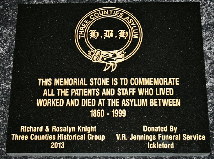
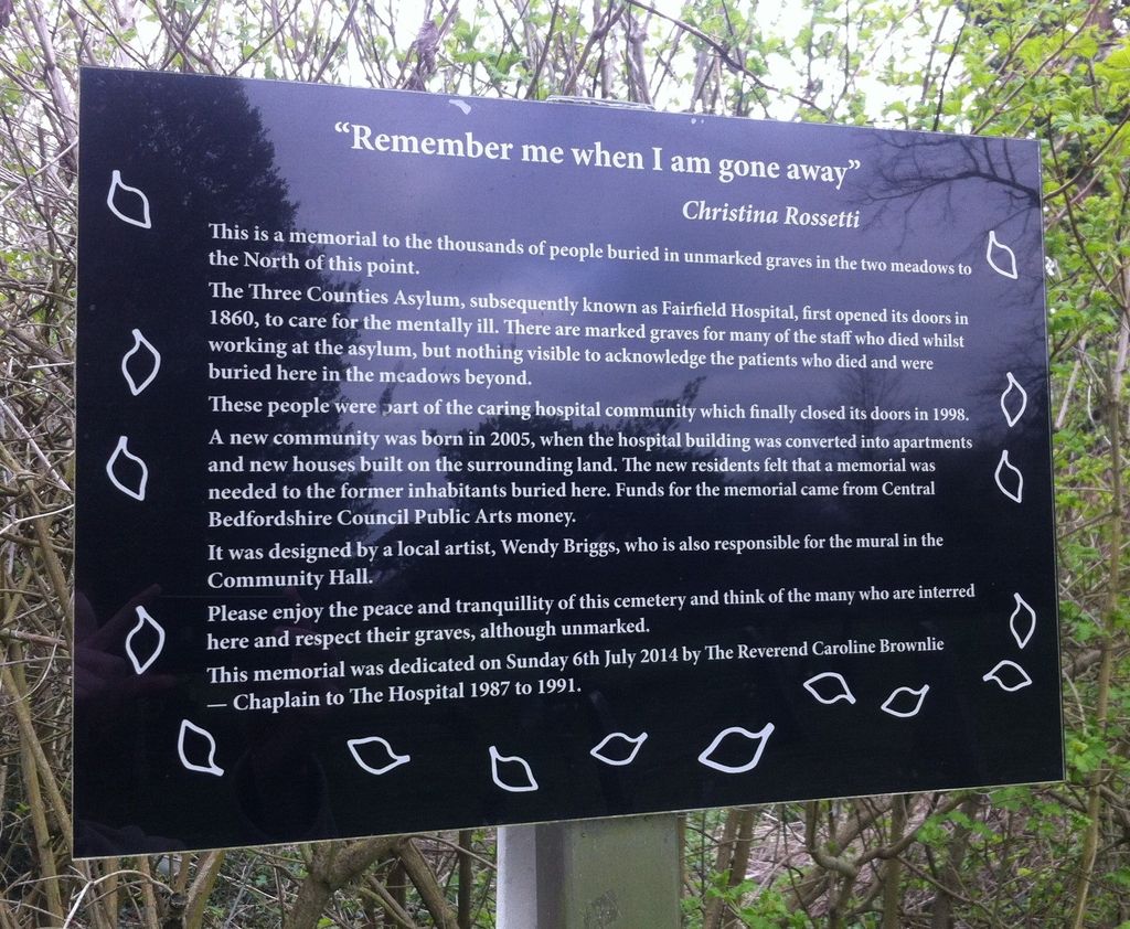
| Description | : | Originally known as The Stotfold Three Counties Asylum (Fairfield Hospital), building of the hospital commenced in 1856 on a 253-acre (230 acres cultivated) site between Letchworth, Arlesey and Stotfold, the land was purchased for £11,000. The new hospital was to replace the Bedford Lunatic Asylum in Ampthill Road in Bedford, which had been built in 1812. The Hospital was designed by architect George Fowler Jones in the corridor format that was prominent at the time. The hospital opened on March 8, 1860 with the transfer of 6 male and 6 female patients from Bedford Lunatic, Cambridgeshire was also going to... Read More |
frequently asked questions (FAQ):
-
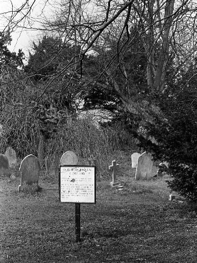
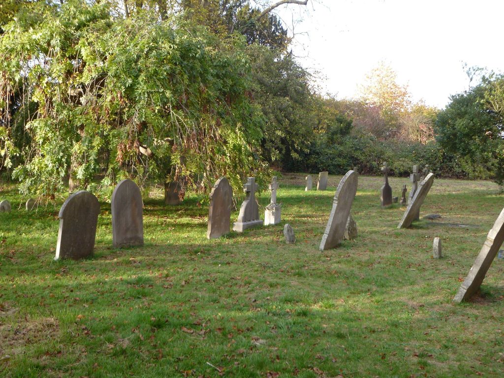
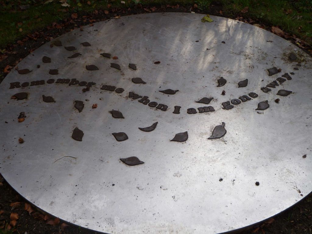
Where is Fairfield Hospital Cemetery?
Fairfield Hospital Cemetery is located at Eliot Way Stotfold, Central Bedfordshire Unitary Authority ,Bedfordshire ,England.
-
Fairfield Hospital Cemetery cemetery's updated grave count on graveviews.com?
0 memorials
-
Where are the coordinates of the Fairfield Hospital Cemetery?
Latitude: 52.0040420
Longitude: -0.2495440
Nearby Cemetories:
1. Wilbury Hills Cemetery
Letchworth, North Hertfordshire District, England
Coordinate: 51.9862210, -0.2474770
2. St Mary the Virgin Churchyard
Stotfold, Central Bedfordshire Unitary Authority, England
Coordinate: 52.0150980, -0.2232980
3. St. Peter's Churchyard
Arlesey, Central Bedfordshire Unitary Authority, England
Coordinate: 52.0234710, -0.2643140
4. Stotfold Cemetery
Stotfold, Central Bedfordshire Unitary Authority, England
Coordinate: 52.0186450, -0.2189540
5. Icknield Way Cemetery
Letchworth, North Hertfordshire District, England
Coordinate: 51.9787300, -0.2506100
6. St Nicholas Churchyard
Letchworth, North Hertfordshire District, England
Coordinate: 51.9948300, -0.2078900
7. North Hertfordshire Memorial Park and Crematorium
Holwell, North Hertfordshire District, England
Coordinate: 51.9847244, -0.2967870
8. Baldock Cemetery
Baldock, North Hertfordshire District, England
Coordinate: 51.9901010, -0.1960690
9. St Mary Churchyard
Henlow, Central Bedfordshire Unitary Authority, England
Coordinate: 52.0348580, -0.2834610
10. St Mary Churchyard
Baldock, North Hertfordshire District, England
Coordinate: 51.9897380, -0.1898930
11. St Mary Magdalene's Church
Caldecote, North Hertfordshire District, England
Coordinate: 52.0304700, -0.1989020
12. St. Vincent Churchyard
Newnham, North Hertfordshire District, England
Coordinate: 52.0229100, -0.1897200
13. All Saints Churchyard
Willian, North Hertfordshire District, England
Coordinate: 51.9609140, -0.2191160
14. All Saints Churchyard
Upper Stondon, Central Bedfordshire Unitary Authority, England
Coordinate: 52.0065450, -0.3258350
15. Clifton Friends Burial Ground
Clifton, Central Bedfordshire Unitary Authority, England
Coordinate: 52.0378800, -0.3033100
16. All Saints Churchyard
Clifton, Central Bedfordshire Unitary Authority, England
Coordinate: 52.0393990, -0.3015550
17. Clifton Baptist Chapelyard
Clifton, Central Bedfordshire Unitary Authority, England
Coordinate: 52.0398940, -0.3025180
18. All Saints New Churchyard
Clifton, Central Bedfordshire Unitary Authority, England
Coordinate: 52.0403500, -0.3018700
19. St George Churchyard
Edworth, Central Bedfordshire Unitary Authority, England
Coordinate: 52.0510350, -0.2189810
20. St Nicholas Churchyard
Hinxworth, North Hertfordshire District, England
Coordinate: 52.0476210, -0.1970460
21. St Andrew Churchyard
Langford, Central Bedfordshire Unitary Authority, England
Coordinate: 52.0583270, -0.2721350
22. All Saints Churchyard
Radwell, North Hertfordshire District, England
Coordinate: 51.9747300, -0.1668550
23. Saint Mary the Virgin Churchyard
Pirton, North Hertfordshire District, England
Coordinate: 51.9722000, -0.3316600
24. St Mary the Virgin Churchyard
Meppershall, Central Bedfordshire Unitary Authority, England
Coordinate: 52.0102000, -0.3483000