
| Memorials | : | 0 |
| Location | : | Edworth, Central Bedfordshire Unitary Authority, England |
| Coordinate | : | 52.0510350, -0.2189810 |
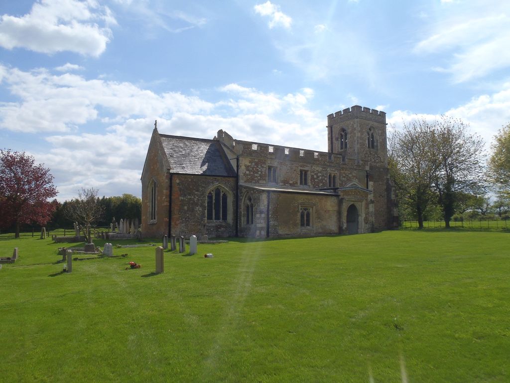
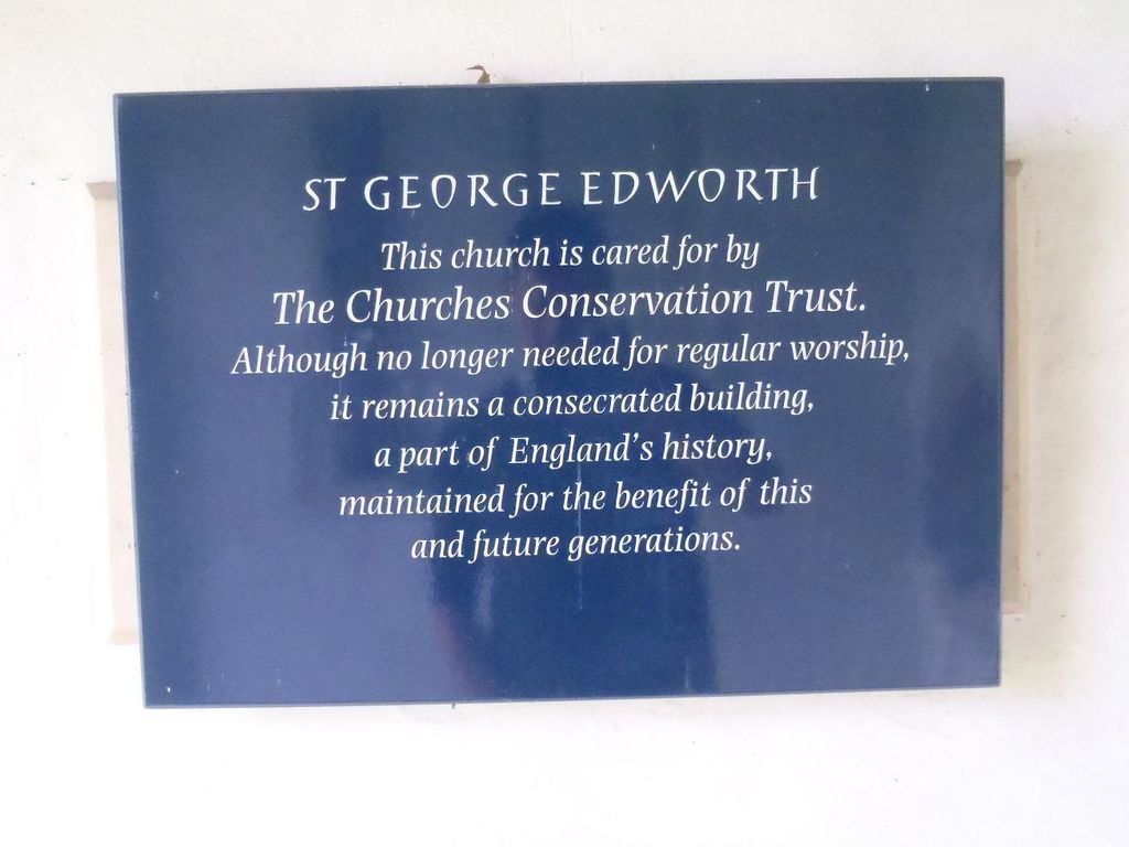
| Description | : | Edworth is a village and civil parish located in the English county of Bedfordshire. It sits just off the Great North Road (A1) between Baldock and Biggleswade. Edworth lies close to the county border and to the village of Hinxworth. There are less than a hundred inhabitants in the village. The village contains the small St. George's Church |
frequently asked questions (FAQ):
-
Where is St George Churchyard?
St George Churchyard is located at Edworth, Central Bedfordshire Unitary Authority ,Bedfordshire ,England.
-
St George Churchyard cemetery's updated grave count on graveviews.com?
0 memorials
-
Where are the coordinates of the St George Churchyard?
Latitude: 52.0510350
Longitude: -0.2189810
Nearby Cemetories:
1. St Nicholas Churchyard
Hinxworth, North Hertfordshire District, England
Coordinate: 52.0476210, -0.1970460
2. St Mary Magdalene's Church
Caldecote, North Hertfordshire District, England
Coordinate: 52.0304700, -0.1989020
3. Stotfold Cemetery
Stotfold, Central Bedfordshire Unitary Authority, England
Coordinate: 52.0186450, -0.2189540
4. St. Vincent Churchyard
Newnham, North Hertfordshire District, England
Coordinate: 52.0229100, -0.1897200
5. St Andrew Churchyard
Langford, Central Bedfordshire Unitary Authority, England
Coordinate: 52.0583270, -0.2721350
6. Dunton Cemetery
Dunton, Central Bedfordshire Unitary Authority, England
Coordinate: 52.0820490, -0.1982770
7. Langford Cemetery
Langford, Central Bedfordshire Unitary Authority, England
Coordinate: 52.0640000, -0.2710830
8. St Mary Magdalene Churchyard
Dunton, Central Bedfordshire Unitary Authority, England
Coordinate: 52.0825200, -0.1955600
9. St Mary the Virgin Churchyard
Stotfold, Central Bedfordshire Unitary Authority, England
Coordinate: 52.0150980, -0.2232980
10. St. Peter's Churchyard
Arlesey, Central Bedfordshire Unitary Authority, England
Coordinate: 52.0234710, -0.2643140
11. St Mary Churchyard
Henlow, Central Bedfordshire Unitary Authority, England
Coordinate: 52.0348580, -0.2834610
12. Drove Road Cemetery
Biggleswade, Central Bedfordshire Unitary Authority, England
Coordinate: 52.0895000, -0.2527300
13. Stratton Way Cemetery
Biggleswade, Central Bedfordshire Unitary Authority, England
Coordinate: 52.0919432, -0.2474864
14. St Andrew Churchyard
Biggleswade, Central Bedfordshire Unitary Authority, England
Coordinate: 52.0875360, -0.2666970
15. All Saints Churchyard
Eyeworth, Central Bedfordshire Unitary Authority, England
Coordinate: 52.0945940, -0.1770800
16. Fairfield Hospital Cemetery
Stotfold, Central Bedfordshire Unitary Authority, England
Coordinate: 52.0040420, -0.2495440
17. All Saints New Churchyard
Clifton, Central Bedfordshire Unitary Authority, England
Coordinate: 52.0403500, -0.3018700
18. All Saints Churchyard
Clifton, Central Bedfordshire Unitary Authority, England
Coordinate: 52.0393990, -0.3015550
19. Clifton Baptist Chapelyard
Clifton, Central Bedfordshire Unitary Authority, England
Coordinate: 52.0398940, -0.3025180
20. Clifton Friends Burial Ground
Clifton, Central Bedfordshire Unitary Authority, England
Coordinate: 52.0378800, -0.3033100
21. St Nicholas Churchyard
Letchworth, North Hertfordshire District, England
Coordinate: 51.9948300, -0.2078900
22. St Peter and St Paul
Steeple Morden, South Cambridgeshire District, England
Coordinate: 52.0655979, -0.1257247
23. St. Mary's Churchyard
Guilden Morden, South Cambridgeshire District, England
Coordinate: 52.0806930, -0.1336810
24. All Saints Churchyard
Sutton, Central Bedfordshire Unitary Authority, England
Coordinate: 52.1126500, -0.2212200