
| Memorials | : | 6 |
| Location | : | Chesterfield County, USA |
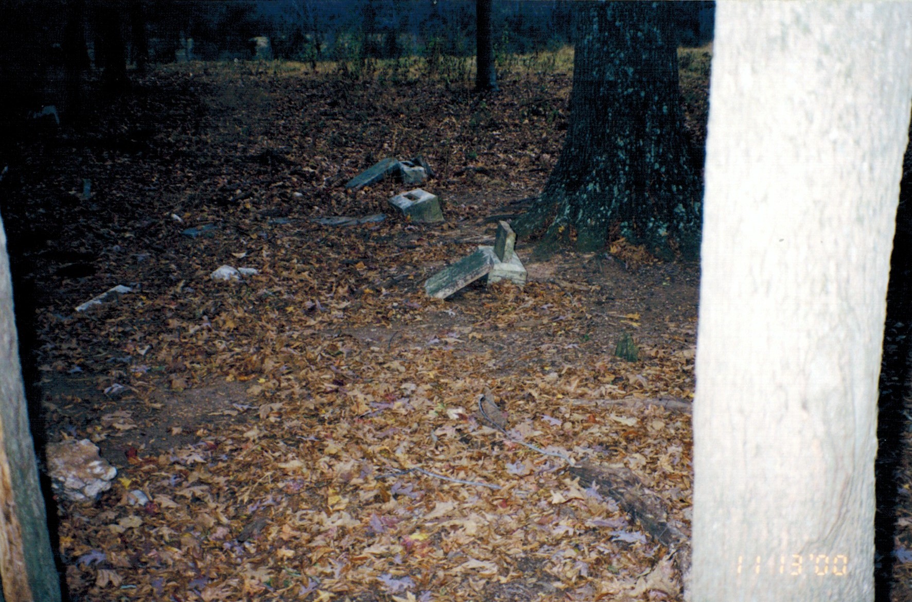
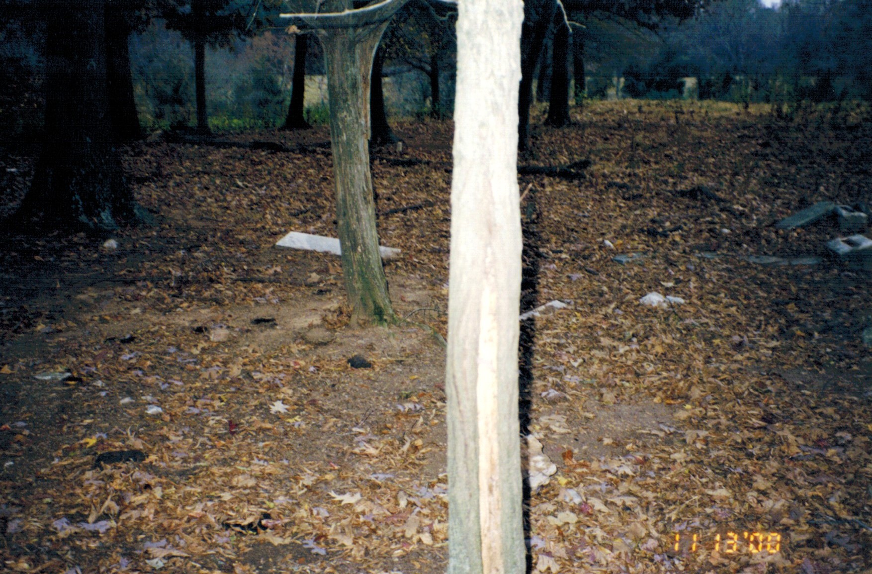
| Description | : | This cemetery is between Jackson Road in Chesterfield County, South Carolina and Long Road in Anson County, North Carolina. It is in Chesterfield County. From Highway 742 at Casons Old Field take Maysville Road until you get to Long Road on the left. Turn left on Long Road. Go about 100 yards and turn right onto a dirt farm road. This road will enter a large pasture and go through the pasture. Just before you get to the back side of the pasture you will pass a small pond on the left. Just beyond that there will be circle of... Read More |
frequently asked questions (FAQ):
-
Where is Ferguson H. Smith Cemetery?
Ferguson H. Smith Cemetery is located at Chesterfield County, USA.
-
Ferguson H. Smith Cemetery cemetery's updated grave count on graveviews.com?
6 memorials
Nearby Cemetories:
1. Angelus Chapel AME Zion Cemetery
Angelus, Chesterfield County, USA
2. Angelus United Methodist Church Cemetery
Angelus, Chesterfield County, USA
Coordinate: 34.7582730, -79.9917660
3. Horton Family Cemetery
Angelus, Chesterfield County, USA
Coordinate: 34.8048360, -80.0441280
4. Macedonia Baptist Church Cemetery
Angelus, Chesterfield County, USA
Coordinate: 34.6254210, -80.1894170
5. Outlaw Family Cemetery
Angelus, Chesterfield County, USA
Coordinate: 34.7338982, -80.0911026
6. Sandy Run Missionary Baptist Church Cemetery
Angelus, Chesterfield County, USA
Coordinate: 34.7245210, -80.0822480
7. Cassidy Cemetery
Chesterfield County, USA
Coordinate: 34.7189250, -80.0960830
8. Cedar Creek Baptist Church Cemetery
Chesterfield County, USA
Coordinate: 34.6876730, -80.0490400
9. Adams Family Cemetery
Chesterfield, Chesterfield County, USA
Coordinate: 34.7300670, -80.0416230
10. Berkley Family Cemetery
Chesterfield, Chesterfield County, USA
Coordinate: 34.6837260, -80.0300450
11. Bethesda United Methodist Church Cemetery
Chesterfield, Chesterfield County, USA
Coordinate: 34.6478430, -80.0053170
12. Bittle Family Cemetery
Chesterfield, Chesterfield County, USA
Coordinate: 34.7928009, -80.0903015
13. Boatwright Family Cemetery
Chesterfield, Chesterfield County, USA
14. Brocks Mill Baptist Church Cemetery
Chesterfield, Chesterfield County, USA
Coordinate: 34.7582730, -79.9917660
15. Campbell Family Cemetery
Chesterfield, Chesterfield County, USA
Coordinate: 34.8048360, -80.0441280
16. Campbell Family Cemetery
Chesterfield, Chesterfield County, USA
Coordinate: 34.6254210, -80.1894170
17. Chesterfield Cemetery
Chesterfield, Chesterfield County, USA
Coordinate: 34.7338982, -80.0911026
18. Chesterfield Community Cemetery
Chesterfield, Chesterfield County, USA
Coordinate: 34.7245210, -80.0822480
19. Chesterfield County Memorial Garden
Chesterfield, Chesterfield County, USA
Coordinate: 34.7189250, -80.0960830
20. Church in the Lord Jesus Christ of the Apostles Ce
Chesterfield, Chesterfield County, USA
Coordinate: 34.6876730, -80.0490400
21. Confederate Soldier Burial Ground
Chesterfield, Chesterfield County, USA
Coordinate: 34.7300670, -80.0416230
22. Cranford Cemetery
Chesterfield, Chesterfield County, USA
Coordinate: 34.6837260, -80.0300450
23. Curry Family Cemetery
Chesterfield, Chesterfield County, USA
Coordinate: 34.6478430, -80.0053170
24. Davids Grove Baptist Church Cemetery
Chesterfield, Chesterfield County, USA
Coordinate: 34.7928009, -80.0903015