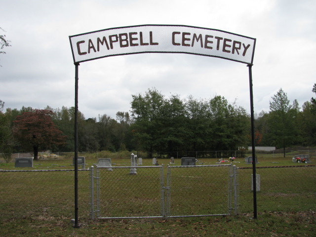
| Memorials | : | 0 |
| Location | : | Chesterfield, Chesterfield County, USA |
| Coordinate | : | 34.8048360, -80.0441280 |
| Description | : | Location: Chesterfield, SC Directions: From Chesterfield take Highway 145 North. Travel approximately 5 miles. Just before you reach the SC-NC State Line you will see a sawmill on the right. Turn right onto the dirt road by the sawmill. Cemetery is at the end of the dirt road (behind the sawmill). Features: Active and well-maintained. |
frequently asked questions (FAQ):
-
Where is Campbell Family Cemetery?
Campbell Family Cemetery is located at Chesterfield, Chesterfield County ,South Carolina ,USA.
-
Campbell Family Cemetery cemetery's updated grave count on graveviews.com?
0 memorials
-
Where are the coordinates of the Campbell Family Cemetery?
Latitude: 34.8048360
Longitude: -80.0441280
Nearby Cemetories:
1. Smith Cemetery
Chesterfield, Chesterfield County, USA
Coordinate: 34.7974840, -80.0480710
2. Sandy Plains United Methodist Church Cemetery
Morven, Anson County, USA
Coordinate: 34.8245800, -80.0488600
3. Griggs Family Cemetery
Chesterfield, Chesterfield County, USA
Coordinate: 34.8042150, -80.0732200
4. Short Family Cemetery
Chesterfield County, USA
Coordinate: 34.7931670, -80.0118550
5. Westfield Creek Baptist Church Cemetery
Chesterfield County, USA
Coordinate: 34.7888985, -80.0108032
6. Stroud Family Cemetery
Chesterfield, Chesterfield County, USA
Coordinate: 34.7919380, -80.0813360
7. Burr Cemetery
Cason Old Field, Anson County, USA
Coordinate: 34.8319120, -80.0709340
8. Pittman Cemetery
Morven, Anson County, USA
Coordinate: 34.8362360, -80.0242320
9. Sandy Ridge Missionary Baptist Church Cemetery
Morven, Anson County, USA
Coordinate: 34.8406570, -80.0453100
10. Davis Cemetery
Chesterfield, Chesterfield County, USA
Coordinate: 34.7676600, -80.0456570
11. McClain Grove Missionary Baptist Church Cemetery
Cheraw, Chesterfield County, USA
Coordinate: 34.7873270, -80.0011380
12. Dred Cemetery
Chesterfield, Chesterfield County, USA
Coordinate: 34.7821920, -80.0837230
13. McLaurin Cemetery
Morven, Anson County, USA
Coordinate: 34.8363590, -80.0145810
14. Davids Grove Baptist Church Cemetery
Chesterfield, Chesterfield County, USA
Coordinate: 34.7928009, -80.0903015
15. Privett Family Cemetery
Chesterfield, Chesterfield County, USA
Coordinate: 34.7658230, -80.0220910
16. Mount Level Baptist Church Cemetery
Chesterfield, Chesterfield County, USA
Coordinate: 34.7990910, -80.0970350
17. Zoar United Methodist Church Cemetery
Brocks Mill, Chesterfield County, USA
Coordinate: 34.7648277, -80.0217819
18. Teal Family Cemetery
Chesterfield, Chesterfield County, USA
Coordinate: 34.7583530, -80.0463330
19. Ramah Grove Missionary Baptist Church Cemetery
McFarlan, Anson County, USA
Coordinate: 34.8241437, -79.9897166
20. Pleasant Grove AME Zion Church Cemetery
Chesterfield, Chesterfield County, USA
Coordinate: 34.7587490, -80.0172040
21. Jones-Hinson Family Cemetery
Chesterfield, Chesterfield County, USA
Coordinate: 34.7989860, -79.9805010
22. New Hope United Methodist Church Cemetery
Wadesboro, Anson County, USA
Coordinate: 34.8382390, -80.0943390
23. Rickets Cemetery
Wadesboro, Anson County, USA
Coordinate: 34.8186700, -80.1066000
24. Vaughn-Campbell Cemetery
Cason Old Field, Anson County, USA
Coordinate: 34.8187140, -80.1066880

