
| Memorials | : | 0 |
| Location | : | Finger, McNairy County, USA |
| Coordinate | : | 35.3371770, -88.6222940 |
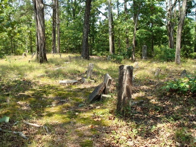
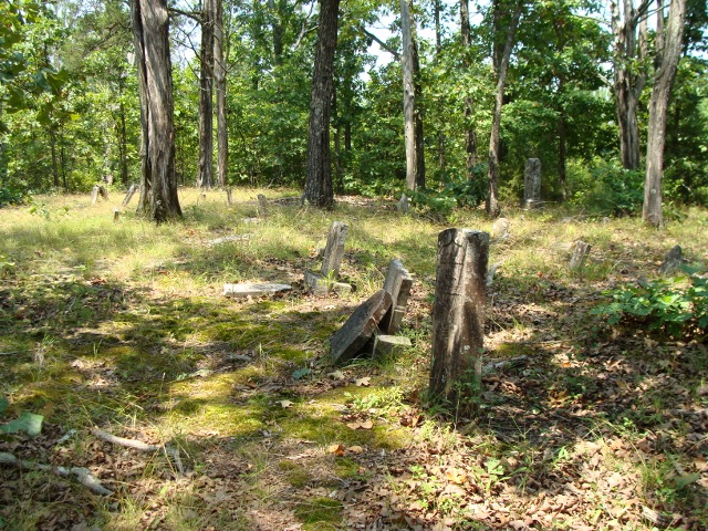
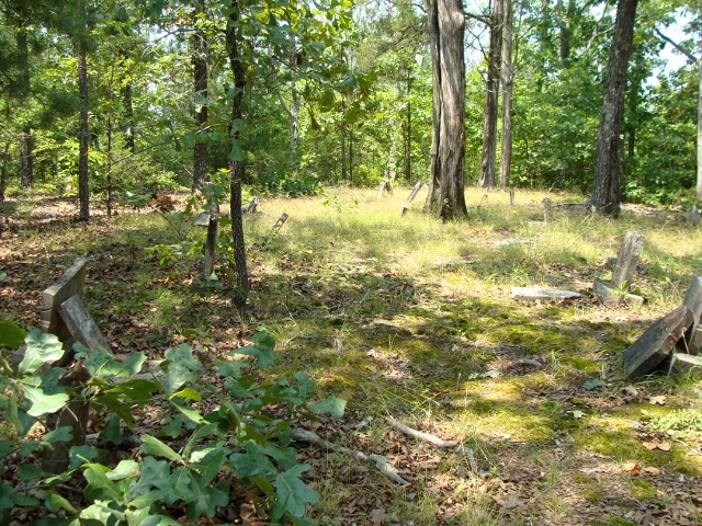
| Description | : | From the intersection of Smith Rd. & US-45, north of MM-26 & north of Bethel Springs, travel east on Smith Rd., going 0.5 mi., turning north (hard left) onto Ward Lane, going 0.7 mi. to the end of the lane & to the area of the cemetery is located. Reports says the cemetery is unkempt, with about 40 graves. Sometimes this cemetery was also called Bivens or Bickins. |
frequently asked questions (FAQ):
-
Where is Floyd Cemetery?
Floyd Cemetery is located at Ward Lane Finger, McNairy County ,Tennessee ,USA.
-
Floyd Cemetery cemetery's updated grave count on graveviews.com?
0 memorials
-
Where are the coordinates of the Floyd Cemetery?
Latitude: 35.3371770
Longitude: -88.6222940
Nearby Cemetories:
1. Mount Carmel Cemetery
Finger, McNairy County, USA
Coordinate: 35.3424988, -88.6003036
2. Finger Christian Fellowship Cemetery
Finger, McNairy County, USA
Coordinate: 35.3576110, -88.6189170
3. Finger Church Cemetery
Finger, McNairy County, USA
Coordinate: 35.3581900, -88.6107260
4. Mount Zion Baptist Church Cemetery
McNairy, McNairy County, USA
Coordinate: 35.3139000, -88.6235962
5. Chambers Chapel Cemetery
McNairy, McNairy County, USA
Coordinate: 35.3044180, -88.6185380
6. Old Friendship Cemetery
Chester County, USA
Coordinate: 35.3622017, -88.6485977
7. Kerby Family Cemetery
Finger, McNairy County, USA
Coordinate: 35.3656810, -88.5971940
8. Lanes Chapel Cemetery
Finger, McNairy County, USA
Coordinate: 35.3312510, -88.5639110
9. Smith Cemetery
Finger, McNairy County, USA
Coordinate: 35.3169870, -88.6766370
10. Estes Church of Christ Cemetery
Henderson, Chester County, USA
Coordinate: 35.3858370, -88.6398660
11. Anderson Slave Cemetery
Finger, McNairy County, USA
Coordinate: 35.3598000, -88.5659000
12. Tillman's Chapel Cemetery
Henderson, Chester County, USA
Coordinate: 35.3894610, -88.6225830
13. Old Estes Cemetery
Henderson, Chester County, USA
Coordinate: 35.3859790, -88.6462870
14. Roger Cemetery
Chester County, USA
Coordinate: 35.3386002, -88.6928024
15. Malone Cemetery
Finger, McNairy County, USA
Coordinate: 35.3602440, -88.5572960
16. Refuge Church Cemetery
Finger, McNairy County, USA
Coordinate: 35.2888985, -88.6616974
17. Harmony Cemetery
Chester County, USA
Coordinate: 35.3960991, -88.6311035
18. Beaty Cemetery
Forty Forks, McNairy County, USA
Coordinate: 35.2901030, -88.5676270
19. Old Oak Grove Cemetery
Henderson, Chester County, USA
Coordinate: 35.3879000, -88.5727200
20. White Plains Cemetery
Finger, McNairy County, USA
Coordinate: 35.3731670, -88.5516960
21. Cason Cemetery
Chester County, USA
Coordinate: 35.3513985, -88.7050018
22. Liberty Church Cemetery
Forty Forks, McNairy County, USA
Coordinate: 35.2770890, -88.5806060
23. Cason Cemetery
Hickory Corners, Chester County, USA
Coordinate: 35.3513480, -88.7051580
24. Weaver Cemetery
Henderson, Chester County, USA
Coordinate: 35.3627760, -88.7009900