
| Memorials | : | 0 |
| Location | : | Finger, McNairy County, USA |
| Coordinate | : | 35.3312510, -88.5639110 |
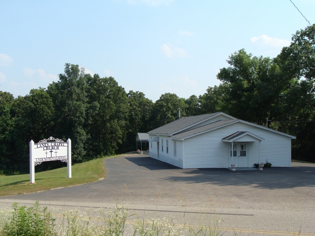
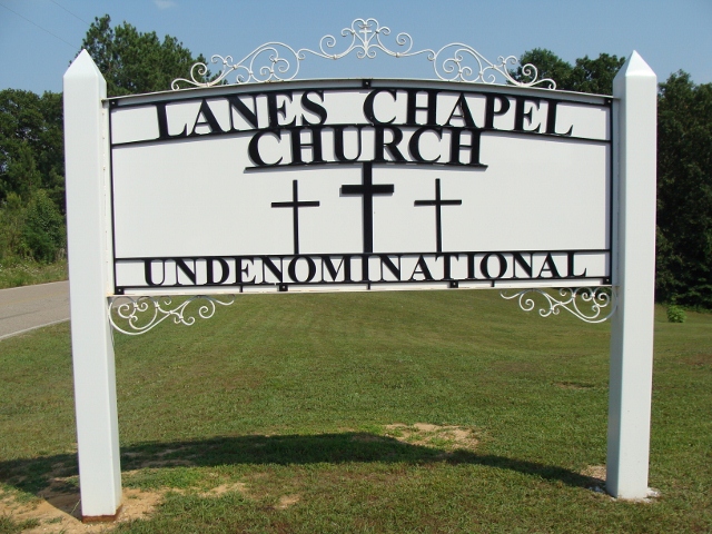
| Description | : | From the intersection of TN-199 E & US-45, south of Henderson, travel east on TN-199 R for 5.4 mi., turning south at the Lanes Chapel Church, onto Ed Barham Rd. & to the cemetery to the rear of the church on the west (right). |
frequently asked questions (FAQ):
-
Where is Lanes Chapel Cemetery?
Lanes Chapel Cemetery is located at 4162 Ed Barham Road Finger, McNairy County ,Tennessee , 38315USA.
-
Lanes Chapel Cemetery cemetery's updated grave count on graveviews.com?
0 memorials
-
Where are the coordinates of the Lanes Chapel Cemetery?
Latitude: 35.3312510
Longitude: -88.5639110
Nearby Cemetories:
1. Plunk Cemetery
Finger, McNairy County, USA
Coordinate: 35.3382988, -88.5333023
2. Hendrix Cemetery
Finger, McNairy County, USA
Coordinate: 35.3189590, -88.5338280
3. Anderson Slave Cemetery
Finger, McNairy County, USA
Coordinate: 35.3598000, -88.5659000
4. Malone Cemetery
Finger, McNairy County, USA
Coordinate: 35.3602440, -88.5572960
5. Mount Carmel Cemetery
Finger, McNairy County, USA
Coordinate: 35.3424988, -88.6003036
6. Maggie Jones United Methodist Church Cemetery
Finger, McNairy County, USA
Coordinate: 35.3291700, -88.5166300
7. Ingraham Cemetery
Finger, McNairy County, USA
Coordinate: 35.3266150, -88.5151560
8. Beaty Cemetery
Forty Forks, McNairy County, USA
Coordinate: 35.2901030, -88.5676270
9. White Plains Cemetery
Finger, McNairy County, USA
Coordinate: 35.3731670, -88.5516960
10. Kerby Family Cemetery
Finger, McNairy County, USA
Coordinate: 35.3656810, -88.5971940
11. Finger Church Cemetery
Finger, McNairy County, USA
Coordinate: 35.3581900, -88.6107260
12. Floyd Cemetery
Finger, McNairy County, USA
Coordinate: 35.3371770, -88.6222940
13. Alexander Cemetery
Finger, McNairy County, USA
Coordinate: 35.3029830, -88.5120090
14. Mount Zion Baptist Church Cemetery
McNairy, McNairy County, USA
Coordinate: 35.3139000, -88.6235962
15. Chambers Chapel Cemetery
McNairy, McNairy County, USA
Coordinate: 35.3044180, -88.6185380
16. Finger Christian Fellowship Cemetery
Finger, McNairy County, USA
Coordinate: 35.3576110, -88.6189170
17. Wharton Cemetery
Purdy, McNairy County, USA
Coordinate: 35.2898140, -88.5192220
18. Liberty Church Cemetery
Forty Forks, McNairy County, USA
Coordinate: 35.2770890, -88.5806060
19. Hopewell Church Cemetery
Finger, McNairy County, USA
Coordinate: 35.3758011, -88.5203018
20. Old Oak Grove Cemetery
Henderson, Chester County, USA
Coordinate: 35.3879000, -88.5727200
21. Baucum Cemetery (Defunct)
McNairy County, USA
Coordinate: 35.3302994, -88.4935989
22. Rose Hill Cemetery
Forty Forks, McNairy County, USA
Coordinate: 35.2673800, -88.5787980
23. Dunn Cemetery
Bethel Springs, McNairy County, USA
Coordinate: 35.2666290, -88.5355270
24. Robinson Cemetery
Chester County, USA
Coordinate: 35.4011002, -88.5642014