
| Memorials | : | 1 |
| Location | : | Forest Park, Clayton County, USA |
| Coordinate | : | 33.6193190, -84.3574260 |
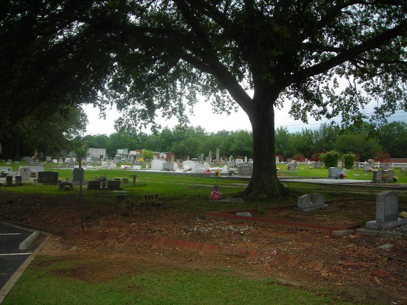
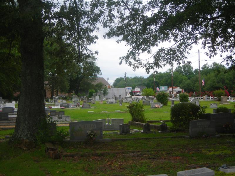
| Description | : | Forest Park City Cemetery is located on the corner of Main Street and Phillips Drive in Forest Park, Ga. This is not to be confused with the cemetery on Elam Road, which is also called Forest Park Cemetery. |
frequently asked questions (FAQ):
-
Where is Forest Park City Cemetery?
Forest Park City Cemetery is located at 1055 MAINST Forest Park, Clayton County ,Georgia , 30297USA.
-
Forest Park City Cemetery cemetery's updated grave count on graveviews.com?
1 memorials
-
Where are the coordinates of the Forest Park City Cemetery?
Latitude: 33.6193190
Longitude: -84.3574260
Nearby Cemetories:
1. Forest Park Primitive Baptist Church Cemetery
Forest Park, Clayton County, USA
Coordinate: 33.6196230, -84.3568800
2. Forest Grove Cemetery
Forest Park, Clayton County, USA
Coordinate: 33.6231003, -84.3546982
3. Old Elam Primitive Baptist Church Cemetery
Forest Park, Clayton County, USA
Coordinate: 33.6271900, -84.3501500
4. Jones Memorial Cemetery
Forest Park, Clayton County, USA
Coordinate: 33.6204400, -84.3816900
5. Rock Springs Cemetery
Clayton County, USA
Coordinate: 33.6399994, -84.3656006
6. Forest Hills Memorial Gardens
Forest Park, Clayton County, USA
Coordinate: 33.6411110, -84.3641670
7. Old Huie-Philadelphia Community Cemetery
Forest Park, Clayton County, USA
Coordinate: 33.5943350, -84.3663310
8. William's Chapel
Clayton County, USA
Coordinate: 33.5988930, -84.3255620
9. Mathalama AME Church Cemetery
Morrow, Clayton County, USA
Coordinate: 33.6031750, -84.3212440
10. Philadelphia Presbyterian Church Cemetery
Forest Park, Clayton County, USA
Coordinate: 33.5900002, -84.3786011
11. Saint Augustine of Canterbury Episcopal Church Col
Morrow, Clayton County, USA
Coordinate: 33.5844150, -84.3504820
12. Travelers Rest Missionary Baptist Church Cemetery
Morrow, Clayton County, USA
Coordinate: 33.5996640, -84.3197970
13. Poole Family Cemetery
Atlanta, Fulton County, USA
Coordinate: 33.6552400, -84.3746200
14. Tanners Road Baptist Church Cemetery
Conley, Clayton County, USA
Coordinate: 33.6316986, -84.3110962
15. Carver Memorial Gardens
Jonesboro, Clayton County, USA
Coordinate: 33.5797005, -84.3792038
16. Morrow Cemetery
Morrow, Clayton County, USA
Coordinate: 33.5774994, -84.3368988
17. Pope Family Burial Ground
Clayton County, USA
Coordinate: 33.6300556, -84.4111778
18. Brown Family Cemetery
Atlanta, Fulton County, USA
Coordinate: 33.6672840, -84.3635800
19. Sherwood Memorial Park and Mausoleum
Jonesboro, Clayton County, USA
Coordinate: 33.5673300, -84.3718200
20. Coffer Grove Baptist Church Cemetery
Clayton County, USA
Coordinate: 33.6450600, -84.2996180
21. Sylvester Baptist Church Cemetery
Ellenwood, Clayton County, USA
Coordinate: 33.6156006, -84.2827988
22. Riverdale First United Methodist Church Cemetery
Riverdale, Clayton County, USA
Coordinate: 33.5810100, -84.4169900
23. Rock Baptist Church Cemetery
Rex, Clayton County, USA
Coordinate: 33.5856018, -84.2910995
24. Mount Zion Cemetery
Morrow, Clayton County, USA
Coordinate: 33.5614014, -84.3214035