
| Memorials | : | 0 |
| Location | : | Forest Row, Wealden District, England |
| Coordinate | : | 51.0965560, 0.0299760 |
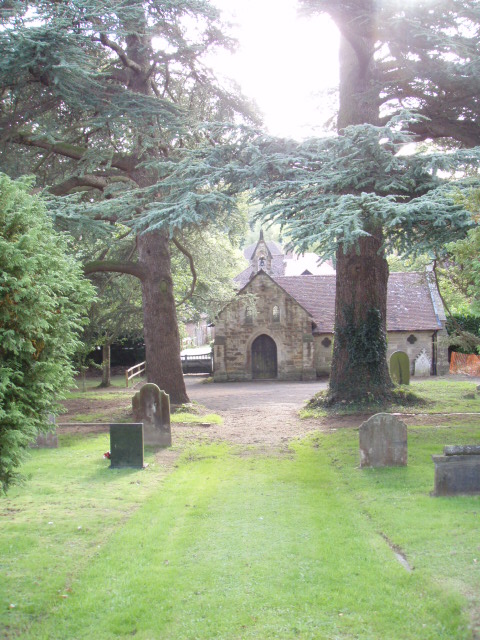
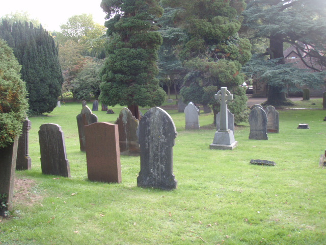
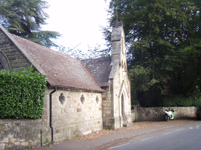
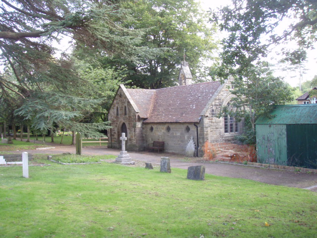
| Description | : | This is on the South side of the village and belongs to the Parish Council. It contains 13 War Graves. (There was a Military Hospital at Forest Row). The cemetery is managed in a low-key way, in that it is not excessively manicured. It has a comfortable rural feel to it and offers a place for quiet contemplation, there is also a little chapel at the cemetery gates. This is de-consecrated. |
frequently asked questions (FAQ):
-
Where is Forest Row Cemetery?
Forest Row Cemetery is located at Priory Road Forest Row, Wealden District ,East Sussex , RH18 5AQEngland.
-
Forest Row Cemetery cemetery's updated grave count on graveviews.com?
0 memorials
-
Where are the coordinates of the Forest Row Cemetery?
Latitude: 51.0965560
Longitude: 0.0299760

Nearby Cemetories:
1. Holy Trinity Churchyard
Forest Row, Wealden District, England
Coordinate: 51.0980712, 0.0330168
2. Holy Trinity Churchyard
Colemans Hatch, Wealden District, England
Coordinate: 51.0855810, 0.0693590
3. St. Swithun's Churchyard
East Grinstead, Mid Sussex District, England
Coordinate: 51.1240380, -0.0058020
4. Mount Noddy Cemetery
East Grinstead, Mid Sussex District, England
Coordinate: 51.1316231, -0.0066281
5. St. Peter's Churchyard
Holtye, Wealden District, England
Coordinate: 51.1338783, 0.0821108
6. St. Mary the Virgin Churchyard
Hartfield, Wealden District, England
Coordinate: 51.1052470, 0.1091770
7. St Margaret of Antioch Churchyard
West Hoathly, Mid Sussex District, England
Coordinate: 51.0762500, -0.0555430
8. St John The Divine
Felbridge, Tandridge District, England
Coordinate: 51.1414480, -0.0392460
9. Cowden New Burial Ground
Cowden, Sevenoaks District, England
Coordinate: 51.1447210, 0.0958650
10. St. Michael and All Angels Churchyard
Withyham, Wealden District, England
Coordinate: 51.0999580, 0.1322440
11. St John the Evangelist Churchyard
Dormansland, Tandridge District, England
Coordinate: 51.1597320, 0.0054300
12. St. James the Less Churchyard
Nutley, Wealden District, England
Coordinate: 51.0322640, 0.0548680
13. St Giles Churchyard
Horsted Keynes, Mid Sussex District, England
Coordinate: 51.0400680, -0.0276550
14. Dormansland Baptist Chapelyard
Dormansland, Tandridge District, England
Coordinate: 51.1634300, 0.0073300
15. All Saints Churchyard
Highbrook, Mid Sussex District, England
Coordinate: 51.0547981, -0.0573000
16. Danehill Cemetery
Danehill, Wealden District, England
Coordinate: 51.0295210, -0.0010970
17. All Saints Churchyard
Crawley Down, Mid Sussex District, England
Coordinate: 51.1211200, -0.0830650
18. St Leonard's Church
Turners Hill, Mid Sussex District, England
Coordinate: 51.1023030, -0.0911310
19. St. John the Evangelist Churchyard
Crowborough, Wealden District, England
Coordinate: 51.0656784, 0.1441483
20. Forest Fold Baptist Chapel
Crowborough, Wealden District, England
Coordinate: 51.0715790, 0.1531650
21. All Saints Churchyard
Blackham, Wealden District, England
Coordinate: 51.1411200, 0.1405600
22. Christ Church Churchyard
Fairwarp, Wealden District, England
Coordinate: 51.0217018, 0.0888000
23. Holy Trinity Churchyard
Markbeech, Sevenoaks District, England
Coordinate: 51.1651750, 0.1077720
24. St Peter and St Paul Churchyard
Lingfield, Tandridge District, England
Coordinate: 51.1763840, -0.0142480