
| Memorials | : | 6 |
| Location | : | Aurelius, Ingham County, USA |
| Phone | : | (517) 628-2093 |
| Coordinate | : | 42.5400367, -84.5822004 |
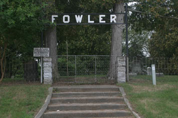
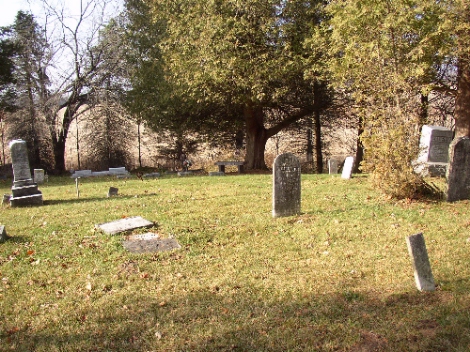
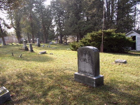
| Description | : | Linus H. Fowler was buried in 1857 on his own farm on a sandy knoll a short distance from his home. He was followed in 1859 by his son, William J. Then neighbors began burying their loved ones. In 1863, Linus' Widow, Clarena N. Fowler, deeded one acre, including the graves, to the Fowler Cemetery Association. For many years the Fowler family and other concerned families kept the records and cared for the grounds. By the 1980's the expenses were too much and the responsibilities were assumed by Aurelius Township. Fowler Cemetery is located in Ingham County, Aurelius Township.... Read More |
frequently asked questions (FAQ):
-
Where is Fowler Cemetery?
Fowler Cemetery is located at 1063-1499 Gale Road Aurelius, Ingham County ,Michigan , 48827USA.
-
Fowler Cemetery cemetery's updated grave count on graveviews.com?
6 memorials
-
Where are the coordinates of the Fowler Cemetery?
Latitude: 42.5400367
Longitude: -84.5822004
Nearby Cemetories:
1. Bunker Hill Cemetery
Eaton Rapids, Eaton County, USA
Coordinate: 42.5534280, -84.6042970
2. Plains Cemetery
Aurelius, Ingham County, USA
Coordinate: 42.5096200, -84.5944480
3. Munger Cemetery
Eaton Rapids, Eaton County, USA
Coordinate: 42.5746994, -84.6213989
4. Greenwood Cemetery
Aurelius, Ingham County, USA
Coordinate: 42.5138893, -84.5233307
5. North Aurelius Cemetery
Aurelius Township, Ingham County, USA
Coordinate: 42.5818420, -84.5388130
6. Markham Cemetery
Holt, Ingham County, USA
Coordinate: 42.6035995, -84.5819016
7. Bentley Cemetery
Eaton Rapids, Eaton County, USA
Coordinate: 42.5456009, -84.6761017
8. Rosehill Cemetery
Eaton Rapids, Eaton County, USA
Coordinate: 42.5003014, -84.6635971
9. Oakwood Cemetery
Eaton Rapids, Eaton County, USA
Coordinate: 42.4947014, -84.6659012
10. Brickyard Cemetery
Eaton Rapids, Eaton County, USA
Coordinate: 42.5243988, -84.6999969
11. Skinner Cemetery
Dimondale, Eaton County, USA
Coordinate: 42.6236000, -84.6222000
12. Green Cemetery
Eaton Rapids Township, Eaton County, USA
Coordinate: 42.5870490, -84.6904910
13. Rolfe Cemetery
Mason, Ingham County, USA
Coordinate: 42.5243988, -84.4569016
14. Lane Cemetery
Onondaga, Ingham County, USA
Coordinate: 42.4505600, -84.5358300
15. Onondaga Cemetery
Onondaga, Ingham County, USA
Coordinate: 42.4445877, -84.5699387
16. Forest Lawn Memorial Gardens
Dimondale, Eaton County, USA
Coordinate: 42.6451836, -84.6173630
17. Courter-Pray Cemetery
Dimondale, Eaton County, USA
Coordinate: 42.6254970, -84.6732940
18. South Center Eaton Cemetery
Charlotte, Eaton County, USA
Coordinate: 42.5381012, -84.7307968
19. Maple Grove Cemetery
Mason, Ingham County, USA
Coordinate: 42.5856018, -84.4458008
20. Country Meadows Pet Cemetery
Dimondale, Eaton County, USA
Coordinate: 42.6471470, -84.6216470
21. First United Methodist Church of Mason Columbarium
Mason, Ingham County, USA
Coordinate: 42.5796620, -84.4414330
22. Pioneer Cemetery
Holt, Ingham County, USA
Coordinate: 42.6500015, -84.5231018
23. Eden Cemetery
Mason, Ingham County, USA
Coordinate: 42.5210991, -84.4191971
24. Dimondale Cemetery
Dimondale, Eaton County, USA
Coordinate: 42.6492004, -84.6607971