
| Memorials | : | 55 |
| Location | : | Aurelius, Ingham County, USA |
| Phone | : | (517) 628-2093 |
| Coordinate | : | 42.5096200, -84.5944480 |
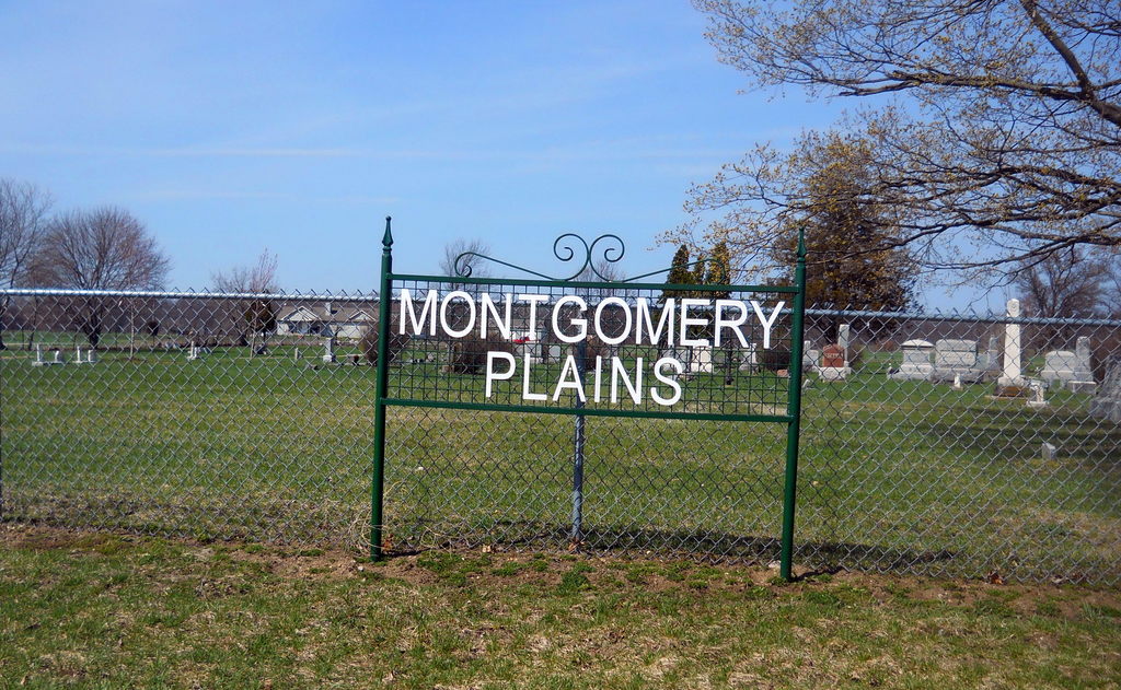
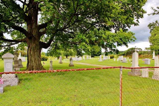
| Description | : | Section 31 on N side of Plains Road east of the intersection of Waverly and Plains Road Members of the Montgomery family were among the earliest settlers i this neighborhood. On 28 August 1841 John and Amenia Montgomery deeded this parcel of land to the inhabitants of Aurelius Township to be used as a Cemetery (Liber 4, Page 282) |
frequently asked questions (FAQ):
-
Where is Plains Cemetery?
Plains Cemetery is located at Plains Road E Aurelius, Ingham County ,Michigan , 48854USA.
-
Plains Cemetery cemetery's updated grave count on graveviews.com?
52 memorials
-
Where are the coordinates of the Plains Cemetery?
Latitude: 42.5096200
Longitude: -84.5944480


Nearby Cemetories:
1. Fowler Cemetery
Aurelius, Ingham County, USA
Coordinate: 42.5400367, -84.5822004
2. Bunker Hill Cemetery
Eaton Rapids, Eaton County, USA
Coordinate: 42.5534280, -84.6042970
3. Rosehill Cemetery
Eaton Rapids, Eaton County, USA
Coordinate: 42.5003014, -84.6635971
4. Greenwood Cemetery
Aurelius, Ingham County, USA
Coordinate: 42.5138893, -84.5233307
5. Oakwood Cemetery
Eaton Rapids, Eaton County, USA
Coordinate: 42.4947014, -84.6659012
6. Onondaga Cemetery
Onondaga, Ingham County, USA
Coordinate: 42.4445877, -84.5699387
7. Munger Cemetery
Eaton Rapids, Eaton County, USA
Coordinate: 42.5746994, -84.6213989
8. Bentley Cemetery
Eaton Rapids, Eaton County, USA
Coordinate: 42.5456009, -84.6761017
9. Lane Cemetery
Onondaga, Ingham County, USA
Coordinate: 42.4505600, -84.5358300
10. Brickyard Cemetery
Eaton Rapids, Eaton County, USA
Coordinate: 42.5243988, -84.6999969
11. North Aurelius Cemetery
Aurelius Township, Ingham County, USA
Coordinate: 42.5818420, -84.5388130
12. Markham Cemetery
Holt, Ingham County, USA
Coordinate: 42.6035995, -84.5819016
13. Griffith Cemetery
Springport, Jackson County, USA
Coordinate: 42.4150620, -84.6215515
14. Rolfe Cemetery
Mason, Ingham County, USA
Coordinate: 42.5243988, -84.4569016
15. South Center Eaton Cemetery
Charlotte, Eaton County, USA
Coordinate: 42.5381012, -84.7307968
16. Green Cemetery
Eaton Rapids Township, Eaton County, USA
Coordinate: 42.5870490, -84.6904910
17. Skinner Cemetery
Dimondale, Eaton County, USA
Coordinate: 42.6236000, -84.6222000
18. Brown Cemetery
Tompkins, Jackson County, USA
Coordinate: 42.3927765, -84.5833359
19. Walker Cemetery
Rives Junction, Jackson County, USA
Coordinate: 42.4218712, -84.4820557
20. Pierson Cemetery
Springport, Jackson County, USA
Coordinate: 42.4004230, -84.6790950
21. Stewart Cemetery (Defunct)
Tompkins, Jackson County, USA
Coordinate: 42.3944321, -84.5210876
22. Fox Cemetery
Brookfield, Eaton County, USA
Coordinate: 42.4935550, -84.7677610
23. Courter-Pray Cemetery
Dimondale, Eaton County, USA
Coordinate: 42.6254970, -84.6732940
24. Eden Cemetery
Mason, Ingham County, USA
Coordinate: 42.5210991, -84.4191971